Esta guía de buceo regional está destinada a proporcionar a los ya calificados buzo con información que ayudará a planificar inmersiones en las aguas de la Península del Cabo y False Bay, ya sea como residente local o como visitante. La información se proporciona sin prejuicios y no se garantiza que sea precisa o completa. Úselo bajo su propio riesgo. Expanda o corrija cuando pueda.
La región descrita se encuentra dentro de un viaje de un día por carretera desde cualquier parte de la mayor Ciudad del cabo, en el cabo Oeste provincia de Sudáfrica e incluye más de 280 sitios de buceo con nombre para los cuales se registran las posiciones, lo cual es mucho para cualquier destino.
La información detallada sobre los sitios de buceo individuales se proporciona en los sub-artículos vinculados desde el Sitios de buceo sección. La información en las descripciones del sitio varía de superficial a muy detallada, dependiendo de lo que se sepa sobre el sitio. Puede haber un mapa. Las cartas batimétricas de SURGMAP se actualizan a medida que se recopilan nuevos datos de levantamiento, y se mapean nadando los contornos remolcando una boya GPS. Son razonablemente precisos, generalmente dentro de un par de metros, y confiables para lo que se muestra, pero rara vez están completos. Es muy posible que se hayan perdido algunos pináculos altos. No hay garantía de que no descubra uno al golpearlo con su bote. Si es así, háganoslo saber.
En algunos casos, un subartículo de un sitio de buceo incluirá varios sitios que se encuentran en las proximidades, ya que gran parte de la información será común a todos ellos. En otros casos, que generalmente involucran sitios de naufragios, dos sitios adyacentes tendrán cada uno su propio sub-artículo, pero si dos o más naufragios se encuentran en la misma posición, o con una superposición sustancial, se describirán en el mismo sub-artículo.
Entender


Topografía general
La ciudad de Ciudad del Cabo fue fundada en el extremo norte de la Península del cabo, una estrecha franja montañosa de tierra como mucho de 11 km de ancho y poco más de 50 km de largo. La frontera norte es la costa de Table Bay, una gran bahía abierta con una sola isla, isla Robben, en su boca.
Una costa irregular marca la frontera occidental a lo largo del océano Atlántico. Varias bahías pequeñas se encuentran a lo largo de la costa con una sola grande, Hout Bay, aproximadamente a la mitad. Más al sur, la península se estrecha hasta llegar a su fin en Cape Point. Una cadena de montañas con Table Mountain a 1.085 m en el extremo norte forma la columna vertebral de la península. El punto más alto de la península sur es Swartkop, a 678 m, cerca de Simon’s Town. La península tiene pendientes bastante pronunciadas a lo largo de la mayor parte de la costa, con áreas muy estrechas de tierra relativamente plana excepto en el lado oeste del extremo sur.
El lado este empinado está bordeado por False Bay, y este tramo de costa incluye la bahía más pequeña de Smitswinkel, la bahía de Simon y la bahía de Fish Hoek, donde una franja de terreno bajo se extiende entre las costas a ambos lados. En Muizenberg, la línea costera se vuelve relativamente baja y arenosa y se curva hacia el este a través del límite sur del Cape Flats a Gordon’s Bay para formar el límite norte de False Bay. De Bahía de Gordon la costa gira aproximadamente hacia el sur y zigzaguea a lo largo del pie de la cordillera de Holanda de los hotentotes hasta el cabo Hangklip, que se encuentra casi en la misma latitud que Cape Point. El pico más alto de este lado es Kogelberg a 1.269 m.
En planta, la bahía es aproximadamente cuadrada con bordes bastante tambaleantes, siendo aproximadamente la misma extensión de norte a sur que de este a oeste (30 km), con todo el lado sur abierto al océano. El área de False Bay se ha medido en unos 1.090 km², y el volumen es de aproximadamente 45 km³ (profundidad media de unos 40 m). El perímetro terrestre se ha medido en 116 km, a partir de un mapa a escala 1: 50.000.
La morfología del fondo de False Bay es generalmente suave y bastante poco profunda, con una pendiente suave hacia abajo de norte a sur, de modo que la profundidad en el centro de la boca es de unos 80 m. El fondo está cubierto de sedimentos que varían de muy gruesos a muy finos, con la mayor parte del sedimento fino y lodo en el centro de la bahía. La principal excepción es una larga cresta de roca sedimentaria que se extiende en dirección sur desde el Strand, hasta aproximadamente el nivel de la desembocadura del río Steenbras. El extremo sur de esta cresta se conoce como Steenbras Deep.
Hay una verdadera isla en la bahía, Seal Island, un afloramiento árido y pedregoso de granito de unos 200 m de largo y con una superficie de unas 2 ha. Se encuentra a unos 6 km al sur de Strandfontein y está a menos de 10 m sobre el nivel del mar en su punto más alto. También hay una serie de pequeños islotes rocosos que se extienden por encima de la marca de agua alta, y otras rocas y bajíos que se acercan a la superficie. La mayoría de estos son granito del Península pluton, pero al este de Seal Island son generalmente areniscas, probablemente del Tygerberg formación dentro de la bahía, aunque es posible que algunos puedan ser de la Montaña de la Mesa serie. La mayor de estas áreas de arrecifes es Whittle Rock, una colina submarina de granito que se eleva desde el fondo arenoso a unos 40 m hasta 5 m de la superficie y aproximadamente 1 km de diámetro.
Fuera de la bahía, pero influyendo en los patrones de olas en ella, se encuentra Rocky Bank, un extenso arrecife de Montaña de la Mesa arrecife de arenisca de entre 20 y 30 m de profundidad en la parte superior, y con una pendiente de más de 100 m hacia el sur.
Estrictamente hablando, False Bay es parte del Océano Atlántico, que se extiende hasta Cabo Agulhas, pero cuando en Ciudad del Cabo, Atlántico generalmente se refiere a la costa occidental de la Península del Cabo, y el lado este se conoce como False Bay, o el lado de Simon's Town. Esta convención se utilizará a lo largo de esta guía.
Topografía local
La influencia más fuerte en la topografía local es la geología local. Los depósitos no consolidados de limo, arena o grava tienden a ser bastante planos. Las tejas y los cantos rodados pequeños pueden tener una pendiente más pronunciada, y el lecho rocoso y los cantos rodados grandes pueden ser cualquier cosa, desde elevadas ligeramente por encima del fondo no consolidado circundante, hasta acantilados y tors que sobresalen. El tipo de roca, y para los estratos sedimentarios, el hundimiento y el rumbo, tienen una gran influencia en la gama de posibles formas de arrecifes.
Las actuales estructuras de los arrecifes se desarrollaron como accidentes geográficos durante las edades de hielo, cuando estaban por encima del nivel del mar, y los arrecifes de granito fueron moldeados en gran parte por el proceso de meteorización subterránea durante períodos aún más largos. Los granitos son bastante antiguos, y están muy unidos por fuerzas tectónicas, y los bordes de las grietas han tenido mucho tiempo para ser erosionados químicamente por el agua subterránea para redondear las esquinas y formar profundas grietas y barrancos, que luego fueron expuestos por la erosión. del saprolito y más modificado por la intemperie y la erosión de las superficies expuestas a las estructuras conocidas como corestones y tors. De manera similar, la roca sedimentaria expuesta se erosionó mientras estaba expuesta por encima del suelo. Cuando el nivel del mar subió durante el derretimiento de los glaciares, estos accidentes geográficos simplemente se inundaron y conservaron gran parte de su forma y carácter anteriores. Desde entonces, la erosión costera ha modificado los arrecifes en áreas expuestas a la acción de las olas de energía lo suficientemente alta, y se produce cierto movimiento de sedimentos debido a las olas y las corrientes.
Clima, tiempo y condiciones del mar

Clima del Cabo Occidental
El clima del suroeste del Cabo es marcadamente diferente del resto de Sudáfrica, que es una región de lluvias de verano, que recibe la mayor parte de sus lluvias durante los meses de verano de diciembre a febrero. El suroeste del Cabo tiene un clima de tipo mediterráneo, con la mayor parte de sus precipitaciones durante los meses de invierno de junio a septiembre.
Durante el verano, el factor dominante que determina el clima en la región es una zona de alta presión, conocida como Atlantic High, ubicada sobre el Océano Atlántico Sur al oeste de la costa del Cabo. Los vientos que circulan en sentido antihorario desde dicho sistema llegan al Cabo desde el sureste, produciendo periodos de hasta varios días de vientos fuertes y cielos despejados. Estos vientos del sudeste se conocen localmente como Cape Doctor. Mantienen la región relativamente fresca y ayudan a expulsar el aire contaminado de las áreas industriales y Cape Flats hacia el mar. Debido a su orientación sur, False Bay está expuesta a estos vientos, particularmente en el lado oeste, mientras que Table Bay y la costa oeste de la península experimentan un viento de alta mar. Este patrón de viento está influenciado localmente por la topografía en la medida en que los vientos huracanados pueden estar soplando Bahía de Gordon , mientras que a unos 10 km partes de Somerset West puede tener un día sofocante y sin viento.
El invierno en el suroeste del Cabo se caracteriza por perturbaciones en los vientos circumpolares del oeste, lo que resulta en una serie de depresiones frontales que se mueven hacia el este. Estos traen un clima fresco y nublado, viento y lluvia del noroeste, seguidos de una caída en la temperatura y un cambio al viento del suroeste a medida que pasa el frente. Los vientos del suroeste sobre el Atlántico sur producen el oleaje predominante del suroeste típico de los meses de invierno, que golpea la costa atlántica expuesta y el lado este de False Bay. Las montañas de la Península del Cabo brindan protección dentro del lado oeste de False Bay de este viento y de las olas del suroeste, un hecho que influyó en el gobernador Simon van der Stel en su elección de Simon's Bay como fondeadero de invierno para la Compañía Holandesa de las Indias Orientales. barcos para Ciudad del Cabo. Las tormentas invernales del noroeste han destruido muchos barcos anclados en Table Bay a lo largo de los siglos. Incluso hoy, a pesar de los avances técnicos y la mejora del pronóstico del tiempo, esto sigue sucediendo, aunque con menos frecuencia que en el pasado, y en estos días las operaciones de salvamento tienen más éxito.
Tiempo
La tendencia general es que el tiempo venga del oeste y se mueva hacia el este con los sistemas frontales, pero también puede haber fenómenos meteorológicos más locales, como tormentas eléctricas (raras) y vientos 'berg', que son vientos cálidos que caen sobre el montañas del interior. Puede haber una variación considerable en las condiciones climáticas entre diferentes sitios en el área cubierta por esta guía en cualquier día, aunque la tendencia general puede ser similar. Por ejemplo, puede que llueva en la península del Cabo por la mañana y, por la tarde, estas condiciones pueden haberse trasladado al lado este de False Bay y la península puede estar despejando con un cambio significativo de dirección del viento del noroeste al suroeste. La variación local en la fuerza del viento puede ser extrema y, a veces, difícil de creer, ya que puede haber una calma absoluta en un lugar y un viento aullante a unos pocos kilómetros de distancia. Hay lugares conocidos por la exposición tanto a los vientos del sudeste como del noroeste, y algunos están protegidos de uno u otro, mientras que los vientos del sudoeste soplan en la mayoría de los lugares, pero no por lo general a los mismos extremos. Lo que esto significa en la práctica es que las condiciones climáticas en las que se encuentra en un momento particular pueden diferir significativamente de las de un sitio de buceo un poco más tarde en el día.
Un viento de témpano es causado por una alta presión tierra adentro a gran altitud, generalmente en invierno, en las áreas frías y secas de la meseta central sobre la gran escarpa, junto con presiones más bajas en la costa. El viento fluye por el acantilado y se calienta por compresión. El aumento de temperatura puede ser considerable y durante un período corto. Este viento cálido y seco se produce en alta mar y no afecta en gran medida las condiciones de buceo, pero generalmente es seguido por vientos fríos en tierra con nubes bajas, niebla y llovizna, y a menudo se asocia con la aproximación de un frente frío desde el oeste en invierno, que puede traer fuertes vientos del oeste y lluvias frontales sustanciales.
Condiciones del mar
Olas y oleaje
Las olas que llegan a las costas de False Bay y la Península del Cabo se pueden considerar como una combinación de olas de viento local y oleaje de fuentes distantes. El oleaje es producido por sistemas climáticos generalmente al sur del continente, a veces considerablemente distantes, los más importantes de los cuales son los sistemas frontales en el Atlántico Sur, que generan olas de viento que luego se dispersan lejos de su fuente y se separan con el tiempo en zonas de diferente variación. período. Las olas de período largo son más rápidas y tienen más energía, y se adelantan a los componentes de período más corto, por lo que tienden a llegar primero a la costa. Esto es conocido por los surfistas como pulso, y generalmente es seguido por un período de acortamiento gradual de oleaje de menor potencia.
Los vientos locales también producirán olas que combinarán sus efectos con el oleaje. Los vientos marinos, como regla general, aplanarán el mar ya que el alcance (distancia que el viento ha soplado sobre el agua) suele ser demasiado pequeño para desarrollar olas de gran altura o longitud. Los vientos en tierra, por otro lado, si son lo suficientemente fuertes producirán un golpe corto y desagradable que puede hacer que la entrada y la salida sean incómodas, y que los nados en la superficie o los paseos en bote sean desagradables.
La combinación de oleaje y viento debe tenerse en cuenta al planificar una inmersión. Esto requiere el conocimiento de estas condiciones, que son pronosticadas con precisión variable por varias organizaciones, en algunos casos con siete o más días de anticipación. La precisión es generalmente inversamente proporcional al intervalo del pronóstico. Por lo general, es bastante confiable mirar con dos o tres días de anticipación, pero puede ser un poco inestable durante más de una semana. El clima es así.
Afloramientos
Los vientos del sudeste que soplan en alta mar y a lo largo de la costa en el lado oeste de la Península del Cabo y el lado este de False Bay provocan un movimiento de agua superficial hacia el oeste de la costa debido al transporte de Ekman. Este movimiento de agua alejándose de la costa se compensa con el afloramiento de aguas más profundas.
Estas afloramientos son de considerable interés para el buceador, ya que el agua aflorada en la costa oeste es fría y relativamente clara. Sin embargo, como el agua con afloramiento tiene un alto contenido de nutrientes, los afloramientos son a menudo precursores de una floración de plancton conocida como "marea roja", que reducirá drásticamente la visibilidad. La temperatura del agua tiende a descender por debajo de los 12 ° C durante un afloramiento en la costa oeste y, en ocasiones, puede alcanzar los 7 ° C fríos.
En el lado este de False Bay, las afloramientos a menudo causan poca visibilidad ya que pueden perturbar el sedimento muy fino y de baja densidad que es común en ese lado de la bahía, particularmente en la parte menos profunda cerca de Gordon's Bay. El agua también es relativamente fría, pero por lo general no tanto como en el lado oeste de la península y las temperaturas pueden bajar de alrededor de 19 ° C a 12 ° C en uno o dos días.
Mareas
Las mareas locales están dominadas por la luna, son semi-diurnas y relativamente débiles, y no hay fuertes corrientes de marea en la costa atlántica o en False Bay. Los flujos de marea resultantes son de poca importancia para el buceador, siendo el efecto principal ligeros cambios en la profundidad en el sitio de buceo y variaciones en el obstáculo que presentan las frondas de algas cerca de la superficie, lo que puede afectar el esfuerzo requerido para atravesar las algas en la superficie. En este sentido, generalmente es más fácil durante la marea alta.
Los lanzamientos de botes en algunas gradas pueden ser difíciles durante la marea baja, lo que ocasionalmente puede afectar los horarios de buceo del bote, y la baja de primavera es aproximadamente en el momento del primer lanzamiento (aproximadamente de 09:00 a 09:30).
El rango máximo de mareas en Ciudad del Cabo es de aproximadamente 1,86 m (mareas vivas) y en Simon’s Town 1,91 m, con rangos mínimos en ambos lugares de aproximadamente 0,26 m (mareas muertas).
Temperatura de agua
La temperatura superficial promedio en verano del Atlántico frente a la Península del Cabo está en el rango de 10 ° a 13 ° C. La temperatura del fondo puede ser unos grados más fría. La temperatura mínima es de aproximadamente 8 ° C, aunque se han hecho afirmaciones de tan solo 6 ° y la máxima de alrededor de 17 ° C.
La temperatura superficial promedio en invierno del Atlántico frente a la Península del Cabo está en el rango de 13 ° a 15 ° C. La temperatura del fondo en la costa es muy similar.
La temperatura promedio de la superficie en invierno de False Bay es de aproximadamente 15 ° C, y la temperatura del fondo es muy similar o un poco más baja. La temperatura promedio de la superficie en verano de False Bay es de aproximadamente 19 ° C. La temperatura del fondo es generalmente de 1 ° a 3 ° C más baja que en invierno, pero no se desconoce de 10 ° a 12 ° C.
Corrientes
Las corrientes generalmente no se consideran un problema en la mayoría de los sitios de buceo en esta región. Una corriente superficial poco profunda puede ser producida por fuertes vientos, durante un período corto, lo que puede ser un inconveniente si se pone en alta mar. La profundidad de la corriente depende de cuánto tiempo ha estado soplando el viento, y cuando se levanta un viento repentino mientras uno está buceando, la corriente es poco profunda y un buzo puede regresar a la costa a una profundidad de 3 a 6 m por debajo de la mayor parte de la corriente. Las corrientes de marea son insignificantes y solo se experimentan en unos pocos sitios de buceo aislados, como Playa del molino de viento, durante las mareas de primavera cuando hay algo de oleaje. Tenga en cuenta que una corriente de superficie impulsada por el viento fluirá hacia la izquierda de la dirección del viento debido a los efectos de Coriolis, y el ángulo aumentará y la fuerza disminuirá con la profundidad.
Dos lugares que pueden experimentar corrientes importantes son la desembocadura de False Bay, en Rocky Bank y Roca de fuelle, donde los remolinos de la corriente de Agulhas con frecuencia producen una corriente de intensidad ligera a media, que puede ser lo suficientemente fuerte como para incomodar a los buceadores en las aguas poco profundas alrededor de Bellows Rock. Bay al sur de Simon's Town y en la costa atlántica cerca de Duiker Point y Robben Island. Estas corrientes suelen ser considerablemente más débiles en el fondo y no suelen presentar muchas dificultades para los buceadores, aunque hacen que el uso de un DSMB para salir a la superficie sea más importante, ya que se puede derivar bastante incluso en un ascenso normal con una parada de seguridad. . Estas corrientes de superficie pueden ser más un inconveniente al inicio de la inmersión, ya que lo llevarán más allá de la línea de tiro si no se le indica que descienda, lo que debe hacerse tan pronto como la línea esté a la vista. También dependiendo de la holgura en la línea de tiro, la boya estará a favor del viento y corriente abajo de la baliza en varios metros. Un patrón competente hará alguna concesión y dejará a los buzos río arriba de la boya.
Datos del tiempo
Los datos meteorológicos en tiempo real están disponibles para False Bay desde un boya meteorológica operado por el Centro de Oceanografía de Observación. Se muestran datos históricos actuales y de 7 días para la temperatura de la superficie del aire y del mar, la fuerza y dirección del viento y la presión barométrica. La posición de la boya puede variar, pero en octubre de 2012 estaba a 34 ° 11'19 "S, 18 ° 27'03" E. (a unos 700 m al este del puerto de Simon's Town)
Predecir el clima y las condiciones del mar
Predecir las condiciones de buceo en esta región es bastante complejo. Hay sitios web como Boya, Surf-Forecast y Windguru que proporcionan previsiones razonablemente fiables de viento y oleaje. Esto, combinado con información sobre las condiciones recientes de temperatura y visibilidad del agua, permitirá una predicción bastante confiable de las condiciones con unos días de anticipación. El local Wavescape El sitio web y el informe de surf también son una referencia valiosa con un ambiente sudafricano distintivo, aunque, al igual que los demás, está destinado principalmente a los surfistas, y los buceadores deben interpolar un poco.
La visibilidad puede aclararse con bastante rapidez (durante la noche) en la costa atlántica debido a las corrientes y los sedimentos relativamente gruesos. En el lado oeste de False Bay es un poco más lento y puede tardar varios días, incluso semanas, en el lado este de la bahía, donde los sedimentos son finos y ligeros.
Los datos satelitales de la temperatura de la superficie del mar y la clorofila también están disponibles en Internet y pueden ayudar a predecir las condiciones de la superficie, pero se desconoce cuánto predicen las condiciones del fondo.
Hasta que no se haya familiarizado con este procedimiento, es útil obtener segundas opiniones de personas u organizaciones con experiencia.
Algunos de los operadores de chárter de buceo locales tienen mejor reputación que otros para la predicción del clima, y hay algunos que casi siempre afirman que las condiciones son o fueron buenas. La Destello azul El boletín semanal es tan bueno como cualquier otro y mejor que muchos. Esto se referirá a las áreas preferidas fuera de la Península del Cabo, incluido el lado oeste de False Bay. Para obtener información sobre el lado este de False Bay, puede intentar llamar a Indigo Divers.
La ecología marina

Las bioregiones
Cape Point en la punta de la Península del Cabo se considera el límite entre dos de las cinco biorregiones marinas costeras de Sudáfrica. Al oeste de Cape Point se encuentra la biorregión costera del sudoeste del Cabo, de clima frío a frío templado, y al este se encuentra la biorregión costera templada más cálida de Agulhas. La ruptura de Cape Point se considera un cambio relativamente distinto en las biorregiones y esto se puede ver claramente en la diferencia en la vida marina entre la costa atlántica de la península y False Bay.
Los hábitats
Existen cuatro hábitats principales en el mar en esta región, que se distinguen por la naturaleza del sustrato. El sustrato, o material base, es importante porque proporciona una base a la que un organismo puede anclarse, lo cual es de vital importancia para aquellos organismos que necesitan permanecer en un tipo de lugar en particular. Las costas rocosas y los arrecifes proporcionan un sustrato fijo firme para la unión de plantas y animales. Algunos de estos pueden tener bosques de algas marinas, que reducen el efecto de las olas y proporcionan alimento y refugio para una amplia gama de organismos. Las playas y los fondos arenosos son un sustrato relativamente inestable y no pueden anclar las algas marinas ni muchos de los otros organismos bentónicos. Finalmente, hay aguas abiertas, sobre el sustrato y despejadas del bosque de algas, donde los organismos deben nadar o flotar. También se encuentran con frecuencia hábitats mixtos, que son una combinación de los mencionados anteriormente. Los hábitats se describen con más detalle en las siguientes secciones.
Arrecifes y costas rocosas

La gran mayoría de los sitios de buceo populares en las aguas locales se encuentran en arrecifes rocosos o fondos mixtos rocosos y arenosos, con un número significativo de naufragios, que son equivalentes a los arrecifes rocosos para la clasificación de hábitat, ya que en general, los organismos marinos no son particulares sobre el material del sustrato si la textura y la resistencia son adecuadas y no es tóxico. Para muchos organismos marinos, el sustrato es otro tipo de organismo marino, y es común que coexistan varias capas. Ejemplos de esto son las vainas de cebo rojo, que generalmente están incrustadas con esponjas, ascidias, briozoos, anémonas y gasterópodos, y abulón, que generalmente están cubiertos por algas marinas similares a las que se encuentran en las rocas circundantes, generalmente con una variedad de otros organismos vivos. sobre las algas.
El tipo de roca del arrecife es de cierta importancia, ya que influye en el abanico de posibilidades de la topografía local, que a su vez influye en la variedad de hábitats provistos y, por lo tanto, en la diversidad de habitantes.
Los arrecifes de granito generalmente tienen una superficie relativamente lisa en la escala de centímetros a decímetros, pero a menudo son de alto perfil en la escala de metros, por lo que proporcionan macro variaciones en el hábitat desde una superficie superior relativamente horizontal, lados casi verticales, voladizos, agujeros y túneles. en una escala similar a los cantos rodados y afloramientos mismos. Hay relativamente pocas grietas pequeñas en comparación con la superficie total.
La piedra arenisca y otras rocas sedimentarias se erosionan y se meteorizan de manera muy diferente, y dependiendo de la dirección del buzamiento y el rumbo, y la inclinación del buzamiento, pueden producir arrecifes que son de perfil relativamente plano a muy alto y llenos de pequeñas grietas. Estas características pueden estar en diferentes ángulos con respecto a la costa y los frentes de olas. En los arrecifes de arenisca hay muchas menos cavernas pequeñas y nadar a través de los arrecifes, pero a menudo muchas grietas profundas pero bajas casi horizontales. En algunas áreas, el arrecife es predominantemente cantos rodados medianos a pequeños redondeados por olas. En este caso el tipo de roca tiene poca importancia.
La línea costera en esta región fue considerablemente más baja durante las glaciaciones más recientes, y la topografía detallada de los sitios de buceo se formó en gran parte durante el período de exposición sobre el nivel del mar. Como resultado, los sitios de buceo son en su mayoría de carácter muy similar al paisaje más cercano sobre el nivel del mar.
Hay excepciones notables donde la roca por encima y por debajo del agua es de un tipo diferente. Estos se encuentran principalmente en False Bay al sur de Smitswinkel Bay, donde hay una costa de arenisca con arrecifes de granito.
Bosques de algas

Los bosques de algas son una variación de los arrecifes rocosos, ya que las algas requieren un sustrato bastante fuerte y estable que pueda soportar las cargas de las repetidas olas que arrastran las plantas de algas. El bambú del mar Ecklonia maxima crece en agua que es lo suficientemente poco profunda como para permitirle llegar a la superficie con sus estípites llenos de gas, de modo que las frondas forman una capa densa justo debajo de la superficie. El kelp de abanico dividido más corto Laminaria pallida Crece principalmente en arrecifes más profundos, donde no hay tanta competencia del bambú marino. Ambas especies de algas marinas proporcionan alimento y refugio a una variedad de otros organismos, en particular el bambú marino, que es la base de una amplia gama de epífitas, que a su vez proporcionan alimento y refugio a más organismos.
Las algas de la vejiga Macrocysta angustifolia también se puede encontrar en algunos sitios, principalmente cerca de Robben Island. Este es uno de los pocos lugares del mundo donde se pueden encontrar tres géneros de algas marinas en el mismo lugar.
Playas de arena y fondos (incluidos fondos de concha, guijarros y grava)
Los fondos arenosos a primera vista parecen ser áreas bastante áridas, ya que carecen de la estabilidad para sustentar muchas de las espectaculares especies de arrecifes, y la variedad de organismos grandes es relativamente baja. La arena se mueve continuamente por la acción de las olas, en mayor o menor grado según las condiciones climáticas y la exposición de la zona. Esto significa que los organismos sésiles deben adaptarse específicamente a áreas de sustrato relativamente suelto para prosperar en ellos, y la variedad de especies que se encuentran en un fondo arenoso o de grava dependerá de todos estos factores.
Por estas razones, los fondos de arena y grava no suelen ser populares entre los principiantes y los visitantes, que generalmente se sienten atraídos por los sitios más espectaculares, pero para el buceador que está interesado en la variedad completa del entorno marino, pueden proporcionar una variación refrescante y fascinante. ya que hay muchos organismos que solo se encontrarán en estos tipos de fondos. En su mayoría, se pueden encontrar adyacentes a áreas de arrecifes, pero hay algunos sitios que son predominantemente arenosos.
Los fondos arenosos tienen una compensación importante por su inestabilidad, los animales pueden excavar en la arena y moverse hacia arriba y hacia abajo dentro de sus capas, lo que puede brindar oportunidades de alimentación y protección contra la depredación. Otras especies pueden cavarse agujeros en los que refugiarse o alimentarse filtrando el agua extraída a través del túnel o extendiendo partes del cuerpo adaptadas a esta función en el agua por encima de la arena.
mareas rojas
En la costa oeste de la península y, en menor medida, en el lado este de False Bay, los vientos del sureste pueden provocar afloramientos de aguas profundas, frías y ricas en nutrientes. Esto generalmente ocurre en verano, cuando estos vientos son más fuertes, y esto, en combinación con la intensa luz solar del verano, proporciona las condiciones propicias para el rápido crecimiento del fitoplancton. Si el afloramiento es seguido por un período de viento suave o vientos terrestres, algunas especies de fitoplancton pueden florecer tan densamente que colorean el agua, más notablemente un color rojizo o marrón, que se conoce como marea roja.
Dependiendo de la especie involucrada, estas mareas rojas pueden causar mortalidad masiva de animales marinos por varias razones. En algunos casos, los organismos pueden consumir todos los nutrientes disponibles y luego morir, dejando restos en descomposición que agotan el oxígeno del agua, asfixiando la vida animal, mientras que otros pueden simplemente volverse tan densos que obstruyen las branquias de los animales marinos, con un efecto similar. Un tercer grupo son inherentemente tóxicos, y estos pueden ser particularmente problemáticos ya que algunas especies que se alimentan por filtración son inmunes a las toxinas pero las acumulan en sus tejidos y luego serán tóxicas para los humanos que las coman.
Las mareas rojas también tienen el efecto más directo sobre las condiciones de buceo al reducir la visibilidad. La reducción de la visibilidad puede variar desde un efecto leve en las capas de la superficie hasta una visibilidad muy reducida hasta una profundidad considerable.
Las mareas rojas pueden ser pequeñas y localizadas y por lo general duran unos días, pero en casos extremos se sabe que se extienden desde Doringbaai hasta Cabo Agulhas, varios cientos de kilómetros a ambos lados de Ciudad del Cabo, y tardan semanas en dispersarse (marzo de 2005).
Equipo
Equipamiento estandar
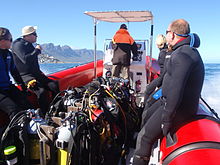
La mayoría de los sitios de buceo en esta región son relativamente poco profundos y se pueden realizar en el aire con equipo de buceo recreativo ordinario, que incluiría:
- Traje de neopreno completo de al menos 5 mm de grosor, capucha, botas y guantes.
- Un cilindro con arnés, regulador y manómetro sumergible.
- Un dispositivo compensador de flotabilidad (BCD).
- Máscara y snorkel.
- Aletas
- Un sistema de lastre desechable correctamente calibrado para el resto del equipo.
- Un ordenador de buceo o un profundímetro y un temporizador con tablas de descompresión y plan de inmersión.
A esto puedes agregar:
- Cualquier equipo adicional que usted o su agencia certificadora considere obligatorio, como un regulador secundario, un inflador BCD de baja presión, un cuchillo, etc.
- Cualquier equipo que lleve o use según sus preferencias personales, como una cámara, un dispositivo de señalización, una muñequera, un traje seco, un carrete y una boya marcadora de superficie, suministro de gas alternativo, brújula, etc.
Recomendaciones
- Si sus aletas tienen bolsillos completos para los pies (talón cerrado) y las botas de su traje de neopreno tienen suelas blandas, puede ser necesario usar zapatos para llegar al punto de entrada en las inmersiones en tierra. Se recomiendan las aletas de tacón abiertas y las botas de suela dura para la mayoría de las inmersiones en tierra en esta región porque el suelo tiende a ser áspero y es posible que los zapatos no estén donde los dejó cuando regrese de la inmersión.
- A standard surface marker buoy is not recommended where there is heavy kelp growth, as it will snag frequently and provide endless annoyance. A deployable or “delayed” surface marker is better at such sites and is always a good thing to carry on a boat dive.
- Leaving out any of the above items is at your own risk. There are divers who will not wear hoods, or gloves, or boots, or feel that a snorkel or BC is not necessary, or that they can dive in a 3 mm suit. Try this on an easy dive first, where you can get out quickly. It may work for you – there are divers who manage in each of these cases, but you have been warned.
Additional equipment

For each dive site there may be additional or alternative equipment required or recommended, which may improve the dive experience or improve safety at that site. The most commonly recommended items are:
- Compass
- Dry suit
- Light
- Nitrox
- Reel with DSMB
Use of a compass is recommended wherever it may be desirable to swim back to shore below the surface to avoid wind or boat traffic, or to keep below the kelp fronds. It is required for the compass navigation routes.
A dry suit is recommended for most dives on the Atlantic seaboard, or in general if the dive is deeper than about 20 m and the water is colder than 13°C. An appropriate undergarment is required for the dry suit, at this is what provides the insulation. With a suitable combination it is possible to enjoy an hour's dive in comfort at a water temperature of 8°C, when most of the divers in 7-mm wetsuits are cold after 30 minutes. If your face and head are particularly sensitive to cold, a full-face mask will keep your face warm.
Recommendations for a light are for daytime dives, as lights are considered standard equipment on night dives. Backup lights should be carried on night dives from a boat. Underwater flashers may not be well received by the other divers as they are extremely annoying. If you feel you must use one, warn the others and stay away from those divers who do not wish to have a light continually flashing in their peripheral vision and distracting them. A strobe which may be switched on in an emergency is another matter entirely, and is accepted as a valuable safety aid.
The equipment recommendations are for divers who are competent to use those items, and if you are not, you should consider whether your competence is sufficient to dive the site without this equipment.
No recommendations are made regarding equipment for wreck penetration dives and deep dives. If you do not know exactly what equipment is required and have it with you, or are not competent in its use, you should not do the penetration. Depth, wrecks and caves are nature’s tools for culling reckless divers.
Recommendations for gas mixtures are generic. You must choose the appropriate mixture based on your qualifications, competence and the dive plan. Nitrox mixtures are generally recommended to increase dive time without obligatory decompression stops, and Trimix to reduce narcotic effects. Nitrox is available from many of the dive shops, and charter operators will usually provide cylinders filled with the blend of your choice if given sufficient notice. Trimix is more difficult to arrange, as not many filling stations keep Helium in stock, so it may require a bit of shopping around.
Decompression dives should generally only be planned by divers who are familiar with the site, and are competent and properly equipped for the planned dive. Recommendations in this regard are outside the scope of this article, and it will be necessary to discuss any planned decompression dives well in advance with the dive operator, as only a few of them are competent and willing to support planned decompression dives, and those will usually require strong evidence of your competence to do the dive, and advance notice of your dive plan.
Exotic equipment
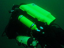

Diving equipment other than open circuit back mounted scuba with half mask and mouth-grip demand valve is considered to be exotic for this section.This would include surface supplied breathing apparatus and full face masks, used as standard equipment by commercial divers, and rebreathers, seldom used by commercial divers, but frequently used by military divers and gaining popularity with Technical recreational divers.
Also considered as exotic equipment is side-mount scuba and diver propulsion vehicles (scooters), as they are not used by many recreational divers.
Generally speaking, any use of surface supplied diving equipment will require special preparation and logistics, which are not available from the listed service providers, but are perfectly legal for use and technical support is available from the suppliers to the commercial diving industry in Cape Town.
Rebreathers are relatively uncommon, but are used by a few local aficionados, and sorb is available over the counter at a few suppliers. There is even one charter boat which regularly runs dives for mainly rebreather divers. Expect to be checked out for skills and certification before being allowed to join these dives, so it would be advisable to make prior arrangements. Technical support is available for a limited range and parts will usually only be available from overseas agencies. Most of the local dive sites do not really justify the expense and relative risk of rebreathers, and they are mostly used by divers who also use them in other places where they are more of an advantage, and by those who just enjoy the technology. They are not available for rental, except in some cases as part of a training package.
Full-face masks will not be a problem, provided you can show your ability to provide buddy support if diving with a partner (some charters will insist that you dive with a buddy). Technical support and parts are available from local agencies for most of the more popular models used for commercial and technical diving, but you may have to wait some time if parts are not in stock. The use of a full-face mask can be a particular advantage when the water is cold, and if you have one and prefer to use it, by all means bring it to Cape Town.
Side mount scuba is relatively uncommon in Cape Town, but there should be no problems if you chose to use it. Do not expect boat crews to know how to help you kit up, but they will probably respond well to explanations. There is a growing number of local side-mount aficionados, including several instructors for side-mount.
Diver propulsion vehicles (scooters) are rare but not unknown. Check with the charter boat whether will be space on board for your unit, and don't expect to find one for rental.
Decompression and bailout sets are not considered exotic, but are not easily available for rental. Bring your own, or ask around. Some of the service providers carry a small range of cylinders suitable for sling mount, but may not have the gas mixture you want in stock. Almost all the local divers that carry decompression or bailout cylinders routinely have their own equipment
Dive sites


The dive sites described in these articles include some which are well known favourites and have been dived frequently and by many divers for decades, and also newly described sites, which may only have been dived a few times, and by a few divers. There are also sites which have been known for years, but seldom dived due to their relative inaccessibility, and a few which are basically not particularly interesting, but have been included in the interests of completeness, as the information is available, and occasionally people want to know what they are like. With a few exceptions, the information provided is based on personal observation at the sites by Wikivoyagers. All photos of marine life and features of interest were taken at the listed site.
Geographical information is provided in as much detail as is available. Sites are geolinked, which allows them to be identified on various internet map systems. Positional accuracy is usually good. The maps provided should be usable, to scale, and accurate, but are not guaranteed either to be correct in all details or complete. Clicking on the thumbnail will open a link to a higher resolution image.
Atlantic coast of the Cape Peninsula

Introduction and some tips on diving the Atlantic coast.
This coastline from Table Bay to Cape Point is exposed to the south westerly swells generated by the cold fronts of the Southern Ocean. The continental shelf is narrow in this part of the coast and swells are not greatly influenced by the narrow band of shallow water, so they retain most of their deep-water energy. These swells pound this coast most of the winter, and to a lesser extent in summer, so diving in this region is mostly a summer activity, and the frontal weather patterns far to the south are more important than local weather for swell prediction.
North westerly winds are a feature of the approach of a cold front, and in winter they can be very strong for a few days before swinging to southwesterly as the front passes. These north westerly winter storms were responsible for many shipwrecks in Table Bay and other parts of the west coast, and the associated wind waves can be severe. However the fetch is short and these onshore wind waves do not last long after the storm. They do mess up the visibility though, and this effect lasts for some time after the waves have dissipated.
The south easterly winds are longshore to offshore in this area and tend to knock the swell down a bit. They also cause an offshore displacement of the surface water, which results in deeper water rising to take its place. This upwelling brings colder, initially cleaner water to the inshore areas, and can produce conditions of 20 m visibility and temperatures down to 8°C, though more usually 10° to 12°C. The diving is wonderful if you are sufficiently insulated. Out of the water, however, it is commonly fine and hot, with blazing sunshine high ultraviolet levels and air temperatures in the high 20 and 30° Celsius. This means you will be overheating until you get in the water, hence the comment that summer diving in Cape Town is one easy step from hyperthermia to hypothermia.
There is no escaping the need for a well-fitting, thick (preferably 7 mm), wet suit or a dry suit with an adequate undergarment for these conditions if you intend to stay for more than a few minutes. Carrying a bottle of water with your equipment to wet the outside of your suit before or after putting it on will help keep the temperature down due to evaporative cooling, specially on a windy day. Overheating after leaving the water is seldom a problem. The alternative option of kitting up at the water’s edge requires a shore party to look after your clothes, etc., while you dive, so it has become less common. Do not leave equipment unattended if you wish to see it again.
An upwelling is frequently followed by a plankton bloom, often called a red tide. This will reduce visibility considerably, particularly near the surface. Often the water will be much clearer below the surface layer, though the light levels may be a bit dim and the colour relatively green, or even brownish. The phytoplankton will bloom while the sun shines, so it is much more developed in summer.
The south-easter is an offshore wind at some sites, and besides its influence on temperature and visibility, it also affects the swim back to shore after the dive. The south-easter can appear seemingly out of nowhere on a previously cloudless and windless day, and build up to near gale force in the time you are underwater on a dive, though it is usually predictable, so take note of weather forecasts, and in any case, allow sufficient reserve air to swim back a few metres below the surface. A compass is extremely useful if you do this as it allows you to swim shallower, which is good for air consumption, decompression and warmth. A depth of 3 to 5 m is recommended for a long swim home. The strong south-easter in these cases produces a short, steep wind chop with white-caps which does not penetrate to any significant depth, but the constant slapping of waves and the spray in the air can make snorkelling unpleasant and difficult. There may also be a shallow offshore wind drift (surface current), but this takes some time to develop and gets rapidly weaker with depth and is not usually a problem below about a metre depth inshore. Further offshore the wind induced current can take you several hundred metres during a decompression stop, at a rate of about 0.5 to 1 kph.
When boat diving a deployable surface marker buoy (DSMB) is useful to both facilitate controlled ascent and accurate decompression or safety stop depth, and as a signal to the boat that you are on your way up. In strong wind conditions it will also improve your visibility on the surface, specially if your equipment is all black, so it is worth carrying even if only as a signalling device. Bright yellow has been shown to be best for all round visibility at sea, but orange and red are fairly good too.
Robben Island

These sites are all boat dives. There is no other practical way to get to them, as they are all several kilometres from the mainland across major shipping lanes.The waters around Robben Island were proclaimed a Marine Protected Area in 2019, so a permit is required to dive there. The boat operator will have to have a permit for the restricted area. Details of how this will be done are not yet known.
Local geography:Robben Island is a low, rocky shored island in the mouth of Table Bay. The island and surrounding reefs are rock of the Tygerberg series of the late Precambrian Malmesbury group. These are folded sedimentary rocks, frequently with very steep dip, which often weather to form rather jagged outcrops.
The sites include:
- 1 MV Treasure: S33°40.45' E018°19.95' (approximate)
- Wreck dive. Boat access only. Depth: 30 to 50 m
- On 23 June 2000 the damaged Panamanian registered bulk ore carrier sank off the coast of South Africa approximately 7 nautical miles north of Robben Island.
- The vessel lies upright on a fairly level bottom at about 50 m depth. The superstructure was removed shortly after the sinking by sawing it off at about 30 m depth with a cable towed by tugs as it was a hazard to shipping.
- 2 Robben Island steamer wreck: S33°49.886', E018°21.524' (approximate centre of wreckage)
- Wreck dive. Boat access only. Depth: 30 to 36 m
- Unidentified wreck of a steel steamship about 48 m long in reasonable structural condition.
- 3 MV Afrikaner: S33°50.012' E018°20.686'
- Boat access only. Deep wreck dive. Depth 43 to 50 m
- The 61 m fishing vessel struck Whale Rock in 1993 and sank while being towed away from the rock.
- 4 Whale Rock: S33°50.112' E018°22.858'
- Reef dive. Boat access only. Depth: Mostly less than 10 m
- A large shoal area of rocky reef, usually with a break over the pinnacle, which is the last resting place of a few ships.
- 5 SS Hypatia: S33°50.10’ E018°22.90’ (Turner 1988)
- Wreck and reef dive. Boat access only. Depth: Shallow, maximum probably about 15 m
- British Houston Line steamer of 5 728 tons, built in 1902. Wrecked on Whale Rock in Table Bay on 29 October 1929 in fog while on a voyage from Beira to New York with a cargo of blister copper and chrome ore.
- 6 MV Daeyang Family: S33°50.388' E18°23.133
- Wreck and reef dive. Boat access only. Maximum depth about 15 m
- A large Korean ore carrier which was wrecked on Whale Rock on 1 March 1986 when anchors dragged in heavy weather. The wreckage lies at a depth of about 15:nbsp;m
Table Bay

- 7 MV Winton: S33°52.1514' E18°29.1828 (Engine block)
- Wreck dive. Boat access, though shore access is feasible. Close to surf line. Maximum depth about 6 m.
- Wreck of a small steel freighter on a flat sand bottom.
- 8 MV Gemsbok: S33°53.0' E018°20.5'
- Boat access only. Deep wreck dive. Depth about 57 m on the sand.
- The 50 m 313 tonne buoy tender MV Gemsbok capsized and sank about 4 km from Green Point Lighthouse on 2 Seprember 1975 while transferring an anchor chain of a cargo vessel. The chain snagged and the weight of the chain caused the vessel to capsize and sink within minutes. The wreck lies on its starboard side.
- 9 Highfields: S33°53.13’ E018°25.83’ (Bow)
- Wreck dive. Boat access only. Close to major shipping lane at harbour mouth. Maximum depth 24 m.
- Wreck of a steel barque which sank after a collision in 1902.
- 10 SS Cape Matapan: S33°53.233' E018°24.533' About a kilometer north of Granger Bay harbour
- Wreck and reef dive. Boat access only. Maximum depth 25 m. The wreck is close to the shipping lane and there are no landmarks nearby.
- Wreck of a steel fishing boat which was sunk in a collision in 1960 in heavy fog.
- 11 RMS Athens: S33°53.85’ E018°24.57’
- Wreck and reef dive. Shore or boat access. Maximum depth about 7 m
- Union Company iron steam screw barque of 739 tons, built in 1856. Wrecked between Mouille Point and Green Point on 17 May 1865 during a north-west gale while trying to steam out of Table Bay. The site can be identified by the remains of the engine-block, which is visible above the water.
- 12 SS SA Seafarer: S33°53.80’ E018°23.80’
- Wreck and reef dive. Boat access recommended. Depth: Fairly shallow. Mostly between 5 and 9 m.
- The 8000-ton Safmarine freighter SS South African Seafarer was wrecked in a north westerly gale on 1 July 1966, and lies in front of the Green Point lighthouse.
- 13 Two Oceans Aquarium: S33°54.476’ E018°25.074’
- Shore access only. Confined water. Maximum depth 6 m
- Visitors may dive in the Predator tank, which is a large oval tank, or the Kelp Forest tank, which is roughly square. There are large windows, almost full height on one side, through which you can observe the other visitors watching you if you get bored with the fish.
Sea Point

Local Geography:There is a narrow coastal plain at the base of Signal Hill and Lion’s Head. The contact zone between the intrusive granites of the Península pluton and the sedimentary greywackes and shales of the Tygerberg formation of the Malmesbury series is in this area.The northern sites are on the Tygerberg rocks, which are steeply dipped and form parallel ridges and gullies, while Bantry Bay is on the granite, and has the characteristic corestone topography of rounded boulders and outcrops with sand bottom in deeper areas.
The sites include:
- 14 Three Anchor Bay: S33°54.36’ E018°23.85’
- Reef dive. Shore access. Depth: Shallow
- A small sand bottomed bay with reef to both sides. Easy access.
- 15 Sea Point Ridge Pinnacles: S33°54.905' E018°21.421'
- Reef dive. Boat access. Depth: 17 to 27 m
- An isolated pair of corestone pinnacles on a low granite ridge.
- 16 Bantry Bay: S33°55.56’ E018°22.65’
- Reef dive. Shore or boat access Depth: Less than 10 m
- This little bay is at the southern end of Sea Point, towards Clifton.
Clifton

Clifton Rocks is generally considered a shore dive, but the Paws are quite a distance offshore and are only dived from boats. Parking in Clifton is often a problem, particularly in the kind of weather in which you may wish to go diving. Weekdays will be better and early morning will help. The offshore dives avoid this problem by using boats from Oceana Power Boat Club slipway, which has its own parking problems, though not quite as serious.
Local geography:The suburb of Clifton is built on the rather steep slopes of the base of Lion’s Head above Clifton Bay. There are four beaches in the bay which are famous for white sand, shelter from the south easter and cold water. North Paw is offshore of the headland to the north, and South Paw is offshore from Clifton Rocks, on the south headland. Access to the area by road is from Sea Point to the north and Camps Bay to the south.
The reefs of Clifton are granite corestones of the Península pluton. In this area the granite base of the mountain extends to approximately the height of Signal Hill, and is capped by sandstones of the Graafwater and Table Mountain formations. Occasional rounded granite outcrops can be seen on the mountainside, which is mostly deeply weathered granitic saprolite, with some sandstone scree.
The sites include:
- North Lion’s Paw: S33°55.854’ E018°21.849’ (Exposed Rock)
- Reef dive. Boat access only. Depth: 15 to 23 m.
- A spectacular site in good conditions. A popular part of the site is the cave rock, which is slightly offshore from the exposed rocks.
- 17 North Lion’s Paw Northern Pinnacles
- 18 North Lion’s Paw Monty's Pinnacles
- 19 North Lion’s Paw Eastern Pinnacle
- 20 North Lion’s Paw Barry's Pinnacles
- 21 North Lion’s Paw Cave Rock
- 22 North Lion’s Paw Main Reef
- 23 South Lion’s Paw: S33°56.308’ E018°21.890’
- Reef dive. Boat access only. Maximum depth about 20 m.
- An extensive reef of granite corestones marked by the large outcrop which extends above the water.
- 24 Clifton Rocks: S33°56.346’ E018°22.222’
- Reef dive. Shore or boat access. Maximum depth about 14 m.
- A large area of granite corestones, bounded to the north by sand bottom. The reef extends to seaward from the shoreline at the point.
- 25 Cleeve's Tunnel: S33°56.540' E018°21.894'
- Reef dive. Boat access. Maximum depth about 20 m.
- A large corestone pinnacle with a long low tunnel
Camps Bay
Local geography:Camps Bay is in the corner made by Lion’s Head and Table Mountain. Access is over Kloof Nek from the city bowl, and round the coast from Sea Point via Clifton to the north, and from Hout Bay via Oudekraal to the south
The reefs of this area are like those of Clifton.
The sites include:
- 26 Bakoven Rock: S33°57.555’ E018°22.204’
- Reef dive. Shore or boat access. Maximum depth 17 m.
- This site is generally considered a shore dive. Parking is limited so it is most conveniently dived during the working week when there is less competition for space, otherwise get there early.
Oudekraal

This area includes some of the best and most popular shore dive sites on the Atlantic seaboard. Most can also be dived from a boat, and this is of particular importance to divers with restricted mobility on shore, as there is generally a rugged bit of coast to negotiate and in some cases a long climb. There is also a moderate to long swim at some of the sites, and at some states of the tide, heavy kelp inshore.
Local geography:The coastline at the base of the Twelve Apostles range just south of Table Mountain is steep, and south of Camps Bay, virtually undeveloped. Fortunately for divers, the coastal road is not far above sea level in the north of this area, and though there are not many off-road parking areas, the road is wide enough to park along the side.
This is an area of pale grey Península Granite corestone outcrops and boulders with some Table Mountain Sandstone boulders which have rolled down the mountainside to the water’s edge. The mountainside below the sandstone cliffs is deeply weathered granite saprolite with occasional corestone outcrops. The cuttings at the roadside display the granular yellow-brown saprolite with a thin soil covering. The underwater topography is almost entirely corestones exposed by erosion, surrounded by samd, and is a continuation of the granite boulders and outcrops at the water’s edge.

North Oudekraal
The sites include:
- 27 Arrecife de rastas: S33°58'22.05" S18°21'42.59"
- Reef dive. Boat access. Depth: 1.5 to 20 m.
- A relatively new site. First survey 30th January 2010. This granite ridge peaks about 1.5m from the surface at low tide, but the tip is small and seldom breaks. Bottom on low granite at about 20m. Colourful and diverse invertebrate cover, and notable for the relatively large colonies of Dreadlock hydroids.
- 28 Geldkis Blinder: S33°58.67’ E018°21.62’
- Reef dive. Boat or shore access. Maximum depth about 20 m.
- A relatively infrequently dived site. The highest rock on the reef is a blinder beyond Geldkis rock which occasionally breaks the surface at low tide. Huge boulders and outcrops, and a few swimthroughs.
- 29 Rocas de fresa: S33°58.725’ E018°21.658’ (approximate)
- Reef dive. Shore or boat access. Maximum depth about 15 m.
- The two smaller rocks to the north of Geldkis rock. Several small caverns and swimthroughs.
- 30 Geldkis: S33°58.73’ E018°21.61’
- Reef dive. Shore or boat access. Maximum depth about 15 m.
- A large group of rocks with lots of overhangs, swimthroughs and chimneys. The Dutch East Indiaman Het huys te Craijestein was wrecked on the rocks in the bay at Oudekraal on 27 May 1698 in thick mist. Three chests of treasure disappeared and the name "Geldkis" (money-chest) appears on maps of the area and is now applied to the offshore rocks.
- 31 Boardroom: S33°58.761’ E018°21.151’
- Reef dive. Boat access, though possible from shore. Maximum depth about 21 m near the pinnacle, but deeper water nearby. about 10 m on top.
- A very large boulder with a large swimthrough cave and a large overhang in an area of high profile boulder reef.
- 32 Het Huis te Kraaiestein: S33°58.85’ E018°21.65’
- Wreck and reef dive. Shore access. Maximum depth 10 m.
- Remnants of the Dutch East Indiaman Het Huis te Kraaiestein of 1,154 tons, which was wrecked in the bay at Oudekraal on 27 May 1698 in thick mist while trying to find the way into Table Bay. Some cannon, anchors and a few baulks of timber are all that are usually visible above the sand.
- 33 Pináculo de hongos: S33°58.781’ E018°21.521’
- Reef dive. Shore or boat access. Maximum depth 17 m.
- A submerged granite tor (stacked group of large corestones) between Geldkis and Justin’s Caves. The pinnacle is surrounded by lower outcrops separated by sandy gullies.
- 34 Sandy Cove: S33°58.90’ E018°21.65’
- Reef dive. Confined waters. Shore access. Maximum depth 4 m
- A shallow sheltered cove at Oudekraal, suitable for open water training exercises, refresher courses and testing equipment when you don’t need depth. Entry area for several other sites.
- 35 Cuevas de Justin: S33°58.85’ E018°21.50’
- Reef dive. Shore or boat access. Maximum depth about 13 m.
- A group of big granite corestone outcrops and boulders with several swimthroughs, overhangs, caves and deep narrow gaps between the rocks. Spectacular in good visibility, colourful reef life.

Central Oudekraal
The sites include:
- 36 Antipolis: S33°59.06’ E018°21.37’ (Bow section)
- Wreck and reef dive. Shore or boat access. Maximum depth about 10 m.
- The tankers "Romelia" and "Antipolis" were under tow on 28 July 1977 during a north westerly gale when the tow cable to the "Antipolis" snagged on the sea bed. In the ensuing confusion the cables broke and the two ships were driven aground by the wind. The "Antipolis" ran aground at Oudekraal and was later cut down to water level.
- 37 Klein Pannekoek: S33°58.91’ E018°21.09’
- Reef dive. Boat or shore access. Maximum depth about 15 m.
- A group of large fairly low and flat rocks visible offshore to the west of the "Antipolis" and north of Coral Gardens.

South Oudekraal
The sites include:
- 38 Groot Pannekoek: S33°59.13’ E018°20.75’
- Reef dive. Boat or shore access. Maximum depth about 15 m
- A large flattish outcrop of granite, which extends a short way above the sea level at all tides. Some overhangs, crevices and small caves.
- Jardines de coral (Oudekraal): S33°59.270' E018°20.782' (The pinnacles)
- Reef dive. Shore or boat access. Maximum depth 17 m
- A spectacular dive in good conditions. Huge granite boulders in groups with open patches between them. There are overhangs, small caverns, a few swimthroughs, and many deep gaps and crevices. Extensively covered in colourful reef life. Possibly the best shore dive on the Atlantic side of the Cape Peninsula on a good day.
- 39 Jardines de coral
- 40 Coral Gardens Offshore Pinnacle
Llandudno

These sites can be accessed from the shore or by boat. Parking is limited, but the area is reasonably secure. Some walking is required, but no serious climbing as the parking is near the sea level.
Local geography:The small residential suburb of Llandudno is built on the moderately steep slopes of the Cape Peninsula below the peak of Klein-Leeukop, where the coast road (M6 – Victoria Drive) from Camps Bay crosses over the neck to Hout Bay. There is only one way into Llandudno by road, which is from the M6 near the top of the pass.This is an area of granite corestone reefs with sand bottom.
The sites include:
- 41 13 ° apóstol: S33°59.486' E18°19.922'
- Reef dive. Boat access. Depth: 10 to 24 m.
- A large granite pinnacle on an area of low granite reef with occasional sand patches.
- 42 Llandudno Reef: S34°00.037' E18°19.897'
- Reef dive. Boat access. Depth: 10 to about 30 m, on sand
- An unsurveyed granite reef, with several pinnacles, outcrops and gullies.
- 43 Bahía Logies: S34°00.25’ E018°20.53’
- Reef dive. Shore access. Maximum depth probably about 10 m.
- A small rocky cove to the north of Llandudno beach.
- 44 MV Romelia: S34°00.700’ E018°19.860’ approximately
- Wreck and reef dive. Shore or boat access. Maximum depth about 24 m.
- The tankers Romelia y Antipolis were under tow on 28 July 1977 during a north westerly gale when the tow cable to the Antipolis snagged on the sea bed. In the ensuing confusion the cables broke and the two ships were driven aground by the wind. La Romelia ran aground at Sunset Rocks, Llandudno, where its back was broken by the heavy surf and the ship split in two. Later the bow section sank, leaving the stern mostly above sea level on the rocks. Over the years the stern section has also broken up and is no longer visible above the water.
Oude Schip headland
Local geography:Oude Schip headland lies at the foot of the Karbonkelberg between Sandy Bay to the north and Leeugat to the south, It is a low rocky headland of Peninsula granite, with several reef dives and one known wreck. It is a fairly exposed section of coast but protected from the south easterly winds by the mountain. The sites are only accessible by boat as there is no road access to this part of the shore, and most are too far offshore to safely swim.
This is an area of granite bedrock of the Península pluton, The reefs are exposed corestone outcrops and boulders, with sand patches in the deeper areas
The sites include:
- 45 Pasos: S34°01.330’ E018°18.600’
- Reef dive. Boat access only. Maximum depth about 20 m.
- An area of high granite reef with deep gullies. Not actually in Leeugat, but just north of Oude Schip headland.
- 46 MV Harvest Capella: S34°01.600’ E018°18.750’
- Wreck dive. Boat access only. Maximum depth about 15 m.
- An area of mostly flattish granite reef with a few ridges and some wreckage of a steel motor fishing vessel, some of which has washed up onto the point and is visible from a distance. Not actually in Leeugat, but on the north shore of Oude Schip headland.

The Blue Flash Reefs
- 47 Rachel's Reef: S34°01.431' E018°18.151'
- Reef dive. Boat access only. Depth between about 3 and 21 m.
- Rachel's Reef is a compact granite pinnacle with surrounding high profile reef.
- 48 Humpback Ridge: S34°01.548' E018°18.142'
- Reef dive. Boat access only. Depth between about 4 and 21 m.
- A fairly massive granite pinnacle in the middle of a more extensive north-south ridge rising to about 12 m. Humpback whales have been seen near these reefs on several occasions.
- 49 Wilhelm's Wall: S34°01.502’ E018°17.931’
- Reef dive. Boat access only. Depth between about 12 and 31 m.
- A granite ridge somewhat more than 50 m long with sheer faces to the north and south, a flattish bottomed gully to the south, and another, more broken ridge south of the gully. Colourful sessile invertebrates on the sides and seaweeds on top.
The Middelmas reefs:
- Hakka Reef (Middelmas): S34°01.747’ E018°18.328’
- Reef dive. Boat access only. Maximum depth about 21 m.
- 50 Die Middelmas is a rock that projects several metres above the water at all tides, to the west of the Oude Schip peninsula.
- 51 Hakka Reef Southeast pinnacles is off this rock.
- 52 Hakka Reef Sven's Caves pinnacles is nearby at a set of pinnacles near a sand patch.
- 53 Twin Towers: S34°01.920’ E018°18.330’
- Reef dive. Boat access only. Depth about 20 m at the tops of the pinnacles to 34 m on the sand.
- A small but tall double-peaked granite pinnacle on a narrow base reef and surrounded by sand.
Leeugat (Maori Bay)

.jpg/220px-Gelderland_(1).jpg)
Although several of the sites are quite close inshore, this area is in practice only accessible by boat, as the distance to the nearest parking is too far to carry dive gear (about 3 km as the crow flies, more on foot).
Local geography:Leeugat, also known to divers as Maori Bay, lies at the foot of the Karbonkelberg, between the northern headland of Oude Schip, and Duikerpunt to the south. It is a small bay, but fairly deep close inshore, which in combination with the partial barrier afforded by the reefs at the headlands, has provided the wrecks in Leeugat bay with better protection from wave action than those on more exposed parts of the coastline. This means that not only have they lasted well for their ages, but conditions are suitable for diving more often than for many other wrecks on the Atlantic seaboard of the Cape Peninsula.
This is an area of granite bedrock of the Península pluton, The reefs are exposed corestone outcrops and boulders, with sand patches in the deeper areas
The sites include:
- 54 MV Keryavor and the Jo May: S34°02.037’ E018°18.636’
- Wreck and reef dive. Boat access only. Depth: Not available, probably between 25 and 30 m.
- These two wrecks lie next to each other approximately between the Maori and the Gelderland. La Jo May sank first and not much of her wooden structure remains. La Ker Yar Vor was a steel lobster fishing vessel and several chunks of hull structure and twisted sections of plating remain.
- 55 SS Maori: S34°02.062’ E018°18.793’ (Machinery)
- Wreck and reef dive. Boat access only. Depth: 6 to 21 m
- The SS Maori was a typical British steam cargo vessel of the early 1890s. The ship was wrecked in the bay between Oude Schip and Duikerpunt on 5 August 1909 in thick fog and drizzle while on a voyage from London to New Zealand.
- 56 SAS Gelderland: S34°02.070’ E018°18.180’
- Wreck and reef dive. Boat access only. Depth: 30 to 35 m
- The Ford class Seaward Defense Boat SAS Gelderland was scuttled on 21s ecember 1988, north west of Duiker Point, as demolition trials.
- The vessel was about 40 m long but the main part of the wreckage is now only about 20 m long as the bow and stern sections were blown right off.
- Plan B pinnacle is just to the south of the southernmost wreckage.
- 57 SS Oakburn / MV Bos 400: S34°02.216’ E018°18.573’
- Wreck and reef dive. Boat access only. Depth: Maximum 22 m
- The "Oakburn", a British cargo steamer of 3865 tons, was wrecked on the north side of Duikerpunt in fog on 21 May 1906, on a voyage from New York to Sydney. The Oakburn has pretty much fallen apart, and on 27 June 1994, the French pipe-laying crane barge Bos 400, broke its towline and stranded virtually on top of the older wreck. The Bos has started to break up, and two large sections have collapsed into the sea, though the main crane section is still firmly stuck on top of the rocks.
Outer Hout Bay


This area includes the dive sites between Duiker Point and Duiker Island and the extensive reefs to the south as far as Vulcan Rock and Tafelberg Reef. All of these are only accessible by boat. There are a number of sites being explored in this area: the reefs between Kanobi’s wall and Stonehenge, and a wreck of a lifeboat which was used to salvage materials from the Boss 400 and which lies between Stonehenge and Duiker Island are among these. There are several unexplored pinnacles in the region identified on the SAN charts as bakleiplaas, where the sea is often very lumpy due to the influence of the underwater topography on the swell.
Local geography:The suburb of Hout Bay lies in the valley between the Constantiaberg to the east and the peninsula formed by Karbonkelberg and its lesser peaks to the west. One of these peaks, the Sentinel, gives its name to a dive site at its foot. At the mouth of the valley is the business area of Hout Bay, with its small commercial fishing harbour and marina, and a public slipway used by dive charters and private dive boats for access to most of the southern peninsula dive sites on the Atlantic coast. The slipway is in good condition, wide and accessible, and has a large parking area, which on occasions can be crowded due to heavy use by commercial fishing skiboats.
The bedrock of this area is granite of the Península pluton, and most of the sites are on corestone reefs of this rock.
The sites include:
Duiker Point sites:
- 58 Die Perd: S34°02.282’ E18°18.324’
- Reef dive. Boat access only. Depth: Not available, maximum probably about 20 m
- This rock off Duiker Point extends above the water and is surrounded by rugged reefs of high outcrops and deep gullies.
- 59 Kanobi’s Wall: S34°02.365’ E018°18.138’
- Reef dive. Boat access only. Maximum depth about 25 m.
- This blinder off Duiker Point is a good site with rugged topography, good biodiversity and large depth variation. Huge boulders are stacked, with tunnels, overhangs and caves of various sizes, and lots of vertical walls, some probably 10 m or more in height.
- 60 SURG Pinnacles: S34°02.375' E018°18.015'
- Reef dive. Boat access only. Depth 9 to over 30 m.
- A group of steep granite corestone pinnacles, probably mostly huge boulders, with walls, overhangs and a swimthrough. Deep narrow cracks divide the pinnacles. Spectacular topography, covered with lots of sea urchins and vast numbers of hairy brittlestars, a moderate variety of sponges, noble corals, gorgonians, and patches of cauliflower soft coral. Red bait and Laminaria on the tops of the pinnacles. Surge can be strong when a long swell is running.
- Star Wall: S34°02.466' E18°18.087' (pinnacle)
- Reef dive. Boat access only. Depth: 6 to 32 m.
- This site has the tallest and longest wall known in the Cape Town area and is a dive site well worth visiting. A massive and continuous granite wall of about 25m almost vertical height, extending for a length of 100 m on the south face and 50 m on the south-east face. Very diverse and colourful invertebrate cover on the wall face. The sites are:
- 61 Star Wall
- 62 Star Wall - M&M Cave
- 63 Star Wall - Lollipop Pinnacle
- 64 Sunfish Pinnacle: S34°02.475' E18°18.290' (pinnacle)
- Reef dive. Boat access only. Depth: 7 to 26 m.
- A fairly large pinnacle on a rocky bottom on the way to Duiker Point from Hout Bay harbour, which has been picked up quite frequently on the echo sounders of dive boats passing over it. It has now been dived, and to some extent mapped. The site is quite pretty and should make a pleasant alternative site. Topography is rugged, with high vertical walls on two sides of the pinnacle.
Stonehenge sites:
- 65 Canyon: S34°02.595’ E018°18.073’
- Reef dive. Boat access only. Maximum depth about 35 m.
- The area is named for a gully between rows of pinnacles. Big boulders and rock outcrops cover an extensive area.
- Stonehenge: S34°02.838’ E018°18.316’
- Reef dive. Boat access only. Maximum depth about 22 m.
- The area is named for a group of tall rocks which break the surface. Big boulders and rock outcrops cover an extensive area. High profile in the deeper areas, with swimthroughs, holes and overhangs. Heavy kelp in some areas. Included in this area, Stonehenge Blinder, a pinnacle that approaches the surface and breaks in a large swell or at low tide.
- 66 Stonehenge Dusky Pinnacles - Coral Pinnacle
- 67 Stonehenge North
- 68 A-340 Pinnacle
- 69 Stonehenge Central
- 70 Stonehenge South
- 71 Stonehenge Blinder
- 72 Stonehenge Wreck
Seal Island sites:
- 73 Seal Island (Duiker island): S34°03.458’ E018°19.562’
- Reef dive. Boat access only. Profundidad: Poco profunda, en su mayoría menos de 6 m.
- El pequeño islote rocoso marcado en mapas y cartas como Duikereiland se conoce como Seal Island debido a la colonia de focas residentes que se ha convertido en una atracción turística. No debe confundirse con Isla de las focas en False Bay.
Sitios de Vulcan Rock:

- 74 Di's Cracks: S34 ° 03.855 ’E018 ° 18.400’ - Gran pináculo de 14 m - roca en la parte superior del arrecife. Aproximadamente 300 m al noroeste (328 ° magnético) de Vulcan Rock
- Buceo en arrecifes. Solo acceso en barco. Profundidad: 10 a 30 m.
- Una inmersión espectacular si la visibilidad es buena. Muchas paredes y voladizos, natación y grietas profundas y anchas. Rica cubierta de invertebrados. Buen sitio para fotografía escénica de gran angular espectacular.
- 75 Roca de Vulcan: S34 ° 03.967 ’E018 ° 18.582’
- Buceo en arrecifes. Solo acceso en barco. La profundidad máxima es de más de 25 m cerca de la roca.
- La roca de Vulcan es el punto más alto de un gran arrecife de granito y rompe la superficie en algunos estados de la marea. Es bajo y plano en la parte superior. Una inmersión espectacular si la visibilidad es buena.
Sitios del arrecife Tafelberg:
- 76 Arrecife Tafelberg: S34 ° 04.22 ’E018 ° 18.93’
- Buceo en arrecifes. Solo acceso en barco. Profundidad: 8 a 30 m.
- Extensa área de afloramientos de granito accidentados con alto relieve y fondo de arena a unos 29 m al oeste. Grietas y barrancos profundos. No mucho voladizo, pero muchas caras verticales. Topografía muy accidentada y espectacular con buena visibilidad.
- 77 Arrecife Klein Tafelberg (Ensaladera, barco hundido): S34 ° 04.442 ’E018 ° 19.191’
- Buceo en arrecifes. Solo acceso en barco. Profundidad: 14 a 36 m.
- Enorme afloramiento de granito con grandes cantos rodados. Fondo de arena en áreas más profundas. Topografía accidentada y espectacular. Los restos de un yate de GRP se encuentran en una hendidura en el costado del pináculo. Es posible hacer una inmersión de 40 a 45 m comenzando en la arena al este del arrecife y nadar por el arrecife en dirección noroeste, pero es probable que se requiera descompresión si llega hasta el final. el pináculo poco profundo.
- Tafelberg Deep:
- Buceo en arrecifes. Solo acceso en barco. Profundidad máxima de unos 40 m sobre la arena.
- Afloramientos de granito de perfil bajo a medio, inclinados hacia el Pináculo profundo de Tafelberg al sur del pináculo en Klein Tafelberg Reef. Es posible hacer una inmersión de 50 my nadar hasta el arrecife, pero se requerirá algo de descompresión.
- 78 Tafelberg Deep
- 79 Pináculo profundo de Tafelberg
Hout Bay


Esta área incluye los sitios entre Sentinel y Chapmans Peak. La mayoría de estos son inmersiones en barco. Se puede acceder a la única excepción, Sentinel, por tierra sin gran dificultad, pero tiene un problema de seguridad.
El Sentinel es una zona típica de la costa de granito, con un gran número de rocas a lo largo de la costa y arrecifes de corestone con los perfiles redondeados habituales. Los restos del Aster y Katsu Maru están en un fondo de arena plano, y el sitio en Die Josie está en granito relativamente sin meteorizar en la base de los acantilados de Lower Chapman's Peak
Los sitios incluyen:
- 80 Centinela:
- Buceo en arrecifes. Acceso a la orilla o en bote. Profundidad: mayoritariamente menos de 10 m.
- Este es el lugar de la costa atlántica donde el contorno de profundidad de 30 m está más cerca de la costa.
- Algunos consideran que el Sentinel es el área debajo de los acantilados verticales, y es un área de arrecife plano con muchas algas marinas y medusas de caja, y algunas rocas grandes.
- Los Pináculos son un grupo de rocas cerca de la costa justo al lado del puerto de Hout Bay, cerca de las obras de alcantarillado.
- 81 MV Aster: S34 ° 03.891 ’E018 ° 20.955’
- Buceo en naufragio. Solo acceso en barco. Profundidad máxima 28 m.
- El buque pesquero a motor de 340 toneladas y 27 m de eslora "Aster" era un buque pesquero de langosta registrado en Sudáfrica que se preparó como un arrecife artificial apto para buceadores limpiando y cortando aberturas en la estructura y se hundió en Hout Bay cerca de los restos del naufragio del "MV Katzu Maru" el 9 de agosto de 1997. Se ha utilizado como lugar de entrenamiento para la penetración de naufragios. El recipiente está en posición vertical en el fondo y comienza a romperse.
- 82 MV Katsu Maru: S34 ° 03.910 ’E018 ° 20.942’ (en medio del naufragio)
- Buceo en naufragio. Solo acceso en barco. Profundidad máxima unos 30 m.
- El arrastrero japonés "Katsu Maru # 25" chocó contra un objeto no identificado en el mar y fue perforado en el costado de babor. Mientras era remolcado a Hout Bay, el buque se inundó y se hundió en la bahía el 7 de agosto de 1978. El naufragio se encuentra a estribor en el fondo de arena.
- 83 Muere Josie: S34 ° 04.497 ’E018 ° 21.256’
- Buceo en arrecifes. Solo acceso en barco. Profundidad: 7 a 17 m.
- Un arrecife poco profundo debajo de Chapman's Peak, que está cerca del puerto de Hout Bay y es adecuado para inmersiones nocturnas. Una de las pocas áreas donde el granito no está redondeado por la intemperie, como se puede ver desde los acantilados sobre el sitio.
Península del Atlántico Sur

Esta área incluye toda la costa de la península al sur de Noordhoek. No se bucea a menudo con fines recreativos, ya que está muy lejos de buenos sitios de lanzamiento y no se conocen muchos buenos sitios de buceo. Hay varios naufragios en esta área, particularmente en Albatross Rocks / Olifantsbospunt. Solo se han identificado positivamente algunos de los restos.
Los sitios incluyen
- 84 SS Clan Monroe: S34 ° 08.817 'E18 ° 18.949'
- Buceo en naufragios y arrecifes. Solo acceso en barco. Profundidad: 4 a 8 m.
- Naufragó un poco al norte del faro de Slangkop en Kommetjie. Muy pocas veces se zambullía. Arrecife de arenisca plano y poco profundo, con restos incrustados de algas coralinas.
- SS Thomas T. Tucker:
- Buceo en naufragios y arrecifes. Solo acceso en barco. Profundidad: poco profunda
- Este barco naufragó en lo alto de las rocas, y partes de los restos son visibles en la costa. La mayor parte de los restos se encuentran en aguas bastante poco profundas.
- 85 Estrella de africa:
- Buceo en naufragios y arrecifes. Solo acceso en barco. Profundidad: unos 27 m como máximo.
- 86 SS Bia: Sección de proa: S34 ° 16.140 'E018 ° 22.812' Sección principal: S34 ° 16.217 'E018 ° 22.638'
- Buceo en naufragios y arrecifes. Solo acceso en barco. Profundidad: 3 a 8 m.
- 87 SS Umhlali: S34 ° 16.435 'E18 ° 22.487'
- Buceo en naufragios y arrecifes. Solo acceso en barco. Profundidad: 5 a 8 m.
- 88 Roca albatros: S34 ° 16.495 'E18 ° 22.197'
- Buceo en arrecifes. Solo acceso en barco. Profundidad: Probablemente menos de 15 m cerca de la roca.
- Arrecifes del suroeste:
- Buceo en arrecifes. Solo acceso en barco. Profundidad: Incierto.
- Un área masiva de arrecifes poco profundos y lechos de algas al oeste de la punta de la península. Es el lugar frecuentado por los pescadores submarinos y los cazadores de cangrejos de río y está inexplorado en el buceo.
Costa de False Bay de la Península del Cabo


Introducción y algunos consejos sobre el buceo en la costa de False Bay de la Península del Cabo (lado de Simon's Town)
A diferencia del resto de la región, el lado oeste de False Bay está protegido de los vientos del oeste de invierno, pero a cambio toma el rumbo sur-este. Como resultado de esto, la región suele bucear en invierno, cuando el Sur-Semana Santa rara vez sopla durante mucho tiempo o con mucha fuerza.
Las tormentas frontales de invierno sobre el Océano Austral producen oleajes que son ralentizados por la plataforma continental y refractados y difundidos alrededor de la Península del Cabo, de modo que se propagan principalmente en paralelo a la costa y han perdido gran parte de su energía cuando se curvan hacia la orilla. La forma irregular de la costa aquí también protege algunas áreas más que otras. En términos generales, aquellas partes de la costa que corren en una dirección más noroeste a sureste están mejor protegidas del oleaje suroeste que las partes norte a sur, por lo que la elección del sitio de buceo depende de los patrones climáticos recientes.
Durante los meses de verano, cuando el Sureste de Pascua sopla con más frecuencia, durante más tiempo y, en general, con más fuerza, esta zona no suele ser apta para bucear y la visibilidad es, en general, más pobre que en invierno, incluso cuando las condiciones son adecuadas.
La temperatura del agua durante los meses de invierno en esta zona es generalmente más cálida que la de la costa atlántica en verano, lo que compensa en cierta medida las horas de luz diurna más cortas y, a menudo, el clima frío y lluvioso.
La temperatura del agua puede variar con la profundidad. Por lo general, hay una termoclina en verano y la visibilidad puede cambiar significativamente por debajo de la termoclina. La superficie puede estar a 18 o 19 ° C con 10 u 11 ° C en la parte inferior, pero es más probable que la diferencia sea de 5 ° C o menos. Las condiciones en profundidad no son fácilmente predecibles y pueden ser mejores o peores que cerca de la superficie. Puede haber una floración de plancton en las capas superficiales y una mejora repentina en la visibilidad de 3 mo menos a más de 10 m en el agua fría del fondo. La profundidad de la termoclina tampoco es muy predecible, pero se sabe que está entre 12 y 20 m a fines del verano.
En invierno, el agua puede tener la misma temperatura de arriba a abajo, y como hay menos luz solar para impulsar las floraciones de fitoplancton, la visibilidad y la iluminación natural pueden ser mejores aunque haya menos luz.
Entre los frentes frío y lluvioso, con frecuencia hay días de poco o ningún viento, y de sol suave a cálido, cuando el agua es plana y clara y el buceo es maravilloso, y la gran cantidad de sitios dificulta la decisión de adónde ir. hay tantas opciones. Es una vida dura aquí al final de África, pero alguien tiene que hacerlo.
La temperatura del agua durante el invierno suele estar entre 13 ° C y 17 ° C, aunque se sabe que desciende hasta los 11 ° C, por lo que también se necesita un buen traje aquí. En verano, la temperatura puede superar los 20 ° C, pero es más probable que oscile entre los 17 ° C y los 19 ° C.
La mayoría de las inmersiones en la costa son relativamente poco profundas, del orden de 8 ma 15 m de profundidad máxima, aunque es posible realizar una inmersión en la costa de 30 m si no le importa nadar 700 m para llegar allí. Las aguas poco profundas hacen que un traje seco sea menos ventajoso, pero salir de un traje de neopreno con el viento y la lluvia por la noche empuja el traje seco hacia arriba nuevamente como una opción deseable. Es bueno tener la opción, y muchos buzos locales intercambian trajes húmedos y secos dependiendo de la inmersión planificada.
Muizenberg a Kalk Bay

Estos sitios son los sitios más al norte del lado oeste de False Bay. Son poco profundas y están expuestas a los vientos y olas del sudeste, por lo que generalmente se consideran inmersiones de invierno.
Geografía local:Hay una estrecha franja de tierra entre la ladera de la montaña y el mar que está ocupada por los suburbios de St James y Kalk Bay, y en el extremo sur de esta hay una pequeña colina llamada Trappieskop. En este punto, la línea costera se curva hacia False Bay antes de regresar para formar Fish Hoek Bay. El pequeño puerto pesquero comercial de Kalk Bay está construido en esta cala.
Esta es un área donde la costa es arenisca de la serie Table Mountain, y el buzamiento es casi horizontal a unos 7 ° hacia el sur. La línea costera resultante es generalmente rocosa, con algunas áreas arenosas, y es sorprendentemente poco profunda considerando la pendiente de la ladera de la montaña. El fondo de arena comienza a unos 5 m de profundidad en Dale Brook y más cerca de 9 m en el puerto.
Los sitios incluyen:
- 1 Naufragios de arrastreros de Muizenberg
- Buceo en naufragio, acceso en barco. Profundidad máxima de unos 18 m.
- Dos arrastreros de acero que fueron hundidos para practicar bombardeos en la década de 1970 o alrededor. Están bastante desperdiciados, pero las estructuras del casco están moderadamente intactas y densamente cubiertas de invertebrados.
- 2 Dale Brook: S34 ° 07.436 ’E018 ° 27.154’
- Buceo en arrecifes. Acceso a tierra. Profundidad máxima de unos 6 m.
- Este sitio es bien conocido en la literatura científica por una gran diversidad de vida marina, y ha sido una zona santuario durante mucho tiempo, pero rara vez es buceado por buceadores deportivos. Es ideal como sitio de snorkel debido a la poca profundidad y la gran variedad de vida del arrecife, y es un buceo muy agradable en condiciones tranquilas. Es el sitio más cercano para el acceso por carretera desde la mayor parte de la ciudad en el lado este de la península.
- 3 Muro del puerto de Kalk Bay: S34: 07.787 'E018: 26.967'
- Buceo en arrecifes. Acceso a tierra. Profundidad máxima unos 10 m.
- Muro de hormigón del puerto con arena y arrecifes de rocas bajas en la base. El relieve del fondo no es muy alto. Arrecife bajo de arenisca, parches de guijarros y arena a unos 8 a 9 m.
Fish Hoek y Glencairn
Estos sitios relativamente poco profundos están expuestos al viento y el oleaje del sudeste y generalmente se consideran inmersiones invernales. Todo se puede hacer como inmersiones en la costa, aunque Fish Hoek Reef y Quarry Barge generalmente se realizan como inmersiones en bote, ya que hay un largo nado desde la costa. Se han visto grandes tiburones blancos navegando en esta área.
Geografía local:El valle bajo y relativamente plano de Fish Hoek está delimitado en el lado sur por las empinadas laderas de Brakkloofrant y Else Peak, que también se inclina abruptamente hacia el mar en el este.
Fish Hoek Reef está a cierta distancia de la playa, y los otros sitios de buceo de esta área se encuentran a lo largo de este corto tramo de costa rocosa. La carretera principal a Simon’s Town, la M4 y la línea de ferrocarril comparten la estrecha franja costera. Hay espacio para algunas casas en Sunny Cove, y justo después de Quarry, el río Else ha cortado un valle más pequeño con la playa de Glencairn. La cantera a la que se hace referencia es una cantera de arenisca en desuso en la ladera de la montaña sobre la carretera, justo al norte del sitio de buceo con ese nombre.
Ésta es un área donde las fallas han causado la Montaña de la Mesa Las areniscas se extienden por debajo del nivel del mar. El rumbo es generalmente de este a oeste y el buzamiento es poco profundo, desde aproximadamente 7 ° (sur) en Sunny Cove hasta aproximadamente 10 ° (sur) en Quarry. Sin embargo, la unión es aproximadamente al noroeste / sureste.
Los sitios incluyen:
- 4 Arrecife de pescado Hoek:
- Buceo en arrecifes. Acceso en barco o en tierra. Profundidad máxima unos 15 m.
- 5 Sunny Cove: S34 ° 08.68 ’E018 ° 26.30’
- Buceo en arrecifes. Acceso a tierra. Profundidad máxima unos 11 m.
- El nombre de la estación de tren en el sitio. Rocas de arenisca de relieve moderado, crestas y barrancos que se inclinan hacia la arena a unos 10 m.
- 6 Cantera: S34 ° 09.390 ’E018 ° 26.157’ (Saliente de entrada / salida)
- Buceo en arrecifes. Acceso a tierra. Profundidad máxima unos 10 m.
- El nombre de la antigua cantera de arenisca en la ladera sobre la carretera ligeramente hacia el norte. Crestas inclinadas en forma de rampa de arenisca de Table Mountain, aproximadamente perpendiculares a la costa, con ocasionales bolsas de arena. Perfil no muy alto.
- 7 Barcaza de cantera: S34 ° 09.395 ’E018 ° 26.474’ (aproximado)
- Buceo en naufragios y arrecifes. Acceso en barco o en tierra. Profundidad de 12 a 14 m.
- Pequeño naufragio de una barcaza de acero. El casco está bastante intacto y se encuentra en posición vertical sobre un parche arenoso entre los arrecifes. Hay dos bodegas abiertas para acceder desde arriba y el techo alrededor de los lados es trivial.
- 8 Jardín de abanicos de Glencairn: S34 ° 09.418 'E018 ° 26.412' (aproximado)
- Buceo en arrecifes. Acceso en barco. Profundidad de 12 a 14 m.
- Área bastante extensa de arrecifes de arenisca de perfil bajo a medio con parches arenosos y un gran número de abanicos de mar gorgonias, principalmente el abanico de mar Palmate, pero también un número moderado de abanicos de mar sinuosos y algunos abanicos de látigo.
- 9 P87 naufragio: S34 ° 09.570 ’E018 ° 26.420’
- Buceo en naufragio, acceso en barco. Profundidad: unos 15 m.
- Restos de una pequeña lancha patrullera naval de madera. Su posición se indica en SAN1017 como ¼ mn al sur-suroeste de la barcaza Quarry en 15 m.
Pueblo de Simon


La pequeña bahía en el lado este de la Península del Cabo conocida como Simon's Bay es la parte más protegida de la costa de False Bay de las olas del suroeste, y también está mejor protegida de las olas del sureste que cualquier otro lugar en esta parte de la costa. .
Como el fondeadero principal del Cabo en Table Bay está muy expuesto a las tormentas del noroeste del invierno, y Hout Bay está abierta al oleaje del sudoeste, Simon's Bay era el único fondeadero alternativo razonablemente seguro a una distancia razonable de Ciudad del Cabo, y por estas razones fue elegido por el primer gobernador holandés en el Cabo, Simon van der Stel, como fondeadero de invierno para la Compañía Holandesa de las Indias Orientales en el Cabo.
La ciudad que se desarrolló en este fondeadero se conoció como Simon’s Town, y el fondeadero se convirtió en el cuartel general y el astillero del hemisferio sur de la Royal Navy y más tarde de la Armada Sudafricana, que permanece hasta el día de hoy.
El acceso por tierra a la ciudad es relativamente deficiente, y comprende la carretera principal sinuosa y estrecha a lo largo de la costa de False Bay, con la paralela Boyes Drive y la línea ferroviaria, la aún más sinuosa unidad de Chapman's Peak en la costa atlántica y Old Cape Road ( Ou Kaapseweg), un paso bastante empinado y sinuoso sobre las montañas en el medio de la península. Todas son rutas panorámicas, pero ninguna es realmente adecuada para el tráfico de alto volumen y puede estar molestamente congestionada durante las horas pico. Todos convergen en la carretera costera de False Bay justo antes de llegar a Simon’s Town.
Los sitios de buceo están bastante protegidos del viento y el oleaje del sureste, más al sur en Long Beach, y se puede bucear la mayor parte del invierno y parte del tiempo en verano.
Geografía local:La ciudad se encuentra en la base de las montañas costeras, que son bastante empinadas y tienen muy poco terreno razonablemente plano al pie de las laderas, sin embargo, la bahía es poco profunda y en su mayoría de fondo arenoso, con una larga playa de arena en el lado occidental. Al este del astillero naval, la costa se vuelve rocosa nuevamente, con corestones de granito expuestos en Seaforth.
Esta zona tiene una costa de arenisca, probablemente Graafwater serie, pero no hay mucho arrecife expuesto en los sitios de buceo que se encuentran principalmente en el fondo de arena.
Los sitios incluyen:
- 10 SS Clan Stuart: S34 ° 10.303 ’E018 ° 25.842’
- Buceo en naufragio. Acceso a tierra. Profundidad máxima 9 m.
- El "Clan Stuart", un vapor de torreta británico de 3500 toneladas, encalló después de arrastrar su ancla en un vendaval del sureste el 21 de noviembre de 1914. El bloque del motor del barco todavía rompe la superficie.
- 11 Brunswick: S34 ° 10.880 ’E018 ° 25.607’
- Buceo en naufragio. Acceso a la orilla o en bote. Profundidad: 4 a 6 m.
- Hombre de las Indias Orientales inglés de 1.200 toneladas, capturado por el almirante francés Linois en el Océano Índico y llevado a Simon's Town. Encalló en Simon's Town el 19 de septiembre de 1805 después de perder tres anclas durante un vendaval del sureste. No queda mucho de los restos.
- 12 HNMS Bato: S34 ° 10.998 ’E018 ° 25.560’
- Buceo en naufragio. Acceso a tierra. Profundidad: 3 a 4 m
- Buque de guerra holandés de 800 toneladas y 74 cañones. El barco se había utilizado como batería flotante en Simon's Bay durante varios años. Se incendió y se hundió frente a Long Beach, Simon's Town, el 8 de enero de 1806, el mismo día en que comenzó la Batalla de Blaauwberg. No queda mucho del naufragio.
- 13 Playa Larga: S34 ° 11.239 'E18 ° 25.559'
- Buceo en naufragio. Ruta de navegación submarina. Acceso a tierra. Profundidad máxima unos 9 m.
- Llamado así por el largo tramo de playa de arena. A primera vista suave, pero una investigación cuidadosa revelará una vida interesante y variada. Este es el lugar para ir cuando las condiciones son malas en otros lugares. Sitio de capacitación muy popular y excelente para resolver nuevas configuraciones de equipos.
- Hay algunos pequeños naufragios que se pueden visitar en una ruta de navegación con brújula.
- 14 Embarcadero de Simon's Town
- Buceo en arrecifes artificiales. Acceso a tierra. Profundidad de unos 2 m.
- Pequeño embarcadero sobre pilotes de hormigón. Muy fácil acceso y muy resguardado.
- 15 Amarres en False Bay Yacht Club
- Buceo en arrecifes artificiales. Acceso a tierra. Profundidad máxima de unos 8 m.
- Puerto deportivo del club de yates con un pequeño arrecife y algunos restos. Se extiende hasta el muro del puerto de Simon's Town, donde algunos de los restos aún flotan.
Arrecifes de la zona de Roman Rock

Las inmersiones en alta mar en las cercanías de Roman Rock están relativamente expuestas al oleaje del sureste, pero son más profundas, por lo que el efecto es menos severo una vez que estás en profundidad. Los fuertes vientos del sureste y los golpes pueden hacer que el viaje en barco sea incómodo, por lo que estos sitios no suelen bucear en verano, cuando la visibilidad suele ser escasa.
Geografía local:El fondo del mar es en su mayoría arena de pendiente muy gradual en esta área, con afloramientos de granito masivos, que son los sitios de buceo. La arena tiende a ser bastante fina lejos de los arrecifes, con arena de concha más gruesa cerca de la base de las rocas.
Los sitios costa afuera en Roman Rock, Rambler Rock y Castor Rock son enormes corestones de granito del Península pluton.
Los sitios incluyen:
- 16 Arrecife objetivo S34 ° 10.619 ’E018 ° 27.226’
- Buceo en arrecifes. Solo acceso en barco. Profundidad 6 a 22 m
- Pequeño arrecife de granito y escombros con base de objetivo de artillería naval de hormigón en desuso.
- 17 Arrecife Livingstone: S34 ° 10.605 'E018 ° 27.571'
- Buceo en arrecifes. Solo acceso en barco. Profundidad 14 a 23 m
- Arrecife corestone granítico de tamaño moderado con buen relieve y diversos invertebrados.
- Arrecifes de Castor Rock: S34 ° 10,74 'E018 ° 27,61'
- Buceo en arrecifes. Solo acceso en barco. Profundidad: 4 a 20 m
- Extenso arrecife de granito. Básicamente, un afloramiento muy grande con áreas altas ocasionales, pequeños barrancos, rocas, pequeñas grietas y voladizos. La parte superior del arrecife es de relieve moderado, con barrancos arenosos relativamente poco profundos, pequeños voladizos y cantos rodados, y tiene algunas áreas empinadas en los bordes.
- 18 Castor Rock - Pináculo del Norte se encuentra a través de un estrecho espacio con fondo de arena al norte del arrecife principal.
- 19 Castor Rock - Pináculo central está en el arrecife principal.
- 20 Maravillas Pináculo está en el lado oeste del lóbulo sur de Castor Rock.
- 21 Descanso de Roman está en el extremo este del lóbulo sur de Castor Reef
- Arrecifes de Roman Rock: S34 ° 10.87 ’E018 ° 27.60’
- Inmersiones en arrecifes. Solo acceso en barco. Profundidad máxima 21 m.
- Esta área comprende un grupo de afloramientos de granito separados por fondo de arena, en el mayor de los cuales se encuentra el faro.
- 22 Roman Rock North: Una extensión de arrecife bastante grande pero relativamente baja aproximadamente al noroeste del faro, de ningún interés especial conocido. El punto más bajo a unos 11 m, y unos 18 m en la arena al noroeste.
- 23 Roca romana: Un sitio de buceo fácil de encontrar, ya que está marcado por el faro del mismo nombre en el puerto de Simon’s Town. Un gran arrecife de granito con un rango de profundidad de 20 m en el extremo este hasta la superficie alrededor de las rocas del faro.
- 24 Arrecifes de cangrejo araña: Dos pequeños arrecifes paralelos al oeste de Roman Rock, que se elevan desde la arena a unos 21 ma 16 m en el punto menos profundo. Están separados por un estrecho espacio de arena y se pueden ver entre sí con una visibilidad razonable.
- 25 Roman Rock South: Una pequeña sección de arrecife paralela al arrecife principal a unos 100 m al suroeste del faro que se eleva desde la arena a unos 21 m hasta probablemente unos 18 m en la parte superior.
- 26 Pináculos de Tivoli. S34 ° 10.892 ’E018 ° 27.765’: Aproximadamente 250 m con rumbo 301 ° magnético al Faro Roman Rock.
- Buceo en arrecifes. Solo acceso en barco. Profundidad de 10 a 22 m.
- Un arrecife compacto y de alto perfil a poca distancia al este de Roman Rock.
- Pináculos de Friskies
- Buceo en arrecifes. Solo acceso en barco. Profundidad de 12 a 22 m
- Dos pequeños arrecifes con pináculo alto a poca distancia al este de los arrecifes de Castor Rock.
- 27 Pináculo de Friskies: S34 ° 10.778 ’E018 ° 27.822’, el más grande y menos profundo, hacia el sur, y
- 28 Pináculo de North Friskies el más pequeño y profundo, al norte.
- Arrecifes de Rambler Rock
- Buceo en arrecifes. Solo acceso en barco. Profundidad de 10 a 22 m.
- Un alto arrecife de granito al este del faro Roman Rock frente al puerto de Simon’s Town. Hay cuatro grupos principales de rocas en este sitio.
- 29 Pináculo del noroeste de Rambler Rock: S34 ° 10.924 ’E018 ° 27.899’
- 30 Arrecifes del noreste de Rambler Rock: S34 ° 10.916 'E018 ° 27.996'
- 31 Pináculos del sur de Rambler Rock: S34 ° 11.011 ’E018 ° 27.918’
- 32 Pináculo de labios calientes: S34 ° 11.145 'E018 ° 28.091' (Pináculo de labios calientes)
- 33 Roca de la cúpula: S34 ° 11.119 'E018 ° 27.776' (cima de Dome Rock)
- Buceo en arrecifes. Solo acceso en barco. Profundidad de 16 a 25 m.
- Un arrecife de granito compacto al sur del faro de Roman Rock y al oeste de la parte sur de los arrecifes de Rambler Rock.
- Arrecifes de rocas al azar
- Buceo en arrecifes. Solo acceso en barco. Un pequeño grupo de arrecifes al sur de Rambler Rocks.
- 34 Rocas al azar de Rudy: S34 ° 11.329 'E018 ° 28.037' (Pináculo en el extremo sur) Profundidad 21 a 26 m. Un arrecife de granito compacto.
- 35 Arrecife sin nombre (pequeños pináculos): S34 ° 11.365 'E018 ° 28.055' (Pináculo) Un arrecife de extensión desconocida, parcialmente estudiado, probablemente bastante pequeño.
Seaforth a Froggy Pond


Estos sitios están al este y al sur del astillero naval en Simon's Town. Son moderadamente poco profundos y están expuestos al viento del sureste y al oleaje, por lo que generalmente se consideran inmersiones en invierno.
Geografía local:Todos estos sitios son áreas de arrecifes de corestone de granito, aunque puede haber rocas areniscas ocasionales.
Los sitios de Seaforth incluyen:
- 36 Barcazas de municiones: S34 ° 11.408 ’E018 ° 26.985’
- Buceo en naufragio. Acceso en barco o en tierra. Profundidad: 8 a 10 m.
- Dos pequeñas barcazas de acero al oeste del bajío de Phoenix. Están muy cubiertos de maleza y bastante destrozados.
- 37 Cardumen de fénix: S34 ° 11.388 'E018 ° 26.898'
- Buceo en arrecifes y naufragios. Acceso en barco o en tierra. Profundidad máxima 10 m.
- El "Phoenix" era un barco británico de 500 toneladas, construido en 1810. Naufragó un poco hacia el mar de Phoenix Shoal en Simon's Bay el 19 de julio de 1829. Se puede ver parte del lastre de hierro en el arrecife, y la popa se encuentra enterrado en la arena.
- El Arca de Noé y los restos de Ark Rock: S34 ° 11.533 ’E018 ° 27.232’
- Buceo en naufragios y arrecifes. Acceso en barco o en tierra. Profundidad máxima 14 m.
- El nombre de la gran roca del mismo nombre en las listas de SAN. Hay un naufragio de una barcaza justo al sur de la roca, el naufragio de una pequeña embarcación a vapor al oeste y una embarcación de hierro o acero más grande, probablemente el "Paraná", naufragado en 1862, al noroeste. Los restos en forma de calderas aisladas de un barco de vapor o barcos de vapor desconocidos se pueden encontrar al sur y al este de los restos de la barcaza. También hay conjuntos de pilares de hormigón que quedan de un campo de desmagnetización naval en desuso al sur, y otro pequeño naufragio de acero al este de la roca.
- 38 Ark Rock de Noé
- 39 Naufragio Ark Rock Barge
- 40 Naufragio de la caldera Ark Rock # 1
- 41 Naufragio de la caldera Ark Rock # 2
- Naufragio de la caldera Ark Rock # 3a
- 42 Naufragio de la caldera Ark Rock # 3b
- 43 Naufragio de Paraná, sección principal
- 44 Naufragio de Paraná, sección pequeña
- 45 Arca de Noé: doble hilera de pilares de hormigón
- 46 Arca de Noé: una hilera de pilares de hormigón
- 47 Arca de Noé - Naufragio oriental
- 48 Arca de Noé - Intercambiador de calor
- 49 Arca de Noé - Barcazas gemelas
- 50 Punta pingüino (Cantos rodados): S34 ° 11.889 ’E018 ° 27.254’
- Buceo en arrecifes. Acceso a tierra. Profundidad máxima 8 m.
- Llamado así por el santuario de pingüinos. Este es el punto y el arrecife costero en el extremo sureste de Boulders Beach en Seaforth.
- Arrecifes de Maidstone Rock: S34 ° 11.581 'E018 ° 27.466'
- Buceo en arrecifes. Acceso en barco Profundidad: 8 a 27 m.
- El nombre del arrecife que se muestra en las cartas de la Armada de Sudáfrica. Los sitios son Maidstone Rock, Anchor Reef y Ammo Reef
- 51 Roca de Maidstone
- 52 Arrecife de ancla
- 53 Arrecife de munición
- 54 Arrecife del fotógrafo (Arrecife JJM): S34 ° 11.839 ’E18 ° 27.434’
- Buceo en arrecifes. Acceso en barco o en tierra. Profundidad de 3 a 14 m.
- Este arrecife está marcado como arrecife de fotógrafo en las listas de SAN. También es conocido por los buceadores que lo bucearon en la década de 1980 como JJM Reef. El arrecife más bajo al sur es JJM junior. Hay varios otros arrecifes aislados en el área, en su mayoría pequeños, bastante bajos y sin nombre.
- 55 Arrecife de la antorcha: S34 ° 11.700 ’E018 ° 27.960’
- Buceo en arrecifes. Solo acceso en barco. Profundidad: 20 a 30 m.
- Este es un pequeño arrecife al este del arrecife de Fotógrafo. En una de las primeras inmersiones registradas en este sitio, un buzo perdió su linterna y el nombre se quedó.
- 56 Arrecife del fotógrafo exterior: S34 ° 11.778 'E018 ° 27.898'
- Buceo en arrecifes. Solo acceso en barco Rango de profundidad de 20 a 30 m.
- Un gran afloramiento de granito aislado al este de Photographer's Reef, a unos 140 m al suroeste del arrecife Torch. Superficie plana y paredes transparentes.

- Molino de viento de los arrecifes de la costa
- Inmersiones en arrecifes. Solo acceso en barco Rango de profundidad de 12 a 30 m.
- Gran cantidad de grupos dispersos de afloramientos graníticos. Rara vez buceó, poco conocido. En su mayoría aún no encuestados. Los que han sido encuestados en parte son:
- 57 Peligroso Doug Reef
- 58 Arrecife de encaje
- 59 Molino de viento costa afuera
- 60 Molino de viento exterior
Los sitios de Windmill Beach y Froggy Pond incluyen:
- 61 Playa del molino de viento: S34 ° 12.06 ’E018 ° 27.40’
- Buceo en arrecifes. Acceso a tierra. Profundidad máxima de unos 8 m.
- Buceo desde la costa con áreas de entrada y salida de playa muy protegidas. Fondo de arena con grandes afloramientos de granito y cantos rodados, algunos de muy alto relieve, que se extienden desde la arena plana hasta cerca o por encima de la superficie. Playas que se inclinan lentamente. Sitio de entrenamiento popular.
- 62 Estanque de ranas: S34 ° 12.22 ’E018 ° 27.40’
- Buceo en arrecifes. Acceso a la costa Profundidad: menos de 10 m.
- Esta pequeña bahía en realidad se llama Froggy Pond en los mapas y gráficos oficiales de la zona. A pesar de su nombre, esta es una inmersión en el mar y no habrá ranas. Playa de arena con cantos rodados en los bajíos. Estanterías bastante empinadas en la costa. Arrecifes rocosos a ambos lados.
- 63 Playa del pescador: S34 ° 12.357 ’E018 ° 27.497’
- Buceo en arrecifes. Acceso a tierra. Profundidad: menos de 10 m.
- La próxima cala al sur de Froggy Pond. Tiene una playa mucho más larga.
Punta Oatlands

Oatlands Point es el primer punto al sur del área de Froggy Pond. Hay un pequeño grupo de casas en el lado de la carretera principal que da al mar, y más casas en la ladera de la montaña. Es fácilmente reconocible por la gran roca de granito con cubierta plana que se encuentra cerca de la costa.
Geografía local:Oatlands Point se encuentra al pie del pico Swartkop, a 678 m, el punto más alto de la península sur. La ladera de la montaña es bastante empinada y las casas están en una franja bastante estrecha a lo largo de la costa. Esta es la parte de False Bay donde la isóbata de 30 m está en su punto más cercano a la costa y donde el acceso es bueno para bucear desde la costa.
Todos estos sitios son áreas de arrecifes de corestone de granito, aunque puede haber rocas areniscas ocasionales. Los cantos rodados más pequeños a lo largo de la costa son a menudo areniscas que se han movido por la ladera de la montaña a lo largo de los años y se han redondeado con las olas.
Los sitios incluyen:
- 64 Un cuadro (Punta Oatlands): S34 ° 12.484 ’E018 ° 27.662’
- Buceo en arrecifes. Acceso a tierra. Profundidad máxima unos 10 m
- El nombre de una baliza de trípode que ahora ha sido reemplazada por un poste simple. La baliza es uno de los marcadores de límites de un santuario marino. El sitio también está marcado por un enorme afloramiento de granito que se extiende varios metros sobre el agua. Al norte hay un fondo de arena con arrecifes bajos y grandes rocas, algunas rompiendo la superficie y un par de nados. Las crestas de mediana altura se extienden más allá de la gran roca con un pináculo en el extremo hacia el mar. Hacia el sur hay más afloramientos y una extensa área de pequeños cantos rodados y afloramientos dispersos con fondo de arena en el medio, volviéndose más rocoso hacia la orilla.
- 65 Marco en D (Arrecife Oatlands, Wave Rock): S34 ° 12.378 ’E018 ° 27.996’
- Buceo en arrecifes. Acceso a tierra. Profundidad: 15 a 30 m.
- Este es el punto en el lado oeste de False Bay donde el contorno de 30 m está más cerca de la costa. Los buceadores que deseen realizar una inmersión en tierra de 30 m pueden hacerlo aquí.
- El arrecife comprende varios afloramientos grandes de granito con fondo de arena entre ellos. Hay un punto que se eleva a unos 4 m de la superficie con un desnivel casi vertical de 14 m en ambos lados. La mayoría de las partes no son tan altas. El arrecife sur tiene un afloramiento rocoso sobresaliente conocido como "Wave Rock".
Punto de Rocklands

Al sur de Oatlands Point, la costa se vuelve más empinada y no hay muchas casas. El camino serpentea a lo largo de la costa, ganando altitud ligeramente hacia Miller's Point. Rocklands Point es reconocible desde la carretera por Spaniard Rock. una roca de granito de tamaño moderadamente grande a unos 100 m de la costa, y la roca visible más grande de la zona.
La costa es bastante empinada en Rocklands Point y no hay casas en las inmediaciones. Hay una extensa área de arrecifes rocosos poco profundos en la costa de Rocklands Blind y Spaniard Rock. Al sur de Spaniard Rock, y extendiéndose hasta un ciego al sur conocido como Stern Reef, hay un área de arrecife de granito disperso, en su mayoría bajo, pero con algunos afloramientos bastante altos. Esta área es compleja y aún no se ha cartografiado.
Al igual que los sitios al norte y al sur, esta es un área de corestones de granito sobre un fondo de arena, aunque con frecuencia se encuentran cantos rodados de arenisca en la orilla del agua.
Los sitios incluyen:
- 66 Arrecife de locura: S34 ° 12.817 ’E018 ° 28.044’
- Buceo en arrecifes. Acceso en barco. Profundidad: 2 a 14 m.
- Grandes afloramientos de granito y rocas en un fondo de arena bastante nivelado. El arrecife es bastante pequeño y está dividido, pero compacto, y todas las rocas están muy juntas. Hay una enorme roca en el extremo norte que se apoya en afloramientos para formar una pequeña natación con fondo de arena con aproximadamente 4 entradas.
- 67 Blinder de Rocklands (Colonia de focas): S34 ° 12.9 ’E018 ° 28.0’
- Buceo en arrecifes. Acceso a la orilla o en bote. Profundidad: 3 a 13 m.
- The main reef is large outcrops of granite rising from about 13 m on the sand to the north east, to about 3 to 4 m depth on top. The inshore side slopes down more gradually to lots of small boulders and low outcrops. The smaller second reef is high and on a sand bottom.
- 68 Spaniard Rock: S34°13.03’ E018°28.03’
- Reef dive. Shore or boat access. Maximum depth 13 m.
- Spaniard rock is a high pinnacle on a sand bottom which extends a couple of metres above the water. Contiguous low reef lies to the north. To the west is another pinnacle comprising a group of big corestone outcrops and boulders, one of which breaks surface occasionally.
- 69 Alpha Reef (Outer Spaniard): S34°12.987’ E018°28.184’
- Reef dive. Boat access. Depth 2 to 15 m.
- The site was previously known as Outer Spaniard, but Alpha reef now seems to be more common usage. The reef is an outcrop of granite corestones in two main sections divided by an east-west gulley.
- 70 Omega Reef: S34.21426 E018.47412
- Reef dive, Boat access. Depth 15 to 25 m.
- A granite corestone reef about 220 m long from NW to SE, and about 80 m wide. Not often dived.
- 71 Stern Reef: S34°13.164’ E018°28.032’
- Reef dive. Shore or boat access. Maximum depth about 14 m.
- An extensive area of high to low relief granite corestone outcrops on a sand bottom, marked by a rock which breaks the surface at some states of the tide.

Punto de Miller

Local geography:This part of the peninsula coastline is a steep mountainside below the Swartkopberge. The mountainside is quite steep close to the shore, but on reaching the sea, the slope flattens out dramatically. The small rocky peninsula of Miller’s Point juts out rather abruptly into the bay and provides a sheltered site for the slipway from which most of the boat launches in this area are made. There is sufficient reasonably level ground for extensive parking areas off the main road, including boat trailer parking.
This area is characterised by large areas of granite corestone reef interspersed with sandy patches, and relatively flat sand bottom further out. There are also sandstone boulders along the shoreline. Many of the reefs are fairly large areas of massive outcrops with ridges, gullies and boulders on top, some of which are very large.
The sites include:
- 1 SAS Pietermaritzburg: S34°13.303’ E018°28.465’
- Wreck dive. Boat access only. Maximum depth 22 m.
- This 1330 tonne minesweeper was launched in 1943 as HMS Pelorus, and was sold in 1947 to the South African Navy and renamed HMSAS Pietermaritzburg. It was scuttled by explosive charges on 12 November 1994 to form an artificial reef. The wreck lies upright on the sand and is slowly collapsing.
- Caravan Reef including PMB Pinnacles, North Caravan, Central Caravan, South Caavan, Inner Caravan.
- Reef dive. Boat access only. Depth: 3 to 22 m
- This site is offshore of the caravan park at Miller’s Point, which may be the origin of its name. Extensive granite reefs on sand bottom. The reef may extend continuously to Miller's Point.
- 2 Caravan Reef - PMB Pinnacles
- 3 Caravan Reef - North Caravan
- Caravan Reef - Caravan Central
- 4 Caravan Reef - South Caravan
- 5 Caravan Reef - Inner Caravan
- Punto de Miller: S34°13.822’ E018°28.411’ (Slipway)
- Reef dive. Shore access. Depth: Shallow inshore.
- Fairly shallow rocky reef of granite outcrops and boulders, some smallish swimthroughs and quite a few overhangs and holes under boulders.
- 6 Miller's Point slipway
- 7 Miller's Point tidal pool
- 8 Miller's Point - Rumbly Bay
- 9 Murphy's: S34°13.958' E018°28.988'
- Reef dive. Boat access. Depth: 14 to about 20 m.
- Small pinnacle with medium profile adjacent reef of boulders and outcrops over a fairly large area.
- 10 Boat Rock (Bakoven Rock): S34°14.05’ E18°29.05’
- Reef dive. Boat access only. Maximum depth 22 m.
- Coarse shelly sand bottom at about 14 m with big granite boulders and reef. The rock that gives the site its name extends a few metres above sea level. High relief and a lot of small holes under rocks, mostly too small to swim through.
Rocas del castillo

This has been a marine sanctuary area for many years and as a result is one of the best sites for fish. There are several excellent dive sites accessible from a very limited amount of roadside parking, or by a short boat ride from Miller's Point.
Local geography:This part of the peninsula coastline is a steep mountainside below the Swartkopberge. There is very little ground along this strip which is not steep, but on reaching the sea, the slope flattens out and the small rocky peninsula of Castle Rocks juts out into the bay. There is sufficient reasonably sloped ground for a few houses above and below the main road.
This area is characterised by granite corestone reefs with sandy patches between them, and almost flat sand bottom further out. There will occasionally be the odd sandstone boulder which has made its way a short distance offshore with the assistance of wave action and gravity, and a lot of the smaller shoreline boulders are sandstone. Many of the reefs are fairly large areas of massive ridges, gullies with occasional loose boulders on top, and some of these boulders are huge.
The sites include:
- 11 Fan Reef: S34°14.165 E18°29.260
- Reef dive. Boat access only. Depth: 25 to 30 m.
- A low granite outcrop at about 30 m maximum depth, with a large number of sea fans.
- 12 Shark Alley: S34°14.21’ E018°28.60’ Estimated
- Reef dive. Shore or boat access. Maximum depth about 12 m.
- Named for the Cowsharks often seen at the site. Big granite boulders and outcrops with sand patches. Shark Alley is between the kelp forests on near-shore reef and the reef surrounding Pyramid rock.
- Pyramid reef
- Reef dive. Shore or boat access. Maximum depth about 12 m.
- Named for the pointed rock that marks the site. It projects above the water at all tides and is easily identified. Large granite boulders and outcrops with sand around them in deep areas and at the bottom of some gullies. Several small tunnels, caves and overhangs. Lots of fish.
- 13 Pyramid Rock: S34°14.225’ E018°28.698’
- 14 Castle Pinnacles: S34°14.356’ E018°28.826’ — A group of fairly tall pinnacles along the edge of the sand. One of them has a large swimthrough under it.
- Sansui Reef An area of picturesque small ridges and boulders on a rippled white sand bottom near the Castle Pinnacles.
- Castle Rocks and Parson’s Nose:
- Reef dive. Shore access. Maximum depth about 18 m.
- Castle Rocks applies to the point as a whole and the offshore rocks to the south east. The point is a small rocky peninsula that can be an island at high tide.
- The small headland just to the south of Castle Rocks is known as Parson’s Nose. Castle Pinnacles is actually part of the Pyramid Rock reef, though if dived from the shore, the Castle Rocks north entry is likely to be used,
- 15 Castle Rocks North SideS34°14.322’ E018°28.65’
- 16 Castle Rocks Point Reefs (Outside Castle) S34°14.4’ E018°28.8’
- 17 Inner Castle (South Castle) S34°14.46’ E018°28.674’
- 18 Phone reef: S34°14.225’ E018°29.202’
- Reef dive. Boat access. Depth 15 to about 24 m.
- A small patch of granite reef east of Outer Castle and north of Giant's Castle. There is a compact group of tall outcrops to the east of the reef, with the top of the pinnacle at about 15 m depth, The reef is surrounded by sand bottom. There is some unsurveyed reef to the south.
- 19 Giant's Castle: S34°14.362’ E018°29.225’
- Reef dive. Boat access. Depth 17 to about 30 m.
- A small patch of granite reef east of Outer Castle. The main feature is a compact group of tall outcrops with the top of the pinnacle at about 17 m depth, Below 24 m and the reef extends mainly to the east, and it is surrounded by sand bottom. There is a small low outlier to the north and Zigzag Reef reef is a short distance to the east.
- 20 Zigzag Reef: S34°14.362’ E018°29.275’
- Reef dive. Boat access. Depth 20 to about 33 m.
- A small patch of granite reef east of Giant's Castle. The main feature is a tall and massive but compact outcrop with the top of the pinnacle at about 20 m depth, Below 24 m the low reef extends mainly to the north-east, and it is surrounded by sand bottom.
- Pie Rock reefs:
- Reef dive. Boat access only. Depth: 5 to 25 m.
- Large granite corestone outcrops and boulders. There is a pinnacle to the east of the site, where it is generally deepest. Spectacular site in good visibility, and there are usually lots of fish.
- 21 Outer Castle (Blindevals): S34°14.320’ E018°29.002’ — Depth: about 3 to 33 m. A blinder off Castle Rocks, which breaks if there is much swell. It is marked on the SAN charts as “blindevals”. The main feature of the site is a huge granite boulder on a rock base standing on four points with a swimthrough gap underneath and a small air trap overhang. Part of the Pie Reef area.
- 22 North Pie Rock Reef: S34°14.375' E018°29.090' — Two adjacent groups of pointy pinnacles rising to about 9 m
- 23 South Pie Rock Pinnacles: S34°14.445' E018°28.985' — A group of pinnacles on a lobe of reef extending southwards between two sand tongues.
- 24 West Pie Rock Reef: S34°14.396' E018°28.943' — A lobe of reef extending in a southwesterly direction.
Punta de Finlay a Punta Perdiz
The stretch of coastline south of Castle Rocks to Smitswinkel Bay is not really accessible from the road, partly due to the higher altitude of the road in this area and partly due to the rather steep mountainside, so these dive sites, though mostly close to the shore, are almost always dived from a boat.
The stretch of coastline south of Castle Rocks to Smitswinkel Bay is not really accessible from the road, partly due to the higher altitude of the road in this area and partly due to the rather steep mountainside, so these dive sites, though mostly close to the shore, are almost always dived from a boat.
Local geography:There are two small points along this relatively straight coastline at Finlay’s Point and Partridge Point, where some very large granite corestones form reefs which extend some distance into the bay. A few of these project quite high above the water and are easy landmarks for the dive sites.
The shoreline is consistently rocky in this section, and is made up of granite corestones with sandstone boulders which have found their way down the mountainside over the years. Above the waterline, the lower mountainside is granitic saprolith with dense vegetation cover.

The Finlay's Point area sites include:
- 25 Finlay’s Point (Jenga Reef): S34°14.959' E018°28.611'
- Reef dive. Boat access. Shore access is possible but rather athletic. Maximum depth about 15 m.
- The last big boulders north of Partridge Point. Bottom is mostly low to moderate rocky reef of outcrops and boulders of assorted sizes, some pretty big, in chaotic arrangement. Directly off the big corestones of the point is an area of big boulders and rugged reef, with small patches of sand.
- Graeme's Spot and The Jambles
- Reef dive. Boat access only. Depth 9 to 24 m.
- Large granite outcrop and huge boulders on an extensive area of granite corestone reef bordered by sandy areas to the west, north and east, and Carnaby Street Pinnacle tom the south. Good biodiversity and reef cover and spectacular topography.
- 26 The Jambles: S34°14.885' E018°28.890' —
- 27 Graeme's Spot: S34°14.9029' E018°28.9170' —
- 28 Finlay's Pinnacle: S34°14.970' E018°28.780'
- Reef dive. Boat access only. Depth 9 to 18 m.
- Large granite outcrop and boulders on an extensive area of granite corestone reef bordered by a sandy strip to the south. Contiguous reef extends to The Jambles to the north and Carnaby Street Pinnacle to the east.
- 29 Carnaby Street Pinnacle: S34°14.980' E018°28.920'
- Reef dive. Boat access only. Depth 9 to 24 m.
- Large granite outcrop and large boulders on an extensive area of granite corestone reef bordered by sandy areas to the south and east, Graeme's Spot to the north, and Finlay's Pinnacle to the west.
- 30 Finlay's Deep (Mont Blanc): S34°15.005' E018°29.194'
- Reef dive. Boat access only. Depth: 20 to 30 m.
- This is a small granite outcrop reef on a sand bottom directly offshore from Finlay's Point on the 30 m depth contour. Rich in Gorgonian sea fans.
- 31 Atlantis Reef: S34°15' E018°29'
- Reef dive. Boat access only Depth 4 to 27 m.
- A pair of huge granite pinnacles (The Pillars of Hercules), on an extensive area of high and low profile reef. Excellent diversity of reef cover, shoals of fish and some exceptionally dense groups of gorgonian sea fans.
The Partridge Point area sites include


- 32 Sherwood Forest: S34°15.190' E18°29.010' (Pinnacle) between Atlantis and Partridge Point.
- Reef dive. Boat access only. Maximum depth about 30 m.
- Reported on Underwater Cape Town as newly discovered site on 3 May 2012. Lots of sea fans.
- 33 Fish Tank: S34°15.229’ E018°28.930’ (Pinnacle)
- Reef dive. Boat access only. Maximum depth about 21 m.
- Compact granite reef, Lots of sea fans.
- Partridge Point
- Reef dive. Boat access only. Maximum depth 26 m.
- The site known as Partridge Point includes the Big Rock group of rocks to the south, while Seal Rock (or Deep Partridge) is the reef offshore of the low rock to the east of the point. Peter's Pinnacle is the reef inshore and slightly south of the Big Rock. Very large granite boulders and outcrops, some extending above the surface by several metres.
- 34 Seal Rock: S34°15.3370' E018°28.8920' — A fairly large flattish rock used as a haulout rock by seals with fairly shallow reef around it.
- 35 Deep Partridge: S34°15.3500' E018°29.0000' — A lobe of high profile reef sloping down to a sandy bottom at about 27 m.
- 36 Dave's Caves: S34°15.3780' E018°28.7040' — An exposed rock with a little cave under it in a kelp forest
- 37 Partridge Point - Big Rock: S34°15.4650' E018°28.7880' — A large exposed rock marking a moderate depth area of high profile reef with a large swimthrough and a small air-trap overhang. Maximum depth about 21 m on the sand to the south and east.
- 38 Peter's Pinnacles: S34°15.5150' E018°28.6870' — A group of shallow pinnacles with a swimthrough cave. Sand depth about 15 m
Bahía de Smitswinkel

The wrecks of Smitswinkel bay are among the best known and most popular boat dives of the Cape Town area. The water is deep enough to reduce surge significantly and shallow enough for recreational divers. The wrecks are easy to find, large and sufficiently intact to be recognisable, and have also developed a thriving ecology which includes a few relatively rare organisms.
Local geography:Smitswinkel Bay is a moderately large bay on the east side of the Cape Peninsula. The coast road gains altitude as it winds along the mountainside south of Simon’s Town and turns inland at Smitswinkel Bay.
To the north of the bay, the exposed rock at sea level is Península granite, but on the south side the Graafwater sandstone extends below sea level. The bottom of the bay is flat sand.
The sites include:
- 39 SAS Transvaal: S34°15.956’ E018°28.778’ (Bow)
- Wreck dive. Boat access only. Depth 27 to 34 m.
- Loch class frigate "HMSAS Transvaal" F602 was launched at Belfast on 2 August 1944. The ship was sold for scrap and scuttled by explosive charges in Smitswinkel Bay to form an artificial reef on 3 August 1978. The wreck lies upright on a sand bottom and has partly collapsed.
- 40 MFV Orotava: S34°16.023’ E018°28.796’ (bow)
- Wreck dive. Boat access only. Depth 23 to 34 m.
- The "MFV Orotava" was built in 1958. The trawler was donated to the False Bay Conservation Society along with the Princess Elizabeth by Irvin and Johnson. In August 1983 the vessels were towed out to Smitswinkel Bay and scuttled. La Orotava is the larger of the two trawlers and lies on the sand heeled to port about 20°.
- 41 Good Hope Reef: S34°16.049’ E018°28.899’
- Reef dive. Boat access only. Depth 30 to 35 m.
- A small granite reef with lots of gorgonian sea fans.
- 42 MFV Princess Elizabeth:S34°16.060’ E018°28.816’(bow) S34°16.068’ E018°28.839’ (stern)
- Wreck dive. Boat access only. Depth 22 to 36 m. La Princess Elizabeth was built in 1961. The trawler was badly damaged by a fire and was donated to the False Bay Conservation Society along with the Orotava by Irvin and Johnson. In August 1983 the vessels were towed out to Smitswinkel Bay and scuttled. La Princess Elizabeth is the smaller of the two trawlers and lies on the sand with a slight list to starboard.
- 43 SAS Good Hope: S34°16.80’ E018°28.851’ (midships)
- Wreck dive. Boat access only. Depth 27 to 36 m.
- The Loch class frigate "HMSAS Good Hope" was launched in 1944. The vessel saw service as a convoy escort during the closing stages of World War II and was for many years the flagship of the SA Navy. The ship was sold for scrap and scuttled by explosive charges in Smitswinkel Bay to form an artificial reef on 18 June 1978.
- 44 MV Rockeater: S34°16.135’ E018°28.855’ (Bow)
- Wreck dive. Boat access only. Maximum depth 34 m
- The 65 m "MV Rockeater" was built in New Orleans in 1945 as a coastal freighter for the United States Navy. The ship was bought by Ocean Science and Engineering (South Africa) in 1964 to be used for marine prospecting. The Rockeater was towed to Smitswinkel Bay on 15 December 1972 and scuttled.
- Smits Swim
- Wreck dive. Boat access only. Depth 22 m to maximum of 36 m
- It is possible to visit all five wrecks on a single no-decompression dive. This is occasionally organised for people who want to have been there and done that.
Área de Batsata

A small group of dive sites just to the south of Smitswinkel Bay. They are inaccessible by land due to the steep cliffs along the shore and lack of nearby roads.
Local geography:These sites are at the foot of Judas Peak, the mountain peak on the south headland of Smitswinkel Bay. Their position at the base of the steep cliffs gives them protection from south westerly winds and swell, but they will catch some of the north westerly wind which comes through the gap above Smitswinkel Bay. They are exposed to south easterly winds and waves.
The shoreline and shallow reef at Smits Cliff is Montaña de la Mesa Sandstone, probably Graafwater series, while the offshore reefs at Smits Reef and Batsata Rock are Península Granite. The unconformity is near sea level in this area.
The sites include:
- Smits Reef
- Reef dive. Boat access only. Depth 6 to 27 m.
- This is a very large area of granite reef extending north from near the Batsata Rock into the mouth of Smitswinkel Bay. It is a huge outcrop rising from coarse shelly sand bottom at about 27 m at the east side to 5 m on top. The reef has gradually sloping low areas and vertical walls, narrow deep gullies and ledges along jointing lines. Kreef Reef is a fairly large, relatively low profile outlying reef to the north.
- 45 Kreef Reef: S34°16.360’ E018°28.780’ — A fairly large, relatively low profile outlying reef to the north.
- 46 Horseshoe Reef: S34°16.410’ E018°28.940’ — The pinnacle on the northeastern ridge.
- 47 Smits Reef: S34°16.4860’ E018°28.9290’ — The top of the main reef at about 5 m depth.
- 48 Smits Reef - Batsata Maze: S34°16.5170’ E018°29.0170’ — A group of huge boulders clustered together on the bedrock forming several small caves, gullies and swimthroughs.
- 49 Smits Reef - West Pinnacle: S34°16.495’ E018°28.863’ — A group of pinnacles rising to about 6 m at the south end of a large but relatively low outcrop to the west of the main reefs.
- 50 Smits Cliff (Hell’s Gate): S34°16.48’ E018°28.41’
- Reef dive. Boat access only. Maximum depth about 16 m.
- The cliffs at the south side of Smitswinkel Bay are marked on the charts as Hell’s Gate. The site is not dived very often as there are more popular sites which are more accessible. As a result it is mostly unexplored and has not been mapped. The reef appears to be mostly sandstone.
- Batsata Rock Reefs
- Reef dives. Boat access only. A large area of mostly granite reef.
- 51 Batsata Blinder: S34°16.553' E018°28.840' — The half-tide rock north of the exposed rock.
- 52 Batsata Rock: S34°16.602’ E018°28.830’ — Sandstone reef with granite substrate at greater depth. Fairly shallow around the exposed rocks, maximum depth not known.
- 53 Banging Rocks Reef: S34°16.775’ E018°28.830’ — Granite corestone reef, depth 6 m on top of the pinnacle, 19 m on sand patch a few metres to the east. Maximum depth about 24 m.
Bahía de Buffels
This site is inside the Cape Point National Park area. Access is controlled by the Parks Board and various fees are charged. A slipway at Buffels Bay is also controlled by Parks Board, and the facilities are usually in good condition, It would probably be more popular if access was allowed after 6 pm.
Local geography:Buffels Bay is the closest place to Cape Point where there is road access to a place sufficiently sheltered for a slipway to be viable.
The shoreline is sandstone in this area.
The sites include:
- 54 Bordjiesrif: S34°18.99’ E018°27.83’
- Reef dive. Shore access. Depth: Fairly shallow.
- Shallow sandstone reef in the Cape Point National Park area.
- 55 Bahía de Buffels: S34°19.217' E018°27.73'
- Reef dive. Shore access. Depth: Fairly shallow, less than 10 m.
- Shallow sandstone reef in the Cape Point National Park area.
False Bay Offshore


Introduction and some tips on diving the Central False Bay sites.
All the sites in this area are fairly far offshore, and can only be done as boat dives. They are also relatively deep and because of the long boat trip and exposed positions, generally only dived when conditions are expected to be good.
This area is exposed to the same south westerly swells as the Atlantic coast, but they must travel over a much wider continental shelf, much of which is less than 100 m deep, so there is a significant dissipation of wave energy before it reaches the shoreline.
During summer the strong south easterly winds have sufficient fetch to produce sea states which are unpleasant and though the wave action may not produce a great deal of surge at the bottom, the surface conditions may be unsuitable for diving, and in winter the north-wester can have a similar effect.
As the area is affected by the winds and wave systems of both winter and summer, there is less seasonal correlation to suitable conditions, and it is simply dived when conditions are good, which is not very often, but may be more often than previously thought, and at some reefs the visibility may be better than inshore.
It is quite common for the surface visibility offshore to be poor, with better visibility at depth, but the reverse effect can also occur. These effects are often associated with a thermocline, which is associated with midsummer to autumn.
Water temperature can differ with depth in summer from 20°C on the surface to 9°C at the bottom at 28 m, sometimes with a distinct thermocline, though usually there is less of a change, and in winter the temperature may be nearly constant at all depths. A dry suit is recommended for any of these dives, but they are also often done in wetsuits.
There is often a surface current associated with wind at the offshore sites, which generally sets to the right of the wind direction.
Arrecifes


These sites are not dived as frequently as the inshore reefs, as they are further from the launch sites and therefore take considerably longer to get to. They are also more exposed to the weather from all directions, so the trip is often bumpy. However, as they are relatively deep, and far offshore, the visibility can be very good, and may well be better than inshore areas at any given time, particularly with an onshore wind and swell. Unfortunately this is not reliably predictable.
Local geography:The topography of the reefs differs according to the geology of the area. As a result the character varies enormously.
Seal Island, Whittle Rock, Anvil Rock and Bellows Rock are granite outcrops, probably all part of the Península del cabo pluton. Steenbras Reef is sedimentary rock, thought to be Tygerberg formation of the Malmesbury series, but looks more like sandstone than shale, and Rocky Bank is sandstone, probably of the Montaña de la Mesa group.
The sites include:
- 1 Choirboys Reef: S34°08.005' E18°45.270'
- Reef dive. Boat access only. Depth 20 to about 26 m
- Hard sedimentary rock reef, in moderate to low profile ridges and gullies.
- 2 Seal Island: S34°08.25’ E018°34.95’
- Cage dive. Boat access only. Depth shallow — the cages are only about 2 m deep.
- These dives are for one purpose only: to see sharks. Other fish may be attracted to the bait, but that is not what you do this dive to see. Cage dives must be done through a licensed Shark Cage Diving charter.
- 3 East Shoal: S34°08'54" E18°38'47"
- Reef dive. Boat access only. Depth probably about 2 to 25 m.
- The reef is said to be Montaña de la Mesa sandstone. A seldom dived site due to distance from launch sites, with an astonishing density of echinoderms.
- 4 Drop Zone: S34°08.561' E18°45.829'
- Reef dive. Boat access only. Depth probably from about 12 to 25 m.
- The moderate profile but extensive reef is sedimentary rock, either Malmesbury series or Montaña de la Mesa sandstone. It was only dived by charter boats beginning in 2014. Colourful invertebrates, including large numbers of gorgonian sea fans.
- 5 Moddergat: S34°09.150' E18°49.650'
- Reef dive. Boat access only. Depth probably from about 13 to 16 m.
- The moderate to low profile but extensive reef is sedimentary rock, either Malmesbury series or Montaña de la Mesa sandstone. It was only dived by charter boats beginning in 2014. Colourful invertebrates, including quite large numbers of nudibranchs. Also known as a fishing spot, but not many fish seen of a size worth catching.
- 6 Sterretjies Reef: S34°09.364' E18°45.039'
- Reef dive. Boat access only. Depth 16 to about 30 m
- Hard sedimentary rock reef, in moderate to low profile ridges and gullies.
- 7 York Shoal: S34°09.367', E018°35.583'
- Reef dive. Boat access only. Depth is between 4 and about 28 m.
- The reef is a hard sedimentary rock. It is near Seal Island where Great White sharks are a tourist attraction.
- Steenbras Deep Reef
- Reef dive. Boat access only. Depth 17 to 30 m.
- This site is at the southern end of a long ridge towards the east side of False Bay. The southern pinnacle is irregular in shape, with a large number of cracks, grooves and indentations, mostly not very deep. Sand is coarse and shelly with lots of bryozoan detritus at the edge of the reef. There is also a northern pinnacle, though both are relatively flat.
- 8 Steenbras Deep - North Pinnacles: S34°12.15’ E018°45.57’
- 9 Steenbras Deep - South Pinnacles: S34°12.642’ E018°45.498’
- 10 Off-Whittle Ridge: S34°14.364' E18°34.847'
- Reef dive. Boat access only. Depth 19 m to more than 30 m.
- An area of granite corestone reef nearly 2 km to the west-northwest of Whittle Rock. The pinnacle is in the form of a ridge running roughly north-south with a cluster of large boulders to the northeast, and is quite small. The topography is rugged in the ridge area, with a wall down to about 25 m on the west side.
- Whittle Rock
- Reef dive. Boat access only. Depth 4 m to more than 36 m.
- This is a large area of granite corestone reefs surrounded by sand. The topography varies considerably as it is such a large area. The top of the shallowest pinnacle is at about 4 m depth, and the surrounding sand is around 30 to 40 m.
- 11 Kelly's Anchor: S34°14.668' E18°33.646'
- 12 Riaan and Sven's anchor: S34°14.735' E18°33.590'
- 13 North-west corner pinnacles: S34°14.750' E18°33.482'
- 14 JJ's anchor: S34°14.756' E18°33.720'
- 15 September anchor: S34°14.762' E18°33.575'
- 16 Whittle Rock North-west Pinnacle: S34°14.765’ E018°33.622’
- 17 Euphrates anchors: S34°14.776' E18°33.801' and S34°14.783' E18°33.795'
- 18 Little anchor: S34°14.785' E18°33.666'
- 19 Whittle Rock West Pinnacle: S34°14.844’ E018°33.682’
- 20 Whittle Rock: S34°14.846’ E018°33.714’ — (Shallowest pinnacle)
- 21 Whaleback Pinnacles: S34°14.850' E18°33.508'
- 22 Whittle Rock Western Reef Pinnacle: S34°14.856' E18°33.269' (inside the MPA)
- 23 Whittle Rock South-east Pinnacle: S34°14.887’ E018°33.775’
- 24 Whaleback Rock: S34°14.900' E18°33.635'
- 25 South-east pinnacle chain (Neptune's bath plug): S34°14.917’ E018°33.753’
- 26 Flash pinnacle: S34°14.931' E18°33.718'
- 27 Georgina's anchor: S34°14.935' E18°33.784'
- 28 M&M Tower (the Spark plug): S34°14.043’ E018°33.549’
- 29 Whittle Cave Complex: S34°14.943’ E018°33.616’
- 30 Bus Stop (the Gnarly wall): S34°14.945' E18°33.573'
- 31 Wreckless Rock and the Little Labyrinth: S34°14.949' E18°33.707'
- 32 Table Top pinnacle: S34°14.968' E18°33.668'
- 33 Grant's Spike: S34°14.991' E18°33.450' (South-western pinnacles)
- 34 Labyrinth: S34°15.004’ E018°33.580’
- Anvil Rock
- 35 Anvil Rock 3 m pinnacle: S34°22.218' E18°31.090'
- 36 Anvil Rock caves: S36°22.244' E18°31.068' — Approx 20 m deep, area of nice caves/swim-throughs:
- Reef dive. Boat access only. Depth 3 m to more than 20 m.
- The reef is Peninsula granite corestone.
- Rocky Bank
- 37 36 m Pablo's steps drop: S34°25.160’ E018°35.571’
- 38 32 m drop: S34°24.994’ E018°35.463’
- 39 30 m drop: S34°24.957’ E018°35.473’
- 40 25 m drop: S34°24.906’ E018°35.478’
- 41 22 m drop: S34°24.820’ E018°35.473’
- Reef dive. Boat access only. Depth 22 m to more than 50 m on the south side.
- The reef is said to be Montaña de la Mesa sandstone. It is a beautiful site with bright colourful reef invertebrates, but is seldom dived due to the distance from the nearest launch site. Visibility is often better than inside the bay.
Naufragios

There are a number of wrecks in central False Bay. Only the ones that are identified and dived are listed here. Exploration of previously undived wrecks occurs sporadically and the list is sure to increase over time. Most of these wrecks are relatively deep, and are all too far offshore to dive from the shore. Some of them are considered among the best dive sites of the Cape Town area, at least partly because of the difficult access and rarity value.
Local geography:The "Lusitania" is on a site where the granite reef is ruggedly spectacular and the boat trip provides a magnificent view of Cape Point. La General Botha, Bloemfontein y Fleur are on the flat sand bottom of the bay and in these cases, only the wreck is of much interest. La Godetia is relatively shallow and on a mixed sand and sedimentary rock reef bottom.
The sites include:
- 42 ST Godetia: S34°6’ E018°44’
- Wreck dive. Boat access only. Depth: 15 to 17 m.
- The SS Godetia was a steam trawler operated by Irvin and Johnson that was sunk for target practice by the SA Air Force. The wreck is very broken up and lies on a bottom of small patches of rocky reef and sand at a maximum depth of about 17 to 18 m. The single scotch boiler and engine block are the most prominent artifacts, and stand on top of a small section of reef, surrounded by fragments of various sizes. The propeller shaft and propeller extend slightly to the west.
- 43 SAS Fleur: S34°10.832’ E018°33.895’
- Wreck dive. Deep dive. Boat access only. Depth: 35 to 41 m.
- The SAS Fleur was a 'Bar' class boom defence vessel, formerly HMS Barbrake. The wreck lies almost level embedded in the bottom as if floating in sand with the weather deck at about 35 m. Hull structure is collapsing.
- 44 SATS General Botha: S34°13.679’ E018°38.290’
- Wreck dive. Deep dive. Boat access only. Depth: 47 to 54 m.
- The River-Class cruiser HMS Thames was built in 1886 and later purchased from the Royal Navy and donated to the South African Government as a training ship for seafarers. The vessel was renamed the "South African Training Ship (SATS)General Botha".
- La General Botha was scuttled by gunfire from the Scala Battery in Simon’s Town on 13th May 1947. The hull is substantially intact from the ram bow to some metres abaft amidships, approximately level with the aft gun sponsons.
- 45 SAS Bloemfontein: near S34°14.655’ E018°39.952’
- Wreck dive. Deep dive. Boat access only. Depth: 47 to 55 m.
- The SAS Bloemfontein M439 was a sister ship to the SAS Pietermaritzburg and has similar dimensions and layout. This Algerine class Minesweeper was built as HMS Rosamund, and was scuttled on 5 June 1967.
- The ship lies upright on a flat sand bottom and is substantially intact.
- 46 SS Lusitania: S34°23.40’ E018°29.65’
- Wreck dive. Deep dive. Boat access only. Depth: 35 to 40 m.
- Portuguese twin-screw liner of 5557 tons, built in 1906. Wrecked on Bellows Rock off Cape Point on 18 April 1911 in fog while on a voyage from Lourenco Marques (Maputo). The granite reef slopes down from Bellows Rock to the east, and drops off almost vertically from about 15 m to about 33 m, where the broken wreckage lies between the wall and some boulders further east. The wreck is very easy to find, and spread over a fairly large area down to 40 m.
- 47 Roca de fuelle
Costa oriental de False Bay


Introduction and some tips on diving the Eastern False Bay coast from Gordon’s Bay to Hangklip.
This coast is exposed to the same south westerly swells as the Atlantic coast, but they must travel over a much wider continental shelf, much of which is less than 100 m deep, so there is a significant dissipation of wave energy before it reaches the shoreline. There are other influences, as some of the swells must pass over the shoal area known as Rocky Bank in the mouth of False Bay, and this tends to refract and focus the wave fronts on certain parts of the shore, depending on the exact direction of the wave fronts. As a result there is a tendency for some parts of the coast to be subjected to a type of “freak wave” which appears to be a combination of focused wave front, superposition sets and the effects of the local coastal topography. There are a number of memorial crosses along the coast to attest to the danger of these waves, though the victims are generally anglers, as divers would not attempt to dive in the conditions that produce these waves.
This area, like the Atlantic coast, is a summer diving area, though there will occasionally be conditions suitable for a winter dive.Even in milder conditions there tend to be more noticeable sets than on the Atlantic coast, and it is prudent to study the conditions for several minutes when deciding on an entry or exit point, as the cycle can change significantly over that time. Timing is important at most of these sites, and often when returning to the shore it may seem that the conditions have deteriorated dangerously during the dive. If this happens, do not be in a rush to exit, hang back for at least one cycle of sets, and time your exit to coincide with the low energy part of the cycle, when the waves are lowest and the surge least. When you exit in these conditions, do not linger in the surge zone, get out fast, even if it requires crawling up the rocks on hands and knees, and generally avoid narrow tapering gullies, as they concentrate the wave energy.
The local geology has produced a coastline with much fewer sheltered exit points on this side of the bay, adding to the difficulty, but there are a few deep gullies sufficiently angled to the wave fronts to provide good entry and exit points in moderate conditions. The most notable of these is at Percy’s Hole, where an unusual combination of very sudden decrease in depth from about 14 m to about 4 m, a long, narrow gully with a rocky beach at the end, and a side gully near to the mouth which is shallow, wide, parallel to the shoreline, and full of kelp, results in one of the best protected exits on the local coastline. As a contrast, Coral Garden at Rooi-els, which is about 1.7 km away, has a gully that shelves moderately, with a wide mouth and very small side gullies, which are very tricky unless the swell is quite low.
There is no significant current in False Bay, and this results in relatively warmer water than the Atlantic coast, but also there is less removal of dirty water, so the visibility tends to be poorer. The South-Easter is an offshore wind here too, and will cause upwelling in the same way as on the Atlantic coast, but the bottom water is usually not as clean or as cold, and the upwelled water may carry the fine light silt which tends to deposit in this area when conditions are quiet, so the effects are usually less noticeable. These upwellings are more prevalent in the Rooi-els area, which is deeper than Gordon’s Bay.
As in the Atlantic, a plankton bloom frequently follows an upwelling. This will reduce the visibility, particularly near the surface. It is quite common for the surface visibility offshore to be poor, with better visibility at depth, but the reverse effect can also occur, particularly inshore. These effects are often associated with a thermocline.
Surface water temperature on this side of the bay can range from as high as 22°C to as low as 10°C, and the temperature can differ with depth, sometimes with a distinct thermocline.
Bahía de Gordon

This area includes some of the best and most popular shore dive sites in the east side of False Bay. All can also be dived from a boat, and this is of particular importance to divers with restricted mobility on shore, as there is generally a rugged bit of coast to negotiate and in some cases a long climb. There are also sites which are only dived from boats as the shore access is too difficult or dangerous. The dive sites are all close inshore, as sand bottom is quite close to the shore in most cases, There is little or no kelp at these sites.
Local geography:The coastline from Gordon’s Bay to just north of Steenbras River mouth lies approximately north east to south west along the foot of the Hottentot’s Holland mountain range. This is a steeply sloping area with low cliffs along the shoreline and no level ground. The southern part of the Gordon’s Bay urban area is perched along the northern end of this strip above the Faure Marine Drive (R44), which is the access road for all shore dives in this area except Bikini Beach.
The dive sites from Bikini Beach to Lorry Bay are along this part of the coast, and are more sheltered from south westerly swell than sites further to the south as a result of the orientation of the coastline approximately parallel to the swell direction.
Further south the coastline curves to the south east, so the sites are more exposed to the swell. By Rocky Bay the swell approaches the coastline almost perpendicularly, which makes it relatively rough in any south westerly swell.
The shoreline topography of this area is generally low rocky cliffs with occasional wave-cut caves, gullies and overhangs. The underwater profile is usually quite steep with the flat sand bottom quite close to the shoreline. Maximum depth increases from north to south, reaching just over 20 m at Rocky Bay, where the rocky bottom extends much further out than at the more northerly sites.
The coastal formation in this area is mostly light grey to yellow brown quartzitic sandstones of the Graafwater formación. This directly overlays the greywackes of the Malmesbury group which form the coastline further north from Gordon’s Bay to the Strand. Higher up the mountainside are the rocks of the Península formation, which are light grey quartzitic sandstone, with thin siltstone, shale and conglomerate beds. The strike is roughly parallel to the coastline, approximately ENE, and the dip is steep SSW, nearly vertical in places.
The sites include:
- 1 Playa Bikini: S34°09.923 E18°51.492
- Reef dive. Shore access. Maximum depth about 3 m.
- Una popular playa para nadar en Gordon's Bay, generalmente no considerada un sitio de buceo, pero adecuada para ejercicios de entrenamiento si las olas no son demasiado grandes. La playa tiene una pendiente bastante pronunciada en la zona de surf, luego un fondo de arena plano con un arrecife de pequeños cantos rodados redondeados dispersos.
- 2 Repisas: S34 ° 10.193 ’E018 ° 50.726’
- Buceo en arrecifes. Acceso en barco. Profundidad máxima unos 9 m.
- El nombre de la cornisa en la orilla justo por encima de la marea alta, que es el punto de referencia desde el lado del mar. También hay un afloramiento rocoso alto en el extremo noreste de la cornisa donde los entusiastas saltan al agua desde varios metros de altura. Fondo bastante plano con cantos rodados más pequeños y ocasionalmente arena entre ellos.
- 3 Vogelsteen: S34 ° 10.302 ’E018 ° 50.355’
- Buceo en arrecifes. Acceso a la orilla o en bote. Profundidad máxima unos 12 m.
- Llamado así por la gran roca que favorecen las aves marinas y ligeramente recubierto de guano. Relieve moderado cerca de la costa, pero bastante plano con solo pequeños cantos rodados y afloramientos. Notable por los lechos de guijarros, limo y conchas entre la zona rocosa costera y el fondo de arena plano más lejos de la costa, donde se pueden encontrar grandes cantidades de anémona excavadora de False Bay (Cerianthid).
- 4 Vaca y ternera: S34 ° 10.310 ’E018 ° 50.263’
- Buceo en arrecifes. Acceso a la orilla o en bote. Profundidad máxima unos 13 m.
- Llamado así por los arrecifes gemelos cerca de la costa que se acercan y, a veces, rompen la superficie, y que recuerdan a una vaca ballena y un ternero. Arrecifes escarpados de arenisca con vetas de cuarcita. Las crestas son aproximadamente paralelas a la costa. La parte inferior es roca y cantos rodados medianos a pequeños con guijarros, arena y conchas en las grietas. También:
- 5 Perro de piedra
- 6 Pináculo: S34 ° 10.468 ’E018 ° 49.981’
- Buceo en arrecifes. Acceso a la orilla o en bote. Profundidad máxima unos 14 m.
- Llamado así por el pináculo de la roca que rompe la superficie cerca de la costa en la mayoría de los estados de la marea.
- Un área de arrecife de arenisca que incluye un pináculo alto, una pequeña caverna, numerosos barrancos y crestas y muchas rocas. Gran diversidad de invertebrados para un área pequeña.
- 7 Arrecife de Tony: S34 ° 10.565 ’E018 ° 49.745’
- Buceo en arrecifes. Acceso en barco. Profundidad máxima unos 14 m.
- Arrecife bastante accidentado con crestas medianas a grandes y afloramientos que descienden bastante abruptamente hasta una zona de guijarros con conchas y finalmente un fondo de arena.
- 8 Ensenada de trogloditas (Barranco de la cueva): S34 ° 10.828 ’E018 ° 49.509’
- Buceo en arrecifes. Acceso a la orilla o en bote. Profundidad máxima unos 14 m.
- El sitio lleva el nombre de la cueva en la cabecera de la ensenada, que muestra signos de habitación reciente en forma de basura y utensilios desechados. Las crestas de los arrecifes de arenisca son aproximadamente paralelas a las formaciones de la costa y llegan a 9 m muy cerca del borde exterior de la costa, luego se inclinan gradualmente hasta 14 m, momento en el que es arena fina. Hay algunos afloramientos bastante grandes y rocas de hasta unos 3 m de altura, y algunos voladizos cerca de la costa, especialmente en la ensenada.
- 9 Bahía de camiones: S34 ° 10.955 ’E018 ° 49.312’
- Buceo en arrecifes. Acceso en barco. Profundidad máxima unos 10 m.
- Llamado así por los restos de vehículos de motor que aún se encuentran en la cala. Varios vehículos se han salido de la carretera sobre la bahía a lo largo de los años y terminaron en el agua. Fondo plano, arena a unos 10 m. Fondo de onda redondeada de cantos rodados en la bahía. Lados cercanos más accidentados y empinados.
- 10 Bahía de Phil: S34 ° 11.199 ’E018 ° 49.133’
- Buceo en arrecifes. Acceso en barco. Profundidad máxima unos 14 m.
- Fondo de arena a unos 14 m, luego arrecife de relieve moderado de rocas areniscas y crestas con lagunas arenosas que corren más o menos paralelas a la costa. Se vuelve más accidentado cerca de la costa y es profundo bastante cerca de la costa.
- Bahía rocosa y Noble Reef: S34 ° 11.585 ’E018 ° 49.035’
- Buceo en arrecifes. Acceso a la orilla o en bote. Profundidad máxima superior a 20 m.
- En realidad, esto no es una bahía. La costa tiene una curva convexa a lo largo de este sitio de buceo. El complejo en la costa se llama Rocky Bay, y el nombre del sitio se deriva de eso. Arrecife noble es una cresta al noroeste del área de Rocky Bay.
- La costa es muy empinada y refleja más que rompe las olas, por lo que el fondeadero es muy accidentado en un oleaje. Más lejos, el fondo se inclina gradualmente, con crestas y afloramientos de tamaño moderado. Más lejos de la costa, generalmente se vuelve más plano con arrecifes rocosos bajos y guijarros y pequeños cantos rodados y la cresta más alta ocasional.
- 11 Bahía rocosa: S34 ° 11.585 ’E018 ° 49.035’
- 12 Arrecife Noble de Rocky Bay: S34 ° 11.332 ’E018 ° 49.123’

Rooi-els
Esta área incluye algunos de los mejores y más populares sitios de buceo en tierra en el lado este de False Bay. También se puede bucear desde un barco, aunque hay un acceso limitado para botar en la zona, y es un largo viaje desde Gordon’s Bay. En muchos de estos sitios hay un poco de costa escarpada para negociar y, en algunos casos, una larga subida. Los sitios de buceo están en su mayoría cerca de la costa, pero en algunos casos se extienden a una distancia considerable. Por lo general, hay algas marinas en las áreas menos profundas de estos sitios. Los babuinos pueden ser una molestia en Rooi-els, aunque aquí no son tan problemáticos como al sur de Simon’s Town. No deje abierta la comida desatendida y no alimente a los babuinos, ya que esto hace que se conviertan en una molestia aún mayor.
Geografía local:Los sitios al norte de la bahía de Rooi-els están al pie de Rooielsberg (636 m), que tiene una pendiente bastante pronunciada en el lado noroeste, pero tiene una pendiente más gradual justo al norte de la desembocadura del río Rooi-els, donde hay es una playa de arena bien resguardada del oleaje del suroeste. Sin embargo, la topografía submarina está en aparente contradicción con esto, ya que el sitio en Bloukrans es menos profundo y se inclina más gradualmente que en Percy's Hole, donde la profundidad desciende a unos 12 m dentro de una distancia muy corta de la costa.
Afloramientos de roca oscura del Tygerberg formación en Bloukrans, con areniscas del Montaña de la Mesa serie más al sur. La huelga se produce al noreste en Rooi-els, con un descenso de unos 25 ° al sureste.
Los sitios incluyen:
- 13 Blouklip (Bloukrans): S34 ° 16.439 ’E018 ° 50.163’
- Buceo en arrecifes. Acceso a la orilla o en bote. Profundidad máxima 17 m.
- Llamado así por la cresta de roca oscura del Tygerberg formación en el punto de entrada. La cadena montañosa detrás del sitio se conoce como Blousteenberge, y el pico directamente encima es Rooielsberg.
- Los arrecifes costeros son rocas y afloramientos de tamaño moderado. Más lejos descienden hasta que a los 10 m hay lechos de grava bastante planos. Más lejos hay más afloramientos, algunos arrecifes de esquisto plano, más lechos de grava y aún más afloramientos. También hay algunos pequeños parches de arena entre las rocas y la grava.
- 14 Blousteen Ridge: S34 ° 16.497 'E018 ° 49.924'
- Buceo en arrecifes. Solo acceso en barco. Profundidad máxima no registrada, probablemente alrededor de 18 m.
- Este sitio está a unos cientos de metros al suroeste de Blouklip. Se extiende hasta la costa, pero el acceso desde la carretera es empinado y difícil y no hay estacionamiento disponible cerca.
- 15 Ensenada de hidromasaje: S34 ° 16.97 'E018 ° 49.55' (aproximado)
- Buceo en arrecifes. Acceso a la orilla o en bote. Profundidad máxima de unos 24 m.
- Llamado así por la turbulenta brecha entre el grupo de rocas y el extremo sur de la cala que produce unos impresionantes vórtices en un fuerte oleaje. El fondo tiende a descender gradualmente en una serie de cordilleras y barrancos de arenisca paralelos, de tamaño variable pero con buzamiento y rumbo constantes.
- 16 Agujero de Percy: S34 ° 17.350 ’E018 ° 49.377 ’E.
- Buceo en arrecifes. Acceso a la orilla o en bote. Profundidad máxima unos 23 m.
- Este es uno de los sitios más conocidos e interesantes de la zona de Rooi-els. El barranco de entrada desciende hasta 14 m entre las cabezas, hay una pared escalonada al sur y extensos arrecifes rocosos de alto perfil al norte con un nado a través de la costa del pináculo de roca expuesta (Seal Rocks). Hacia el mar de estos altos arrecifes, el fondo desciende hasta 23 m con fondo de arena, y al norte hay una pequeña caverna. Este es un sitio de variadas características topográficas y una rica diversidad ecológica.
- 17 Kruis (Cruces): S34 ° 17.431 ’E018 ° 49.304
- Buceo en arrecifes. Acceso a la orilla o en bote. Profundidad máxima unos 22 m.
- El nombre de la cruz erigida en memoria de J.F. Marais, Rector del Gimnasio Stellenbosch, que se ahogó en las inmediaciones. La ensenada desciende gradualmente hacia el noroeste sobre una extensa área de arrecife de perfil bajo más profundo con algunos parches de arena hasta que alcanza el fondo de arena. Hacia el mar del barranco de entrada hay un arrecife bastante grande y poco profundo que desciende abruptamente hasta el arrecife bajo y profundo.
- 18 Punto de Rooi-els: S34 ° 17,8 'E018 ° 48,8'
- Buceo en arrecifes. Acceso a la orilla o en bote. Profundidad máxima unos 20 m.
- El punto de Rooi-els parece un lugar obvio para un sitio de buceo. Hay una ruptura que se extiende al norte del punto indicando un arrecife extendido. Estos arrecifes son una continuación de los arrecifes de Coral Gardens al norte y son muy similares en muchos aspectos. Crestas y cárcavas de arenisca escarpadas, en su mayoría bastante quebradas, y de altura variable en una profundidad de fondo razonablemente constante.
- 19 Jardines de coral (Rooi-els): S34 ° 18.144 ’E018 ° 48.795’
- Buceo en arrecifes. Acceso a la orilla o en bote. Profundidad máxima superior a 25 m.
- Llamado así por las abundantes gorgonias, abanicos de mar y corales blandos que se encuentran en la zona. Las crestas rocosas corren aproximadamente de noreste a suroeste. Grandes afloramientos y rocas forman un relieve accidentado y proporcionan un hábitat para una gran variedad de invertebrados. Hay tres grandes pináculos a lo largo de la costa más alejada de las altas cordilleras. La más al sur de estas crestas tiene una característica de arco justo al sur del punto más alto. La cresta norte tiene una cueva / nado debajo de una gran roca.
- 20 Andre se Gat: S34 ° 18.25 ’E018 ° 48.76’ (estimado)
- Buceo en arrecifes. Acceso a la orilla o en bote. Profundidad máxima informada como 25 m.
- Este sitio fue utilizado para entrenamiento y como un sitio de buceo recreativo general hace algunos años.
- 21 Balcón: S34 ° 18.454 ’E018 ° 48.911’
- Buceo en arrecifes. Acceso a tierra. Profundidad máxima unos 10 m.
- Este sitio se utiliza principalmente como sitio de capacitación o cuando las condiciones son marginales. No es muy profundo y el arrecife no es muy espectacular, pero está mejor protegido del oleaje que la mayoría de los sitios de la zona. Arrecife de arenisca de bajo a moderado con una pendiente bastante pronunciada hasta el fondo de arena.
- 22 Ankers: S34 ° 17.350 ’E018 ° 49.377’
- Buceo en arrecifes. Acceso a tierra. Profundidad máxima unos 20 m.
- Llamada así por la casa original que se encontraba en lo alto de la cala, que fue demolida y reconstruida en 2003. Este es un sitio con un área de entrada y salida relativamente protegida.
- 23 Punto de Mike: S34 ° 18.75 ’E018 ° 48.72’ (estimado)
- Buceo en arrecifes. Acceso a la orilla o en bote. Profundidad máxima unos 20 m.
- Ésta es la continuación de los arrecifes que corren al sur de Ankers, en el cabo norte de Container Bay. El sitio rara vez se bucea y no se ha cartografiado.
- 24 Bahía de contenedores (Mike’s Bay): S34 ° 18.75 ’E018 ° 49.05’ (aproximado)
- Buceo en arrecifes. Acceso a la orilla o en bote. Profundidad máxima unos 14 m.
- Este sitio lleva el nombre de un contenedor que fue arrastrado a tierra hace varios años y que se ha oxidado casi por completo. No se suele bucear con submarinismo. El acceso es relativamente bueno.
Pringle Bay y Hangklip
Estas áreas son en su mayoría buceadas por pescadores submarinos, pero se sabe que se han buceado con escafandra autónoma. Desafortunadamente, no hay información disponible en esta etapa.
Los sitios incluyen:
- Buceo en arrecifes. Acceso a tierra.
- Buceo en arrecifes. Acceso a la orilla o en bote.
- Cresta Hangklip:
- Buceo en arrecifes. Acceso en barco.
Sitios de buceo de agua dulce


Solo hay un sitio de agua dulce en la región que está abierto al público. Esta es la cantera de Blue Rock en la parte inferior del paso de Sir Lowry, cerca de la bahía de Gordon,
Los sitios incluyen:
- Cantera de roca azul: S34 ° 07.536 ’E18 ° 54.066’
- Buceo en cantera. Solo acceso a tierra. Profundidad máxima al menos 47 m, posiblemente más. Mayormente a menos de 30 m de profundidad.
- Llamado así por el agregado de construcción que se extrajo aquí en el pasado, que era de un color azul grisáceo oscuro. La cantera se cerró y ahora está inundada y se utiliza para deportes acuáticos como buceo y esquí acuático utilizando un sistema de cable aéreo.
- 1 Cantera de roca azul profundo
- 2 Embarcadero flotante de Blue Rock Quarry
- 3 Cantera de roca azul West End
- 4 Esquina de buceo y aventura de Blue Rock Quarry
Respeto
Buceo en arrecifes rocosos
Como regla general, evite el contacto con organismos vivos. Obviamente, esto es imposible en los bosques de algas marinas, por lo que es una suerte que el bambú marino y las algas marinas crezcan rápidamente y sean resistentes. De hecho, se recomienda que si necesita estabilizarse en un oleaje, use la parte inferior de los estípites de algas marinas como asideros en lugar de otros organismos si no hay un sustrato claro para agarrar. Por lo general, están fuertemente adheridos al sustrato, ya que deben soportar un fuerte golpe en las tormentas, por lo que el buzo ocasional que se agarra parece una carga ligera. En algunos casos, las plantas pequeñas de algas marinas pueden ser arrancadas con una fuerte oleada. Aprenderá a reconocer cuándo es probable que esto suceda y luego deberá hacer otro plan.
El daño causado por los buceadores en nuestra ecología marina local parece deberse principalmente a organismos relativamente frágiles de crecimiento lento que se encuentran debajo de la zona de oleaje. Los corales falsos (Bryozoa) parecen estar entre los más frágiles, y debe evitarse todo contacto con los corales falsos enrollados, enchapados en poros y cuerno de ciervo. Los corales duros, corales blandos, anémonas y abanicos de mar también deben tratarse como muy sensibles. Es probable que las esponjas sean menos sensibles a ser tocadas, pero generalmente no son muy fuertes y pueden romperse con bastante facilidad, y no son adecuadas para sostenerse.
Cebo rojo (la gran ascidia muy común y prolífica) Pyura stolonifera) parece ser resistente y resistente, y se puede utilizar como asidero, ya que parece no sufrir daños notables. Esto no se aplica a todas las ascidias, la mayoría son mucho más delicadas. El cebo rojo también es frecuentemente el sustrato de otros organismos más delicados, en cuyo caso, trátelos con el cuidado apropiado para las especies más delicadas.
Patear el arrecife y remover el fondo de arena con las aletas se considera una mala forma y la marca de un buceador inexperto. Evite esto manteniendo una flotabilidad neutra y siendo consciente de su posición en relación con su entorno, mantenga moderados los movimientos de las piernas y los brazos, recorte para permitir la orientación adecuada del cuerpo y evite colgar el equipo, que puede chocar contra el arrecife o engancharse a cosas y causar daño directo o indirecto. Como regla general, una orientación horizontal con las aletas levantadas por encima del torso es apropiada y permite maniobrar usando las aletas sin patear el arrecife o remover una nube de arena.
Algunos fotógrafos parecen haber desarrollado el desagradable hábito de cambiar las cosas para adaptarlas a la composición deseada de la imagen. Esto es extremadamente irresponsable y no debe hacerse, ya que el manejo puede ser fatal para algunos organismos. También es ilegal en las Áreas Marinas Protegidas, aunque en la práctica es prácticamente imposible de hacer cumplir.
La recolección de organismos marinos es ilegal sin el permiso correspondiente. Si necesita los organismos para algún propósito legítimo, obtenga el permiso. De lo contrario, déjelos tranquilos y no moleste innecesariamente a otros organismos vecinos si los recolecta.
Existen preocupaciones sobre el impacto del buceo deportivo en la ecología de los arrecifes. Algunos de estos pueden ser legítimos y se necesitan más estudios para probar si se trata de un problema real. El número de inmersiones en la región ha aumentado significativamente a lo largo de los años, pero no hay datos numéricos disponibles. El número de sitios también ha aumentado, por lo que la frecuencia de las inmersiones en la mayoría de los sitios no habrá aumentado proporcionalmente. Desafortunadamente, el departamento gubernamental anteriormente conocido como Gestión Marina y Costera, ahora parte del Departamento de Agricultura, Silvicultura y Pesca, ha visto la oportunidad de interferir con la actividad deportiva y ha hecho uso de encuestas en los arrecifes de coral tropicales para apoyar un esfuerzo por tomar el control. del buceo deportivo en los arrecifes templados de la península del Cabo. No se pueden realizar estudios de arrecifes templados para justificar sus afirmaciones y parece poco probable que su interferencia beneficie a la ecología o la industria del buceo.
Áreas marinas protegidas


La mayoría de los sitios de buceo de Ciudad del Cabo se encuentran en el Área Marina Protegida del Parque Nacional Table Mountain o en el Área Marina Protegida de Robben Island.
Se requiere un permiso para bucear en cualquier AMP. Los permisos son válidos por un año y están disponibles en algunas sucursales de Correos. Los permisos temporales, válidos por un mes, pueden estar disponibles en las tiendas de buceo o en los operadores de botes de buceo. Los permisos son válidos para todas las AMP de Sudáfrica.
Los límites del Área Marina Protegida del Parque Nacional Table Mountain se muestran en la imagen, que también muestra las zonas restringidas, donde en teoría, no se permiten actividades de pesca o recolección. Esto no detiene a los cazadores furtivos, y si tiene influencia política, parece que puede obtener permisos de pesca comercial para algunas de las zonas restringidas.
El Área Marina Protegida de Robben Island también tiene algunas inmersiones en naufragios moderadamente populares, y el Área Marina Protegida Helderberg se encuentra en False Bay, pero no se conocen sitios de buceo recreativo en esa área.
Buceo en naufragios alrededor de la Península del Cabo y False Bay
Buceo en naufragios en Sudáfrica es una actividad popular, y los restos históricos están protegidos legalmente contra el vandalismo y el salvamento no autorizado y la arqueología extractiva. Una consecuencia interesante, aunque no particularmente lógica, de la legislación es que cualquier naufragio se convierte automáticamente en un naufragio histórico 60 años después de la fecha del naufragio, con el efecto de que un montón de basura oxidada, que cualquiera puede retirar a voluntad, puede convertirse de la noche a la mañana en un desastre. valioso e insustituible artefacto histórico y parte del Patrimonio Nacional. Parece haber un efecto similar en los buceadores, que se mueven asiduamente en un naufragio con la esperanza de encontrar un artefacto que no se inclinarían para recoger si estuviera en la calle.
Sin embargo, el buceo en naufragios tiene sus atractivos, y las aguas de la Península del Cabo y False Bay tienen una gran cantidad de naufragios. Las razones de esto son, en primer lugar, que una de las rutas marítimas más importantes del mundo pasa por Cape Point y, en segundo lugar, el clima y las condiciones del mar en esta región pueden ser muy difíciles. El fondeadero en Table Bay ofrece poco refugio si el viento es del noroeste, que es común en invierno, y muchos barcos han sido llevados a tierra en Table Bay y cerca de ellos durante las tormentas invernales cuando las anclas se han arrastrado o los cables fallaron, y el barco fue incapaz de batir la costa de sotavento. Esto sucede con menos frecuencia desde que los barcos estaban motorizados, pero cada pocos años otro barco es arrastrado a tierra en Table Bay debido a averías o incompetencia.
La lista de naufragios es larga, pero la lista de naufragios en áreas convenientes para bucear es mucho más corta y no se ha encontrado un número significativo de naufragios que probablemente se encuentran en áreas convenientes. - Registrar una posición exacta cuando el barco se hundía no era a menudo una alta prioridad para las tripulaciones, incluso cuando hubiera sido posible. Como resultado, hay exploración continua y búsquedas realizadas por los entusiastas del buceo en naufragios en busca de naufragios cuyas posiciones aproximadas se conocen, y hay algunos operadores que guardan celosamente su conocimiento de la ubicación de los naufragios para que puedan tener acceso exclusivo.
Muchos barcos se hundieron una distancia significativa más allá del punto en el que fueron dañados, y muchos en aguas demasiado profundas para sumergirse o directamente en la orilla, donde posteriormente fueron destrozados por la acción de las olas. Otros se han deteriorado hasta el punto en que el buceador recreativo medio difícilmente los reconocería como restos de un barco. Como resultado de estos factores, el número de naufragios que son sitios de buceo populares es un pequeño subconjunto del número total conocido, y muchos de ellos fueron originalmente hundidos, ya sea como práctica de tiro naval o como arrecifes artificiales. Estos naufragios se sumergen con bastante frecuencia, según lo permitan las condiciones.
Consigue ayuda
En caso de emergencia
| Nota: National Hyperbarics ha cerrado indefinidamente desde enero de 2011. No hay una cámara de descompresión disponible para accidentes de buceo recreativo en el área de Ciudad del Cabo. Hasta nuevo aviso, comuníquese con DAN o Metro Rescue. |
En los casos en los que exista una necesidad de soporte vital durante la evacuación, comuníquese con uno de los servicios paramédicos como Netcare 911.Si el buzo es miembro de DAN, al menos intente comunicarse con DAN (Diver Alert Network) durante la evacuación, ya que hacer más arreglos. Para los no miembros de DAN, comuníquese con el servicio de paramédicos o con Metro Rescue directamente.
Si necesita transportar a la víctima usted mismo, diríjase al Unidad Médica de Emergencia del Hospital Claremont primero, donde el personal tenga conocimiento de los accidentes de buceo y pueda brindar soporte vital y el tratamiento adecuado.
Se recomienda encarecidamente que alguien del grupo de buceo acompañe a la víctima en la ambulancia, preferiblemente con un teléfono celular para que pueda responder preguntas sobre el incidente. La computadora de buceo de la víctima debe transportarse con la víctima, y es útil si la persona que acompaña a la víctima sabe cómo extraer el historial de inmersiones de la computadora.
- Línea directa de 24 horas de DAN Sudáfrica, ☏ 27 82 810-6010, 27 10 209-8112, sin cargo: 0800 020 111.
- Netcare 911, ☏082911 (nacional). Línea de salvamento marítimo, helicóptero, ambulancia, cámara hiperbárica, venenos y urgencias médicas.
- Metro Rescue, ☏10177 (nacional).
- 1 Unidad de Emergencia del Hospital Claremont (acceso desde Main Road), ☏ 27 21 670-4333.
- Instituto Nacional de Rescate Marítimo, ☏ 27 21 449-3500.
- Rescate de montaña, ☏ 27 21 937-1211.
- Fuego, ☏107 (nacional).
- S. A. Servicio de Policía, ☏10111 (nacional).
- En caso de dificultades con una llamada de emergencia, ☏1022 (nacional).
Descubrir
- Grupo de Investigación Subacuática del Sur (SURG), ✉[email protected]. Para la identificación de la vida marina y guías de campo. Envía una foto a SURG e intentarán identificar el organismo.
- África austral iNaturalist. Para identificación de plantas y animales. Sube una foto de observación y la ubicación a iNaturalist y uno de los colaboradores puede identificar el organismo. También puede compartir su conocimiento identificando el tema de sus fotos y las de los demás.
- África submarina. “La RCP del buceo”: Conservación, promoción y representación. Underwater Africa intenta servir a sus miembros identificando problemas clave que afectan el crecimiento y el éxito del buceo recreativo. Es la voz unida que habla en nombre del deporte y su función operativa es crear programas enfocados que afecten positivamente tanto al buceo recreativo como al entorno submarino. Específicamente, si tiene dificultades para obtener un permiso de buceo de una oficina de correos con un pasaporte extranjero, o para personas menores de 16 años, Underwater Africa intentará solucionar su problema, ya que algunos empleados de la oficina de correos no conocen adecuadamente las reglas. .
- El arqueólogo marítimo de SAHRA, P O Box 4637, Ciudad del Cabo, ☏ 27 21 462-4502, fax: 27 21 462-4509, ✉[email protected].
Obtenga servicio
Aprender
Ver Directorio de servicios para detalles de contacto.
Escuelas de buceo:
- Centro de buceo Alpha
- Centro de buceo de Ciudad del Cabo
- Acción de buceo
- Buceo y Aventura
- Dive Inn Ciudad del Cabo
- La tribu del buceo
- Centro de buceo Indigo
- En el azul
- Sólo Africa Scuba
- Aprende a bucear hoy
- Club submarino Maties
- Experiencias oceánicas
- Oceanus Scuba
- Industrias Orca
- Piscis buceadores
- La escuela de buceo
- Exploradores submarinos (solo tecnología)
Comprar
Ver Directorio de servicios para detalles de contacto.
Tiendas de buceo:
Se enumeran los distribuidores minoristas especializados en equipos de buceo. Otras tiendas de artículos deportivos también pueden suministrar una gama limitada de equipos de buceo.
- Centro de buceo de Ciudad del Cabo
- Acción de buceo
- Centro de buceo Indigo
- En el azul
- Industrias Orca
- Piscis buceadores
Llenado de cilindros de buceo:
Los distribuidores enumerados llenarán cilindros para el público en general. Algunos otros proveedores de servicios se ocuparán únicamente de los miembros o de sus propios estudiantes o clientes autónomos. Consulte el directorio para obtener más detalles.
- Centro de buceo Alpha: Aire.
- Centro de buceo de Ciudad del Cabo: Aire, Nitrox
- Acción de buceo: aire, oxígeno
- Suministros de seguridad ejecutiva (ESS): Aire.
- Industrias Orca: Aire, aire compatible con oxígeno, Nitrox (presión continua y parcial, todos los porcentajes), oxígeno.
- Centro de Buceo Indigo: Aéreo.
- Into the Blue: Aire.
- Piscis Divers: aire, aire compatible con oxígeno, Nitrox (presión parcial todos los porcentajes), oxígeno
- Unidad de Investigación de Buceo: Aire, Aire compatible con Oxígeno, Nitrox (presión continua y parcial).
- The Scuba School: Aire hasta 300 bar, Nitrox
Renta
Ver Directorio de servicios para detalles de contacto.
Algunos operadores de buceo te alquilarán equipo cuando bucees con ellos. Verifique al hacer una reserva. Los operadores enumerados alquilan equipo completo de buceo. La mayoría de los barcos de alquiler proporcionarán cilindros completos a pedido.
- Centro de buceo de Ciudad del Cabo
- Acción de buceo
- Buceo y Aventura
- Dive Inn Ciudad del Cabo
- En el azul
- Piscis Buceo
- La escuela de buceo
Hacer
Ver Directorio de servicios para detalles de contacto.
Alquiler de barcos de buceo:
Inmersiones en barco desde un barco de buceo especializado. Por lo general, una inmersión por viaje, a veces dos. Reserva imprescindible. Algunos operadores proporcionan un divemaster, algunos alquilan equipos, otros solo proporcionan transporte. Las inmersiones pueden cancelarse hasta el último minuto si las condiciones empeoran. Si se cancela el viaje, puede esperar un reembolso. Algunos operadores cancelarán si creen que la inmersión no será buena, otros se lanzarán a menos que parezca demasiado peligroso. Consulte los términos antes de reservar.
Esta lista es de operadores que poseen y manejan un barco. La mayoría de las tiendas y escuelas de buceo que no tienen su propio barco reservarán inmersiones en barco para los clientes de estos barcos. Por lo general, este es el camino a seguir si necesita alquilar equipo o necesita transporte. La reserva directa es apropiada si tiene su propio equipo. La mayoría de las excursiones de buceo alquilan cilindros.
- Océano animal
- Blue Flash (amigable con la tecnología)
- Dive Action (compatible con tecnología y rebreather)
- Buceo y Aventura
- Centro de buceo Indigo
- Aprende a bucear hoy
- Experiencias oceánicas
- Piscis buceadores
- Exploradores submarinos (amigable con la tecnología)
Inmersiones en tierra guiadas:
Inmersiones en tierra dirigidas por un Divemaster. Por lo general, una inmersión por viaje. Normalmente se requiere reserva. La mayoría de los operadores alquilan equipos, algunos proporcionan transporte al sitio desde un área de reunión específica, generalmente una tienda de buceo. Consultar condiciones antes de reservar
- Centro de buceo Alpha
- Cabo RADD
- Centro de buceo de Ciudad del Cabo
- Acción de buceo
- Dive Inn Ciudad del Cabo
- Centro de buceo Indigo
- En el azul
- Sólo Africa Scuba
- Aprende a bucear hoy
- Experiencias oceánicas
- Piscis buceadores
- La escuela de buceo
Clubes de buceo:
Lugares donde los buceadores se reúnen para llenar cilindros, tomar una copa y hablar sobre el buceo. Por lo general, los clubes también ofrecen capacitación y alquiler de equipos a los miembros, y rellenos de aire y ocasionalmente con Nitrox y Trimix. Aquí solo se enumeran los clubes de buceo que no están afiliados exclusivamente a una escuela de buceo o una tienda de buceo. Algunos clubes dan la bienvenida a los visitantes a las salidas de buceo del club, pero los que no son miembros generalmente tendrán que proporcionar su propio equipo.
- Club de adictos al agua
- Club submarino de Bellville
- Cape Scuba Club
- Club submarino de False Bay
- Club submarino Maties (Club submarino Stellenbosch)
- Old Mutual Sub Aqua Club
- Club Subacuático de la Universidad de Ciudad del Cabo
Buceo en jaula (tiburones)
Un pequeño número de operadores con licencia ofrece buceo en jaulas en aguas abiertas para acercarse a los grandes blancos en su propio entorno. De abril a septiembre es la temporada alta para ver grandes blancos en Sudáfrica. Hay viajes por la mañana y por la tarde a Seal Island, donde se pueden ver los famosos tiburones blancos grandes de False Bay, así como bucear en jaulas, a veces todo en un solo viaje. No todo el buceo en jaula se realiza con escafandra autónoma; de hecho, la mayoría se realiza en apnea. Consultar al hacer la reserva.
- Eco-charters de tiburones africanos
- Expediciones Apex Shark
- Aventuras de tiburones
- Exploradores de tiburones
Reparar
Ver Directorio de servicios para detalles de contacto.
Servicio y reparación de equipos de buceo:
- Centro de buceo Alpha
- Centro de buceo de Ciudad del Cabo
- Acción de buceo
- Centro de buceo Indigo
- Industrias Orca.
- Piscis Divers.
Inspección y prueba de cilindros de buceo:La mayoría de las tiendas de buceo aceptan cilindros para que los revisen las instalaciones de prueba, los que se enumeran aquí hacen la prueba real.
- Sistemas de seguridad ejecutiva. Pruebas hidrostáticas e inspecciones visuales.
- Industrias Orca. Prueba de corrientes parásitas "Visual plus" de cilindros de aluminio y limpieza de servicio de oxígeno a pedido.
Servicio y reparación de trajes secos:
- Flash azul.
- Mantarraya.
Reparación de trajes de neopreno y ajuste personalizado:
- Trajes de neopreno coral.
- Trajes de neopreno Reef.
Directorio de servicios

- 2 Eco-charters de tiburones africanos, Tienda WC13, Simon's Town Boardwalk Center, St Georges St, Simon's Town, ☏ 27 21 785-1941, 27 82 674 9454 (móvil), ✉[email protected]. Oficina: 9 AM-6PM. Inmersiones en jaulas de tiburones blancos. Buceo en jaula de gran tiburón blanco R1450-1750.
- Animal Ocean Marine Adventures, Operación móvil - sin oficinas, ☏ 27 79 488-5053, ✉[email protected]. Disponible en cualquier momento por correo electrónico o teléfono celular. Buceo con focas, safaris oceánicos, alquiler de barcos, carrera de sardinas y expediciones fotográficas especializadas. Buceo en barco local R200 sin equipo, mínimo 2 personas.
- 3 Centro de buceo Alpha, 96 Main Rd, Strand (frente a la estacion de tren), ☏ 27 21 854-3150, fax: 27 86 551 0702, ✉[email protected]. Lunes a viernes de 7:30 a. M. A 6 p. M., Sá. Dom. De 7:30 a. M. A 2 p. M.. Formación NAUI, PADI y DAN; venta y alquiler de equipos; se llena de aire; servicio de regulador y BC; inmersiones en barco y en tierra (Gordon's Bay).
- 4 Expediciones Apex Shark, Edificio Quayside, Tienda nº 3, Main Rd, Simon’s Town, ☏ 27 21 786-5717, 27 79 051-8558 (móvil), ✉[email protected]. Buceo en jaula de tiburones blancos.
- 5 Club submarino de Bellville, Jack Muller Park, Frans Conradie Drive, frente a DF Malan High School, ✉[email protected]. Noche de club miércoles, de 7 p.m. a 11 p.m.. Capacitación CMAS-ISA e IANTD; buceos en club la mayoría de los domingos; rellenos de aire y nitrox para miembros; club social para buceadores recreativos y técnicos.
- 6 Destello azul, 5 Glenbrae Ave, Tokai, ☏ 27 73 167-6677, ✉[email protected]. Servicio de traje seco, reparaciones y ajustes; nuevo (Cape Gear) y ventas de trajes secos usados; charters de buceo técnico y recreativo; viajes en lancha de alta velocidad y turismo marino; exploración de nuevos pecios y arrecifes (Península del Cabo). El boletín de noticias semanal por correo electrónico se puede suscribir en el sitio web. Buceo en barco local R400 sin equipo.
- 7 Centro de buceo de Ciudad del Cabo, 122 Main Road, Glencairn Simon’s Town, 7975 Western Cape, ☏ 27 84 290 1157, ✉[email protected]. 9 AM-4:30PM (algunos días más). Entrenamiento PADI y descubre experiencias de buceo. Para los que ya están certificados, botes de botes e inmersiones en tierra. Venta y alquiler de equipos de buceo, así como servicio y reparación de equipos.
- Cape Scuba Club, ✉[email protected]. Reuniones sociales semanales. Cape Scuba Club es un club de buceo divertido y familiar. Los miembros obtienen: reabastecimiento de aire con descuento, alquiler de barcos con descuento, apoyo de buzos experimentados, buceo de fin de semana en Ciudad del Cabo dirigido por buzos experimentados, que incluyen inmersiones nocturnas, inmersiones en naufragios, inmersiones en barco y entradas en tierra, y viajes de buceo de fin de semana.
- 8 Trajes de neopreno coral, 60 Hopkins Street, río salado, ☏ 27 21 447-1985, fax: 27 21 448-8249, ✉[email protected]. Trajes de neopreno en stock y personalizados. Confección y reparación de trajes de neopreno.
- 9 Acción de buceo, 22 Carlisle St, Paarden Eiland., ☏ 27 21 511-0800, ✉[email protected]. Lunes a viernes de 8:30 a. M. A 5:30 p. M., Sá. De 8:30 a. M. A 1 p. M.. Formación PADI e IANTD (NAUI a petición); charters de buceo técnico y recreativo (Península del Cabo); venta y alquiler de equipos; rellenos de aire, nitrox, oxígeno y trimix; servicio de regulador y BC; el respiro se llena y sorbe. Excursiones y paseos en lancha de alta velocidad. Buceo en barco local R350 sin equipo.
- Buceo y Aventura, Bahía de Gordon, ☏ 27 83 962-8276, ✉[email protected]. Formación CMAS-ISA; Renta de equipo; charters de buceo en barco (Gordon's Bay); se llena de aire; formación de patrón de embarcaciones pequeñas.
- 10 DiveInn Ciudad del Cabo (Carel van der Colff), ☏ 27 84 448-1601, ✉[email protected]. Entrenamiento privado de buceo PADI y RAID, especialista en cazadores de nudibranquios, curso de primeros auxilios aprobado por el Departamento de Trabajo a través de DAN, alquiler de equipos, excursiones privadas a Cape Winelands, Ciudad del Cabo, Península del Cabo, inmersiones en barco, buceo privado a través de la costa, Inmersión en tierra con pesas y aire R380.
- 11 Servicios de seguridad ejecutiva (E.S.S.), 4 Dorsetshire St, Paarden Eiland, ☏ 27 21 510-4726, fax: 27 21 510-8758, ✉[email protected]. Lunes a jueves de 8 a. M. A 4 p. M., V. De 8 a. M. A 3 p. M.. Inspección visual y prueba hidrostática del cilindro de buceo; Servicio de válvulas de pilar; El aire se llena hasta 300 bar.
- 12 Club submarino de False Bay, Bajo el puente de Wetton Road, Wynberg (La entrada está en Belper Road, fuera de Kildare Road), ✉[email protected]. Noche de club miércoles, de 7 p.m. a 11 p.m.. Capacitación CMAS-ISA, SSI e IANTD; inmersiones en club la mayoría de los domingos; rellenos de aire, nitrox y trimix para miembros; club social para buceadores recreativos, técnicos y científicos, Spearos y hockey subacuático.
- 13 Centro de buceo Indigo, 16 Bluegum Avenue, Gordon's Bay, ☏ 27 83 268-1851 (Móvil), ✉[email protected]. Lunes a viernes de 9 a. M. A 5 p. M., Sá. Dom. De 8:30 a. M. A 2 p. M.. Entrenamiento SSI; venta y alquiler de equipos; rellenos de aire, mantenimiento de equipos. inmersiones en barco y en tierra. Charters de buceo y safaris en el mar
- 14 En el azul, 88b Main Road, Sea Point (Justo enfrente de Pick 'n Pay en Sea Point Main Road), ☏ 27 21 434-3358, 27 71 875-9284 (móvil), ✉[email protected]. Lunes a sábado de 9 a. M. A 6 p. M.. Entrenamiento PADI. Renta de equipo. Inmersiones en tierra 7 días a la semana si las condiciones lo permiten. Inmersiones en barco W, Sa y Su. Reservas y transporte de buceo con tiburones. Transporte proporcionado desde el centro de la ciudad. Buceo en barco R280, alquiler de equipo completo R360 / día.
- 15 Sólo Africa Scuba, Unidad 17, The Old Cape Mall, 33 Beach Rd, Gordon's Bay (Esquina de Sir Lowry Road. La tienda está en la parte trasera del centro comercial.), ☏ 27 82 598 1884, ✉[email protected]. Lunes a viernes de 8:00 a. M. A 6:00 p. M., Sa-Do, de 8 a. M.. Entrenamiento PADI, inmersiones en tierra y en barco, viajes en barco a Seal Island Inmersiones en tierra desde R300 con cilindro incluido, inmersiones en barco desde R450 sin cilindro.
- 16 Aprende a bucear hoy, 5 Corsair Way, Sun Valley, Ciudad del Cabo, ☏ 27 76 817-1099, ✉[email protected]. Entrenamiento de buceo SDI y PADI, alquiler de barcos e inmersiones guiadas en barco y en tierra. Alquiler de equipos para estudiantes. Miembro de DAN Business.
- 17 Club submarino Maties (Club submarino Stellenbosch), Campos deportivos de la Universidad de Stellenbosch, Coetzenburg, Stellenbosch. Club de buceo recreativo de membresía abierta. Buceo, pesca submarina, hockey subacuático; Alquiler de equipos y recargas de aire para socios.
- 18 Ocean Experiences (OceanX), V&A Waterfront, Shop 8, Quay 5, Cape Town, ☏ 27 21-418-2870, ✉[email protected]. Daily 9:30AM-6PM. PADI 5* scuba and freedive centre: Scuba diving courses from try dives and beginner courses to professional levels, freediving courses from beginner to advanced levels. Boat and shore entry dives. Boat dive charter trips out of the Cape Town V&A Waterfront on 8.5-m RIB or 40-ft catamaran. Snorkeling and scuba diving with Cape fur seals, scuba diving on shipwrecks, reefs and kelp forests. Adventure boat rides, Adventure combo packages with partner Cape Town Helicopters. Stand up paddle boarding lessons and trips in the V&A Waterfront Canals, Granger Bay & Windmill Beach. Surfing and Kitesurfing lessons.
- Oceanus Scuba, Mobile Operation (based in Tokai), ☏ 27795225903, ✉[email protected]. PADI training, guided dives (shore and boat), equipment rental & sales.
- Old Mutual Sub Aqua Club (OMSAC), Old Mutual head office in Pinelands. Thursday nights from 7PM. Air fills and equipment hire for members. Open membership recreational diving club.
- 19 Ollava, 122 Main Road, Glencairn, Simon's Town, 7975, ☏ 27 217861261, ✉[email protected]. PADI recreational and technical diver training, PADI emergency first response training, equipment sales and rental, Air and nitrox fills, equipment service See website.
- 20 Orca Industries, 3 Bowwood Road, Claremont, ☏ 27 21 671-9673, ✉[email protected]. M-F 8:30AM-5:30PM, Sa 8:30AM-1PM. Naui & CMAS-ISA training; equipment sales; air, nitrox and oxygen fills; regulator and BC servicing; scuba cylinder inspection and testing (Visual Plus); oxygen cleaning.
- 21 Pisces Divers, Goods Shed, Main Road Simon's Town, Cape Town, ☏ 27 21 7863799, 27 83 231-0240 (Mobile), fax: 27 21 7862765, ✉[email protected]. Tu-F 8AM-4:30PM, Sa Su 8AM-4PM, M closed. PADI training; dive charters (Cape Peninsula); equipment sales and rental; air and nitrox fills, regulator and BC servicing. Local boat dive R400 excluding equipment.
- 22 Reef Wetsuits, Royal Park, Percy Road, Ottery, ☏ 27 21 703-6662, fax: 27 21 703-6678, ✉[email protected]. M-Th 8AM-4:30PM, F 8AM-2:30PM. Stock and custom wetsuits, Wetsuit tailoring and repairs
- Shark Adventures, 11 Faure Street, Gordons Bay, 7150, ☏ 27 21 856-4055, 27 83 225-7227 (móvil), fax: 27 86 627-0374, ✉[email protected]. White shark cage dives.
- Shark Explorers, ☏ 27 82 564-1904, ✉[email protected]. Shark, seal and kelp forest diving packages. Cage dives with Great Whites R1300 per person.
- The Scuba School, Western Cape, Independant, fax: 27 86 662-3989, ✉[email protected]. PADI recreational & technical diver training, EFR & DAN First Aid training, Sharklife training, air and nitrox fills, equipment rental, boat and shore dives.
- Underwater Explorers, PO Box 60604, Flamingo Square, 7439, Cape Town, ☏ 27 82 648-7261, ✉[email protected]. Rebreather diving and rebreather courses; Technical diver training; recreational and technical dive charters. DAN Diving Safety Partner. Local boat dive from R330 excluding equipment.
- 23 University of Cape Town Underwater Club (UCTUC), Lower Campus Sports Complex, off Woolsack Road, Rondebosch. Training, equipment rental and air fills to members.
Llegar

Transportation to shore dive sites or boat launching sites is best done by road. In most cases there is no other option. The public transport in the region is not diver-friendly. Trains do not stop near most of the sites, Buses are infrequent, and also usually do not pass near the sites, and Mini-bus taxis are geared to maximising the number of passengers. If you are visiting for a short period and do not wish to rent a vehicle, it may be possible to arrange transport through a local divemaster or charter organisation. Ask if they have facilities for fetching you from your accommodation when you arrange a dive. Not all will offer this service, but it can be a great convenience if available. Some will even fetch you from the airport.
If travelling in your own or a rented vehicle, bear in mind that many dive sites, particularly on the Cape Peninsula, are notorious for theft from parked vehicles. Do not leave any items that may attract unwanted interest in the front of the vehicle, and ensure that the luggage compartment is secure. Dive clubs will sometimes arrange for an attendant to watch over parked vehicles during club dives.
La Street Guide to Cape Town, published by MapStudio and available at most book shops in Cape Town, is recommended for finding your way around to any of the sites north of Miller’s Point on the peninsula, and north of Steenbras river mouth on the east side of False Bay. This is adequate for most divers.
The map shows the most useful main road routes for getting around the dive sites. Road signs for these routes are as good as any in the region. The National roads are indicated with white numbers on blue signs and the prefix norte. Regional routes are white on green signs prefixed with R. Main routes in the greater metropolitan area are prefixed with an M and are usually black on white signs.
Map links to Geocoded sites — Most of the dive sites, harbours and slipways featured in this guide are Geocoded . Look in the left hand sidebar 'toolbox' for a "Map" link. If you click on this a choice of on-line zoomable street maps will become available. The Google maps have the advantage that a photo-overlay is available as an option.
Inmersiones en barco
Excursiones de un día

Most of the dive charter boats of Cape Town are large rigid hulled inflatable boats powered by twin outboard engines. These boats are usually launched from a slipway for the day’s dives and are transported to the slipway on trailers. The boats are usually from 6 to 7.5 m in length and are licenced to carry from 8 to 12 divers.
Bookings are made by phone, e-mail or in the shop. If you are not known to the operator you will be asked to present certification, and usually to sign a disclaimer.
Many of the dive charter boats in this area are purely transport facilities, leaving the responsibility for safety during the dive to the divers. If you want a guided tour, or need a buddy, check whether this is provided before booking.
Equipment is usually loaded onto the boats before launching or at a jetty near the slip. Diving suits are generally put on before boarding and worn during the ride, though occasionally jackets may be carried and put on at the site if the weather and sea conditions are suitable. Ask your skipper.
If you dive with unusual or specialised equipment such as large twin cylinders, side mounts, rebreather or bulky video equipment it is recommended that you clear this with the operator before booking. Similarly if you wish to dive solo or do scheduled decompression this should be cleared before booking, as some charter boats do not cater for these procedures.
Liveaboards
There are no liveaboard dive boats based in Cape Town. However there are a number of large motor and sailing yachts that may be chartered, and there is no fundamental reason why they could not be chartered for a dive trip. Enquire about diving equipment and compressor rental when booking, as these will generally not be included.
Puertos y varaderos


Atlantic seaboard:
There is a beach launching area behind the point reefs at Melkbosstrand which is sometimes used for dives to the Treasure. Adequate parking, Restaurants nearby, Security dubious but probably better than on the southern Peninsula.
- 1 Melkbosstrand launch site: S33°43.705' E018°26.330'
Most launches for the Table Bay and north Peninsula sites are from the Grada Oceana Power Boat Club at Granger Bay, just west of the V&A Waterfront.
- 2 Grada Oceana Power Boat Club: S33° 54.074' E018° 24.926'
The V&A Marina slipway near the Cape Grace hotel in the V&A Waterfront has also been used, but access is limited and parking can be a problem.
- 3 V&A Marina slipway: S33°54.570' E18°25.244'
The southern part of the Atlantic seaboard is served by the Hout Bay harbour and slipway
- 4 Grada del puerto de Hout Bay: S34°03'01.76" E018°20'42.97"
The launching area at Kommetjie is only for vessels less than 5.8 m long. This is a beach launch into a protected gully. Parking is usually adequate except in Rock lobster season. Security unknown. There is a public toilet about 200 m back along the road you come in on.
- 5 Kommetjie launch gully: S34°8.406' E018°19.314'
- 6 Kommetjie parking: S34°8.496' E018°19.455'
The Peninsula south of Noordhoek is also served by the Witsand slipway at the Crayfish factory near Scarborough.
- 7 Witsand slipway: S34°10.692' E018°20.684'
False Bay coast of the Cape Peninsula:
Western False Bay launches are from the slipway at Punto de Miller or the slipway at the False Bay Yacht Club in Simon's Town.
- 8 False Bay Yacht Club slipway: S34°11'32.54" E018°26'0.22"
- 9 Miller's Point slipway: S34°13'49.63" E018°28'25.12"
The municipal jetty of Simon's Town is also used for diver pickups, but it has no launching facilities and parking is limited. Long Beach is also sometimes used for diver pickup and drop-off, as it has fairly extensive parking, but no slipway. Boats can be launched at the False Bay Yacht Club by members or prior arrangement, or at Miller's Point slipway.
- 10 Municipal jetty parking: S34°11'33.56" E018°25'56.49"
- 11 Municipal jetty: S34°11'31.49" E018°25'58.06"
There is a slipway at Bahía de Buffels, but that is seldom used by divers.
- 12 Buffels Bay slipway S34°19'15.24" E018°27'40.29"
Gordon's Bay:
On the east side of False Bay, there are two good slipways in Gordon's Bay: at the Old Harbour and at Harbour Island.
- 13 Old Harbour slipway: S34°09'53.48" E018°51'33.90"
- 14 Harbour Island slipway: S34°09.132' E018°51.470'
Rooi-els:
There is a small and very shallow slipway at Rooi-els which can only be used by local residents who have permits, and is too small for the charter boats.
- 15 Rooi-els slipway: S34°17'56.27" E18°49'2.67"
Hangklip:
Lastly there is a slipway at Masbaai just east of Hangklip, which is open to the public, but is very shallow at low tide.
- 16 Masbaai slipway: S34°22'49.62" E18°49'51.70"
Mantenerse a salvo
The regional and local hazards are of the following main types:
Rasgos topográficos
Many of the local dive sites require some level of fitness and agility to access as shore dives. Research the site, ask the locals, but the final responsibility is with the diver to assess each site personally. Beware of loose rocks and slippery slopes.
Sea and weather conditions
These are variable, and even the experts get them wrong occasionally from forecasts and reports. You just have to estimate which area looks most promising, and go there to take a look. Be aware that a strong offshore wind can develop in a relatively short time, and plan accordingly. This is particularly prevalent in summer, when a strong South-easter can spring up from a quiet morning, and make a long surface return swim hard work.
Many of the shore dive sites have limited access areas, which may vary in suitability with changes in tide or weather conditions.
The air and water temperatures can also be considered as hazards, particularly in summer on the Atlantic coast, where on an extreme day it is possible for the air temperature to be over 30°C and the water below 10°C. Both hyperthermia and hypothermia are possible on the same dive outing.
Boats and shipping
Some areas are more heavily used by seaborne traffic than others. In this respect, shore dives are not generally a problem, except for a few of the deeper shore dives on the west side of False Bay, in the vicinity of Miller’s Point. It is recommended to tow a brightly coloured SMB with an Alpha flag if you dive Boat Rock, Outer Castle, Oatlands outer reefs, or Photographer’s Reef as a shore dive.
Bakoven is a launching site for the National Sea Rescue Institute, and divers are required to tow a SMB when diving there.
The Law requires all powerboats to be in the charge of a licensed skipper who is theoretically aware of the international regulations regarding divers in the water and keeping clear, but in reality there are a number of skippers who are either ignorant or don’t care. Look out for yourself and do not fasten the SMB to your equipment in an area of boat traffic, in case it gets hooked up on a boat and you get dragged up. Report incidences of dangerous boat-handling to Table Mountain National Park offices if in their jurisdiction, or to the nearest harbour master.
Incidences of dangerous or illegal boat handling can be reported to the SA Police Services Water Wing in Simon's Town, but it appears that they only work alternating weekends, so there is a 50% chance there will be no-one there, and the regular police charge office does not know how to deal with this class of offense. More action is likely if you report the problem to SAMSA, (South African Marine Safety Authority). Try to provide as much information as possible to identify the offenders. Ideally the registration number of the vessel should be included, and a photograph can be helpful.
Marine life forms


La Great White Shark is found in False Bay and is considered by some to be a danger to divers. This may be true, and it would be prudent to avoid them when possible. There are areas and seasons when they are more common. The west side of False Bay from Muizenberg to Simon’s Town seems to be the most popular inshore cruising ground, particularly in spring and summer, and Whittle Rock has also been reported to be a popular site for the sharks. Seal island is known as their main feeding area, and there are known cases of attacks on divers and close encounters of the terrifying kind from that area. If you want to see the sharks, do a cage dive with a licensed operator. If you do encounter one during a dive, try to avoid looking like a seal. Some divers suggest keeping close to the bottom, most recommend getting out quickly. Hanging around in mid-water or on the surface is not recommended by anyone. If there are Great Whites around, a safety stop may not be safe. On the other hand, if you do a cage dive, some cage operators will tell you that the noise of open circuit scuba keeps the sharks away, but this may be to save them money by not providing air and space on the boat for scuba equipment. Cow sharks are not kept away by scuba noise.
An analysis of sightings by shark spotter personnel has shown that some conditions are correlated to shark sightings:
- More sharks are seen in summer than in winter. This trend has been known for a long time, and is confirmed by the data.
- Sea surface temperatures of 16-20 °C increase the probability of a sighting — the probability of a shark sighting at Muizenberg is significantly higher when the water is warmer. This is thought to relate to the preferred temperature range of many of the shark’s prey species.
- There is a greater probability of shark sightings from 3 quarter (waning) to new moon than at full moon.
Bluebottles or Portuguese Man o’ War are often seen in the bay, and can give an unpleasant sting, which may be dangerous to sensitive people. A wet suit is good protection. Avoid contact with your face; hands can be used to cover the exposed parts, or dive below the trailing tentacles, which can be quite long. Box jellyfish are also reputed to sting. The stinging cells of bluebottles and jellyfish may become attached to your gloves or other equipment by contact during a dive, and may later sting you if they come into contact with unprotected skin. The triangular shaped leafed succulent beach groundcover creeper the 'Sour Fig' provides excellent treatment. Rub some of the leaf`s juice on the sting. Ammonia also works well as does Meat Tenderiser.
Cape Fur Seals are not considered a hazard, though they make some people nervous. If they are relaxed, there are probably no Great Whites hunting nearby. If you ignore them they will typically get bored eventually and go away. They are big, strong, fast and have large teeth with strong jaws, so don't molest them.
Stingrays are theoretically a hazard. If you walk on one it may swipe you with its tail barb. This does not happen here, as we don’t walk on them. If you don’t try to grab hold or harass them they will not sting you.
Electric or Torpedo rays may shock you if you touch them. This is unlikely to happen as they are shy and usually avoid divers, but it could happen that you might touch one inadvertently when it is buried under the sand. This is highly unlikely, and will probably not do any lasting harm. Don’t worry about it, and don’t touch any yellowish brown disc-shaped ray that your buddy suggests you handle.
Sea urchin spines are a real but minor hazard. Surge or inattention may result in you getting spiked by these. If they bother you, get medical attention, but usually they will dissolve or if large may work their way out in time. A few spines is not usually considered a reason to abort a dive. There are so many sea urchins that it is only a matter of time before you get spiked by one. It is no big deal, the local urchins have fairly short and non-venomous spines, but they will go right through most suits and gloves.
There are various polychaete worms with bristles that may be an irritant. Avoid touching them. Gloves which are recommended as thermal protection will also protect against these bristles.
mareas rojas have occasionally produced irritant aerosols which can affect the respiratory passages. More often they do not and merely cause poor visibility, but bear this in mind. If by some chance you find yourself diving in waters where the air on the surface seems to be an irritant, breathe off your scuba gear until clear of the water. Associated toxins in the water may also produce a skin rash in these conditions, so get out as soon as possible.
Terrestrial life forms
Most of the terrestrial life forms in the Western Cape are not ordinarily considered a hazard to divers, though theft from parked vehicles at dive sites puts people at the top of the list.
Baboons in the southern peninsula and Rooi-els areas have become an occasional nuisance as they have learned to steal food from tourists, and as they are quick and strong and are armed with large teeth, they should be taken seriously. Some have learned how to open car doors and break into houses. Do not feed them, do not let them see that you are carrying food, and do not leave food where they can get to it. If you do you may be prosecuted, and will certainly be contributing to a problem that may result in serious injury to people and the necessity to kill the offending baboons.
There are a few species of venomous snake in the area, but mostly they are shy and keep away from people.
At some sites it is necessary to walk through bush with overgrown paths. Some of the bushes may have thorns. They will not usually penetrate a wet-suit, but be careful.
Microbiological hazards
These are not generally considered a problem in the region. There are no endemic parasite-transmitted diseases. The area is free of Malaria, Bilharzia, Sleeping sickness and other tropical diseases. Aids can be avoided by the usual precautions, and municipal water supplies are safe to drink. Sewage is treated before discharge to the sea, and the greatest hazard is probably storm water runoff from the Cape Flats after heavy rains. Most of the dive sites are in areas well clear of major storm drainage, and if the water looks clear it should be fine.
Marine filter feeders should not be eaten after Red tides, but anything served in a restaurant should be safe.
Artificial hazards
Unfortunately some of our citizens and visitors are complete slobs and dispose of their garbage illegally, and broken bottles and similar hazards may be encountered. This can happen almost anywhere, but is most common at the roadside within throwing distance and along the paths where you need to walk. Some places are worse than others, and you will just have to be careful. Wet-suit boots are not always sufficient protection. Areas controlled by SAN Parks Board are usually better than those theoretically maintained by the City Council. Areas outside the municipal and Table Mountain National Park area appear not to be maintained at all.
Afrontar
Most divers will drive to the meeting point by car. Public transport is very limited and does not usually get you where you need to go. Uber and other taxi services will get you there, but at a price. It may be cheaper to rent a car. Minibus taxis are cheaper, but crowded, and are restricted to a route. Some dive operators will collect visitors from their accommodation by arrangement, but this should be negotiated as early as possible during the booking process. Make sure you know exactly where the meeting point is when making a booking. For shore dives, it is sometimes possible to just drive along the coast until you find a suitable parking place and find yourself a path to the shore and a suitable entry and exit point, but a lot of effort can be avoided by consulting local knowledge through a dive shop, a local diver, or a website. There are several websites provided by local dive shops, but they tend to tell you almost nothing about doing your own thing, as they would prefer you to pay them to take you diving, which is fair enough - that is their business. The sites that are more likely to provide practical information are those of dive clubs and Wikivoyage, which is particularly detailed for the sites around Cape Town.
Hazards of the parking lot

Security at parking areas in South Africa is unfortunately a big problem, and some of the worst places are harbours nominally under the control of the Department of Agriculture, Forestry and Fisheries, who pay no apparent attention to security, since the local fishermen and poachers are too much for them to handle. If they do show themselves, it is usually to be officious and harass someone unlikely to fight back, like tourists and divers. Sad, but that’s how it goes.
Parking attendants may improve security. They are a mild equivalent to a protection racket, but not organised. They are usually unemployed and what they get in way of tips is their income. However if a couple of Rand can reduce the risk of having your car broken into and the contents stolen it is a bargain. Car guards who have some form of a uniform are usually semi-official at least, and are less likely to turn a blind eye on vandals and thieves as their income depends on satisfied customers, and they could lose their spot. Don’t leave your car unlocked unless you are watching it. Some dive charters employ a person specifically to guard the customers' cars.
Parks Board controlled parking areas are usually acceptably secure, and most areas where you pay to get through the gate are not too bad (Hout Bay harbour excepted).Some south peninsula parking areas have an added hazard: Baboons are intelligent and have learned how to open unlocked car doors, and will do so on the chance there may be food inside. They will not intentionally steal anything else, but may damage and befoul anything that happens to be in the wrong place at the time. They are very strong, and have large teeth. Do not attempt to get between them and the only escape route. They will go right over you.
Inmersiones en tierra
Getting to the water for shore dives

Most Cape Town shore dives are from rocky shores, or from beaches with some surf. These entries can be more physically challenging than the actual dive. In some places the parking area is about 50 m above sea level, with a scramble over boulders to get to the water, and occasionally a further scramble over boulders in the water. In other places there may be a surf line to cross.
Entry and exit
When you plan a shore dive there are a few complications that must be considered.
One is that you need to find your way back to a suitable exit point. Often this is the same place as the entry point, but not always. There are places where it is easy and convenient to get in, but not to get out. Be sure you can recognise the exit point from the sea, and find your way to it after the dive.Ideally you should be able to find the exit point while underwater, but at an unfamiliar site this is seldom possible, so make sure you know the landmarks which will be visible from where you are likely to surface. They will look different from the sea. Check them out before you descend, and take a bearing. Keep track of your movements underwater if you swim a long way, and try to keep a picture in your mind of where you are in relation to where you will need to be later.Another complication is that the conditions may change at the exit point while you are underwater, and it may not be so suitable when you get there. Have an alternative planned where this can happen.
Notification
When you do a shore dive it is a good idea to let someone on shore know your dive plan, so that they can start things happening if you are not back on schedule. This can be a hassle, but if you end up drifting out to sea in the wind at the end of a dive, you will have some idea of when the search party is likely to be notified.The other side of this is that if you don’t report in at the expected time, you may be sitting in the pub looking out to sea and wondering what all the fuss is about. This will not be appreciated by the rescue teams.
Inmersiones en barco
The joys of rubber ducks (not the bath-time version)


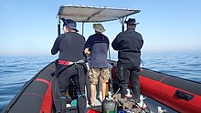
In South Africa, the standard dive boat is a large (6 to nearly 9 m) Rigid Inflatable Boat These are known as rubber ducks. Power is generally twin outboard motors, which may be two-stroke and smoky, but are increasingly often either four stroke, or the improved two-strokes which are cleaner and quieter.
These boats are generally powerful and fast, but speed is usually limited by sea state. They have a wet ride in a bumpy sea or if there is a crosswind. You travel in your dive suit, quite often with your hood on, and sometimes with your mask on to keep the spray out of your eyes. It has been known for the occasional diver to also use a snorkel to keep out heavy spray in rough conditions. If you wear a hat to protect your head from UV, make sure the hat is a tight fit, and preferably with a lanyard. The combination of cool sea air, wind, spray and high levels of UV can grill you in quite a short time, even in winter. Wear a good blockout or other method of keeping the sun from your skin. Unfortunately some blockouts wash off easily, and others sting your eyes if water gets into your mask and sloshes around a bit. A ski-mask is considered slightly eccentric, but it does the job.
Preparing for the dive.

If using all your own equipment, pack it as you find convenient, and check that everything is in good working order before leaving home. It will be wet on the way home, a waterproof bag or bin will keep the water off the upholstery. If using rental gear, get to the shop early to make sure it fits and works properly. If you are an unusual shape or size you may have difficulty finding a suit which fits well.At some places you will kit up at the side of the road or in a parking lot, and at others there will be changing rooms provided by the dive operator. If this is an issue, find out before the dive, You might want to take along a small mat or towel to stand on while putting on your suit, particularly if the ground is sandy or muddy.Some operators provide facilities at the dive shop for the customers to change into their dive suits and assemble equipment and load the boat before leaving for the launch site. In these cases the heavy equipment is usually loaded by staff, and the divers carry their light equipment to the boat. Where the boat collects divers from a jetty, the divers are expected to get their own kit to the boat. Actual loading will usually be done or supervised by the skipper.You will almost always be expected to wear your dive suit on the boat trip. There is no space to put it on during the ride, which may be wet.
What to take
- A small bag is useful to carry items like sunglasses, sunblock, hat, etc. Cell phones and car keys are usually kept in a waterproof bag or box by the skipper, and stored in the console. Large boxes for underwater cameras or video equipment should be negotiated before the dive, as there may or may not be space for them on board. In summer sunblock is advised for most skin types. UV factor is generally high and reflection from the water grills you from below. A peaked or brimmed hat may help if securely strapped on against the wind generated by boat speed.
- Kit bags for dive gear are not usually carried, but a medium sized soft bag to hold fins and mask, and other dive accessories like DSMB, reel, computer, dive light etc. is OK.
- On a long boat trip a small bottle of water or other suitable rehydration drink is nice to have, specially for after a deep or long dive. Similarly a small amount of high energy food may be welcome after a cold dive. In Cape Town, many dive boats supply a small chocolate bar or other sweet (candy) to each diver after the dive.
- A light waterproof windbreaker jacket is useful if the wind is strong, the weather or water is cold, or the trip is long. This can reduce wind-chill, particularly after the dive if you wear a wetsuit.
- A small emergency supplies (dive saver) kit of spare O-rings, fin strap, etc is acceptable.
What not to take
- Don’t take anything that you do not intend to use on the trip. (emergency equipment excepted).
- Don’t bring anything that must not get wet unless you have a watertight bag or box for it. A towel is usually a waste of time, as it will probably get wet. The same goes for dry clothing.
- Space is limited and must be shared by all. Do not annoy everyone by bringing a huge bin for your kit and fighting with the skipper at boarding time. No-one will have sympathy when you are evicted.
Loading kit and getting into the boat


The boat may loaded before launching, except where the water at the slipway is too shallow, when the boat is not taken out between dives, or when the slipway is not at the same place where the divers will be boarding.Loading of the boat is usually done by the skipper and divemaster. You are usually expected to transport your own equipment to the boat and hand it over to the person who will stow it for the trip. The standard arrangement is to stack scuba sets along a centreline rack, and tie them in place. You will usually sit at your scuba set, so if you want to do pre-dive buddy checks, ask for your gear and your buddy’s to be stowed together.Weight belts and pockets may be stacked on deck or in a box at the front or back of the rack. They are handed out when the boat gets to the site, so be sure you can identify your weights.
Fins and masks are usually stowed by the diver. There are often no special places reserved for this purpose, and fins are generally stowed either behind a handrope along the inner side of the pontoons, or between scuba sets along the rack. Be careful how you do this, as simply stacking them on top of the scuba sets can sometimes result in a fin or two being blown overboard by wind. This can ruin your dive, and is usually expensive. Masks are commonly stored in the foot pocket of a fin. The deck is not a good place for fragile items.Large cameras with strobe arms should be carried in the smallest plastic bin or crate that will hold them. There will often be several divers with camera boxes contending for the same limited storage space. Do not expect special treatment unless you have specifically organised it with the charterer.Some crews will carry your scuba set to the boat, but don’t count on it. If you need help, say so. If you are renting gear from the same organisation that runs the boat, they will usually load it for you. Make sure you can identify your rented gear and that it has all been loaded.
Slipway launches


Slipway launches are standard in the Western Cape
Where launching is from a slipway the procedure is fairly relaxed, and much depends on how far the slipway is from the parking area, and whether there is a convenient jetty.In some cases, usually at low tide, the water may be too shallow to launch the boat loaded with kit, but more often the boat is loaded with most of the dive gear, but not the divers, before launching. The boat is then launched with usually just the skipper on board, and the divers either get in from shallow water or from a jetty, as described above.Sometimes there may be commercial ski-boat fishermen launching at the same slipway. There are exceptions, but the lasting impression is of a mob of hooligans with no respect for anyone. They are generally a law unto themselves, and you will not gain brownie points by pointing out the error of their ways, and are likely to be given a brief introductory course in local invective at no charge.
Getting into the boat will depend on the launch site. In most cases the boat will be launched with only a skipper on board. Divers will board from the jetty or from the water.
Boarding from a jetty
Boarding from a jetty is usually easy, unless the step down to the boat is high. The crew will help where necessary and direct boarding. Follow their instructions. Do not leap down onto the deck, as it may not be designed to take this kind of shock load, and the sound of cracking glass fibre will not bring a smile to the skipper’s face. Also don’t leap down onto the pontoon, as this is likely to be followed by an inelegant face-plant onto the rack of scuba gear. The owners may be more concerned with damage to their equipment than your injuries.
The roll bar at the stern is a good place to hold if you can reach it. The radio antenna, plastic windscreen and engine control levers are not.Try to avoid getting parts of yourself between the boat and the jetty. The pontoons are fairly soft, but the jetty usually isn't, and may be decorated by barnacles and other abrasive material.
Boarding from shallow water
If boarding from standing in the water, try to get in where the water is not too deep, as most divers do not have the agility and upper body strength to boost themselves in without fins or a jump. Ask for help if you need it, but your fellow divers are more likely to be enthusiastic than skillful at pulling you in, Say goodbye to dignity, and hope for a reasonably comfortable landing.
The stern of the boat (blunt end) is usually lower and therefore easier to get into. This is often combined with it being in the shallowest water, so get in and out of the way of the people who have to hold the boat while the rest are getting in.
If you are a gymnast or acrobat you may safely ignore this advice.
Seating


Seating is almost exclusively on the pontoons, with your back to the water. This puts you in a position where losing your balance backwards will result in falling into the water, a manoeuvre most divers prefer to restrict to times when the boat is stationary at the dive site. To prevent unscheduled backward rolls, use the foot-straps and hand-ropes provided. As a general rule, sit opposite your scuba set, so you don’t have to move around when kitting up on site.
Occasionally there may be a seat across the stern in front of the motors. This will be the most comfortable place on the boat but may catch more spray in your face. The boat will bounce up and down as it hits waves. Bigger boats less so than small ones, and the part that bounces the least is the stern, so the most comfortable seating is as far back as you can get. This puts you close to the motors, and if they are two-stroke, closest to the exhaust smoke when the boat is not moving. You may not have much choice where you get to sit, but if you have a bad back or other disability which makes a rough ride a problem, mention this to your dive-master or the skipper as soon as possible. You will not be popular if the boat has to stop to re-arrange passengers. With practice it is possible to sit with one foot in a foot-strap (preferably the foot nearer the bow (pointy end)) and ride the bumps with very little effort. It is much like riding a horse, don’t fight the motion, absorb the bumps by relaxing a bit, and you will bounce less. A death-grip on the hand ropes will be exhausting if the ride is long.
Some boats have no footstraps. You will have to find something else to hold onto, or lean into the boat to keep more weight on your feet. Some divers may be seen comfortably sitting on the tubes, riding the waves with no obvious concern as the boat bounces along. They may not even need to hold on. They have done this before.
Moving around in the boat
If possible, don’t move around while the boat is moving, unless asked to trim the boat. You will be expected to sit where directed by the skipper, and unless there is a good reason not to, do as requested. Standing up when the boat is moving and there is nothing to hold onto can result in a fall and possible injury if the boat hits a wave or moves in an unexpected direction. If equipment comes loose under way, shout to the skipper, who will stop if it is safe, so that the equipment can be re-stowed.There may be cables and pipes in places on the deck. These are usually routed through areas where they are reasonably protected, but as a rule don’t stand on them or use them to hold on to. Batteries are often stored in plastic boxes near the transom, to keep the wires short. The lids are not usually load bearing structures, do not use them as steps.
Getting out of the boat

Getting into the water is usually done by a synchronised backward roll – falling into the water alongside your neighbour, neither on top nor underneath. Generally all the divers or a nominated group will roll off together, on a countdown from the skipper or divemaster. It is important to all roll together, as if you do not, the later divers may fall on top of the earlier ones, possibly casing injury or equipment damage. If you are not ready, or are not happy with this procedure, wait until the others are in and the boat is clear of them. The skipper will then let you roll in clear of the others, but you may have to fin a bit to get to them. This can be a problem if diving in a current. Some divers may not wish to backward roll with a large camera setup. Pueden pedirle al patrón que les pase la cámara cuando estén en el agua. En este caso, deben permanecer cerca del barco y, preferiblemente, sujetarlo hasta que pasen la cámara.
La línea de tiro y la boya marcadora

La mayor parte del buceo en Ciudad del Cabo se realiza en un arrecife o un naufragio. Es habitual marcar la posición con una línea de tiro antes de la inmersión para que los buceadores puedan descender al lugar correcto. Si hay una ligera corriente en la superficie, la línea de tiro se desplazará a favor del viento para compensar la holgura. En este caso lo habitual es entrar en el agua una distancia corta corriente arriba de la boya, y comenzar el descenso tan pronto como la línea sea visible a través del agua, para minimizar el trabajo de nadar en contracorriente. Derrapar hasta la boya significa que tendrás que nadar contra la corriente. La línea de tiro no es un ancla. Si se baja por la línea de la boya, puede arrastrar el tiro y terminará corriente abajo del sitio, al igual que todos los demás detrás de usted. Si la línea de tiro es demasiado corta, la boya puede levantar el tiro y desviarse fuera del sitio, por lo que necesita algo de holgura. Es posible que la corriente no corra directamente a favor del viento. Incluso cuando se trata de una corriente inducida por el viento, las fuerzas de Coriolis la compensarán en sentido antihorario desde la dirección del viento en el hemisferio sur, en un efecto conocido como transporte de Ekman. El efecto es de unos 45 ° en la superficie, más a medida que se profundiza, pero con menos velocidad.
Puede optar por salir a la superficie en la línea de tiro o lejos de ella. Si no conoce el sitio, puede resultarle difícil encontrar el camino de regreso. Esto no suele ser un problema, y la mayoría de los buceadores de Ciudad del Cabo ascenderán donde sea que se encuentren al final de la inmersión, pero en este caso se recomienda encarecidamente desplegar un DSMB y salir a la superficie en su propia boya, o la boya de su compañero. El DSMB indicará la presencia de un buceador para que los barcos en el área puedan mantenerse alejados y para que el patrón de su barco de buceo pueda realizar un seguimiento de dónde es probable que sus clientes salgan a la superficie.

Si existe una posibilidad significativa de salir a la superficie lejos de la línea de tiro en un área con mucho tráfico de botes, se recomienda a los buzos, o se les puede solicitar, que lleven un DSMB y lo desplieguen antes de salir a la superficie. Otros sitios donde se puede requerir que los buzos lleven un DSMB son los que están lejos de la costa, o en cualquier momento en que el patrón crea que puede ser difícil encontrar un buzo debido a las condiciones del mar. Para el buceo recreativo, la elección del color y el tamaño de un DSMB personal depende del buceador. El amarillo, el naranja y el rojo son los más comunes, pero ocasionalmente también se ve un rosa brillante y, a menos que notifique explícitamente al patrón de un significado especial para un color, se asumirá que no hay ningún significado especial aparte de marcar su posición. A nadie le importará su tamaño siempre que se pueda ver desde una distancia razonable. Las tiras reflectantes, las luces intermitentes y su nombre también son opcionales.
Divemasters
Puede que haya uno en el barco o puede que no. Es menos probable que los barcos que atienden a los lugareños proporcionen un divemaster que los barcos conectados con las escuelas o que generalmente atienden al comercio y visitantes que pasan. Si no está seguro de bucear sin alguien que le muestre los alrededores, mencione esto cuando reserve y pregunte sobre las opciones.
Buceo de algas
En áreas donde hay muchas algas marinas, los buzos generalmente no remolcan a las PYMES durante la inmersión. Afortunadamente, estos también suelen ser lugares donde no hay corrientes importantes, aunque el oleaje puede ser fuerte. Muchos de los sitios costeros y costeros de Ciudad del Cabo tienen algas pesadas, particularmente en la costa atlántica. En estas áreas, se alienta a los buceadores a llevar DSMB y usarlos cuando salgan a la superficie lejos de la línea de tiro, para que el patrón pueda realizar un seguimiento de dónde están saliendo todos y para que los barcos que pasan puedan tener la oportunidad de evitar atropellarlo si alguien se molesta. para vigilar. Los DSMB también son muy efectivos para señalar al barco cuando estás en la superficie, mucho más que un brazo en un traje de neopreno negro. Esto puede ser particularmente valioso si el viento se levanta durante la inmersión y la superficie está agitada por el agua blanca.
Regresar al bote después de una inmersión.


Regla 1: No se quite las aletas en el agua a menos que haya una escalera. Los necesitas para animarte. La mayoría de los patos de goma no cuentan con una escalera de embarque. Esto es aún más importante si está embarcando en el lado del barco en el lado del viento, ya que el barco casi siempre se desplazará a favor del viento más rápido que un buceador. Acérquese al barco y agarre la cuerda de mano exterior. Trate de sujetar el bote en todo momento y suéltelo solo durante el tiempo que sea absolutamente necesario para quitar el kit, ya que el bote puede alejarse mientras no lo esté agarrando.
Algunos barcos pueden proporcionar una línea de agarre corta con un lazo por el que se puede deslizar un brazo, pero por alguna razón esto es extremadamente raro. Aún menos común es una línea con un clip que puede colocar en el equipo antes de quitarlo. Es de suponer que no hay demanda de los clientes por estos artículos ... Su equipo será levantado a bordo por la tripulación u otros buzos.
El procedimiento recomendado es primero dejar pasar cualquier cámara u otro equipo suelto, luego despegar y entregar las pesas. Esto asegura que flotará después de quitarse el chaleco. No lo suelte hasta que esté seguro de que la otra persona tiene un buen agarre, los cinturones de lastre se hunden muy rápido. Retire el equipo de buceo y entréguelo a la tripulación. Puede ayudar empujando hacia arriba debajo del televisor cuando se levantan y verificando que los DV y los calibres no se enganchen en las cuerdas de mano. La máscara y el esnórquel se pueden entregar en cualquier momento si es conveniente. Sujete bien las asas provistas, o una cuerda de mano lo más alto posible por el costado de los pontones. Sumérjase lo más que pueda para obtener un poco de flotación, luego alete fuertemente hacia arriba y use los brazos para levantarse lo más alto posible, luego empuje hacia abajo la cuerda o las manijas mientras hace rodar la parte superior del cuerpo sobre el pontón. Cambie el agarre a una manija interior o una línea de mano, y balancee una pierna hacia el interior del bote. Puede ser conveniente detenerse aquí mientras alguien le quita las aletas, luego sentarse y balancear la otra pierna dentro del bote. Con buenas aletas, buena técnica y una fuerza razonable, es posible abordar de esta manera con comodidad y dignidad. Este método es mucho más difícil si está a favor del viento con un viento fuerte.

Si no tienes la fuerza, el procedimiento es similar, pero con la ayuda de la tripulación o los buzos que ya están en el bote, que te arrastrarán con la fuerza principal y lo que sea que puedan agarrar. Antes de acusar a alguien de agresión indecente, considere si había un lugar alternativo razonable para que pudieran agarrarlo y que hubiera funcionado. La elegancia es inversamente proporcional a tu tamaño y masa. Si tiene bolsillos en los muslos delante de su traje, no aborde con ningún equipo frágil o voluminoso en los bolsillos. Los bolsillos laterales no suelen ser un problema.

Hay una nueva tendencia con algunos barcos para proporcionar una escalera para abordar. El estilo del "árbol de Navidad" es relativamente popular ya que es fácil de escalar con las aletas en los pies. En los patitos de goma se suele colgar por el costado, y en los catamaranes de casco rígido se prefiere el espejo de popa.
Salir del barco después de bucear

Salir a un embarcadero suele ser sencillo, pero puede complicarse por un embarcadero alto y marea baja. Si es un problema, la tripulación ayudará y dará instrucciones. Si hace lo suyo, se aplican las mismas advertencias que para entrar desde un embarcadero. Sobre todo sobre no meterse entre el barco y el embarcadero.
Salir a la playa es inusual en Ciudad del Cabo, pero relativamente sencillo. Por lo general, es más seguro y conveniente bajarse por el lado bajo si el bote se inclina al correr por la playa. Si está en el lado alto, espere hasta que haya espacio y muévase hacia el lado bajo, o en algunos casos el lado alto se convertirá en el lado bajo cuando el bote se inclina hacia atrás mientras se retira la carga. No intente descargar el equipo por el lado alto, en caso de que esté en el lugar equivocado y el bote se le caiga encima. Esto es particularmente probable si el barco no está completamente libre de las olas.
Ver

Las aguas de la península del Cabo y False Bay mantienen una ecología próspera de organismos marinos templados fríos, muchos de ellos endémicos de Sudáfrica, o incluso regiones más pequeñas, y aunque los peces no tienen colores tan espectaculares como los que se ven en aguas tropicales, muchos son bastante coloridos para camuflarse entre los invertebrados extremadamente vivos que cubren los arrecifes.
animales marinos
Hay una amplia gama de animales marinos que se pueden ver mientras se bucea en esta región, e incluyen algunos de los encuentros más impresionantes y espectaculares posibles para un buceador.
Ballenas y delfines
False Bay es un destino conocido por la observación de ballenas. Un gran número de ballenas francas australes visitan la bahía cada año, pero es inusual ver una durante una inmersión. Otras especies de ballenas que se ven ocasionalmente en False Bay son las ballenas jorobadas, las ballenas de Bryde y la orca, y es incluso menos probable que se vean mientras se bucea. Si tiene la suerte de encontrarse con una ballena durante una inmersión, tenga cuidado, ya que su enorme tamaño facilita que un buceador se lesione involuntariamente.
También se ven delfines en False Bay y en la costa atlántica. Los delfines comunes visitan de vez en cuando cientos de miles de escuelas, pero los buzos no suelen verlas. Los delfines oscuros tienden a viajar en grupos más pequeños, pero también es más probable que investiguen a un buzo en la parada de seguridad. Otras especies visitan ocasionalmente, pero son más conocidas por incidentes de varamientos que por ser vistos bajo el agua por los buceadores.
Tiburones

False Bay es uno de los lugares más confiables para ver grandes tiburones blancos, aunque rara vez como buceador, y también se ven con frecuencia otras especies de tiburones. El Sevengill o Cowshark a menudo se pueden ver en algunos sitios, mientras que los tiburones Gully y los tiburones gato están más extendidos. Hay cuatro especies de tiburón gato comunes a nivel local, desde el colorido tiburón puffadder hasta el tiburón pijama mucho más grande. Otros tiburones pelágicos generalmente solo se ven en inmersiones en "aguas azules" en alta mar en la península sur, y varias especies de peces pelágicos grandes se pueden ver en viajes similares.
Pelágicos

Ocasionalmente se ven grandes bancos de jurel en algunos sitios de buceo, y en ocasiones impredecibles los buzos pueden tener la suerte de ver peces luna oceánicos, ballenas francas australes, ballenas jorobadas, delfines comunes, nariz de botella o delfines oscuros.
El Snoek común, que es la piedra angular de la industria local de pesca con línea, es muy tímido y casi nunca lo ven los buceadores, a pesar de su hábito de pescar en grandes cantidades.
Pingüinos y focas

Hay colonias de pingüinos africanos en False Bay, pero es extremadamente inusual verlos durante una inmersión. Por otro lado, los lobos marinos del Cabo son curiosos y no temen a los buceadores, y se ven con mucha frecuencia, tanto en False Bay como en la costa atlántica. Hay varios lugares donde casi se puede garantizar que se verán.
Pez de arrecife


Los peces de arrecife de esta región son más variados en False Bay, y más comunes en las zonas restringidas de las Áreas Marinas Protegidas, donde han estado protegidos por la ley durante varias décadas, aunque la caza furtiva todavía ocurre y la aplicación es bastante poco confiable. La mayoría de los peces de arrecife están camuflados hasta cierto punto. Muchos son de color gris plateado y sombreados, como el omnipresente besugo hotentote, el plateado Fransmadam y el Steentjie. Otros tienen barras verticales o parches oscuros que pueden ayudar a romper su perfil en las algas marinas, como White stumpnose, Zebra y White steenbras, mientras que muchas de las especies más pequeñas tienen colores crípticos y se mezclan muy bien con su entorno. Se trata generalmente de peces que pasan la mayor parte del tiempo en el arrecife o muy cerca de él, y su coloración suele ser una indicación de los colores típicos de su hábitat. Estos incluyen varios klipfish endémicos y algunos blennies y gobios, los fingerfins, el Cape triplefin, el pez escorpión Smoothskin, dos especies de horsefish, un pez pipa y el Rocksucker. También hay algunos peces rojos, que son bastante visibles, como el muy común Roman, y los menos comunes Red stumpnose y Red steenbras. La mayoría de los peces mencionados son solitarios o se encuentran en pequeños cardúmenes, pero también hay Strepies y Maasbanker que tienden a formar cardúmenes en cantidades bastante grandes, y los cardúmenes moderadamente grandes de Hottentot se ven con bastante frecuencia. Los galjoen son bastante raros y generalmente se ven en pequeños grupos en la parte superior del arrecife donde hay mucho movimiento de olas, y el Cape knifejaw de aspecto similar prefiere un arrecife más profundo y de alto perfil entre las rocas. Los bagres son tímidos y tienden a pasar el día en grietas y agujeros.
Zonas arenosas

Los arenosos también tienen sus peces característicos, que incluyen algunas especies de rayas, soles, rubios, un pez globo y el arenero picudo, que es raro y tímido durante el día, pero puede verse en gran número por la noche en algunos sitios, cuando sale de la arena en la que se esconde y nada libremente. Algunas especies de klipfish también viven en la arena, y las diversas especies prefieren diferentes densidades de arena, y las que prefieren la arena fina tienen un cuerpo más parecido a una serpiente, mientras que las de arena gruesa son más robustas. El patrón de su cuerpo también tiende a coincidir con el tipo de arena.
Invertebrados de arrecife
Los invertebrados bentónicos proporcionan la mayoría de los colores brillantes en los arrecifes de esta región, y la distribución de especies es tan característica de las diferentes subregiones como la profundidad y la temperatura del agua. La diversidad es grande y existe una gran variación en la cobertura de arrecifes predominante con la profundidad y la ubicación geográfica. La vida característica de los arrecifes varía considerablemente entre los lados este y oeste de la Península del Cabo, y esto se reconoce como el límite entre las biorregiones costeras del sur del Cabo Occidental y Agulhas. La zonificación vertical también es característica de las diferentes biorregiones, por lo que puede haber diferencias muy notables en lo que se puede ver en los distintos sitios.
Existe una tendencia general a que un área determinada del arrecife esté dominada por una especie particular de organismo, por ejemplo, estrellas de plumas comunes, pepinos de mar de pecho rojo, pepinos de mar malva, carnada roja o erizos de mar, en la medida en que un importante parte de la superficie está cubierta por el organismo dominante. Esto no significa que no haya variedad, ya que existe una gran variedad de hábitats en la mayoría de los arrecifes dependiendo de la orientación y rugosidad y, en gran medida, los organismos sésiles viven donde pueden, y esto depende en gran medida de dónde se encuentran las larvas planctónicas. encontrar un punto de apoyo.
Midwater
Los invertebrados pelágicos son, por su naturaleza principalmente planctónica, impredecibles en cuanto a cuándo y dónde pueden verse. Incluyen varias especies de medusas, algunas especies de medusas, algunos sifonóforos esporádicos, salpas y pterópodos, y muchas cosas demasiado pequeñas para notarlas fácilmente. También hay calamares, pero son muy tímidos y rara vez se ven de día.
Las esponjas, cnidarios, medusas, gusanos planos, gusanos segmentados, artrópodos, moluscos, briozoos, equinodermos, ascidias, peces, aves marinas y mamíferos marinos registrados en esta región se enumeran en el Wikipedia: Lista de animales marinos de la Península del Cabo y False Bay. Muchos de estos pueden ser vistos por un buceador recreativo.
Algas
Bosques de algas
Los bosques de algas marinas son las algas marinas más evidentes de Ciudad del Cabo. Hay tres géneros que se encuentran localmente, a veces muy cerca. El más obvio es el bambú marino, que llega a la superficie cuando está completamente desarrollado y tiene un estípite grueso con una cavidad llena de gas en la parte superior, y que mantiene la fronda cerca de la superficie para una máxima exposición a la luz. Esta alga es muy común en la costa atlántica y también se encuentra a ambos lados de False Bay, pero más comúnmente hacia la parte sur de la bahía.
Las algas marinas más pequeñas crecen en arrecifes más profundos y no llegan a la superficie. Los estípites son más cortos y no hay cavidades llenas de gas, por lo que las frondas permanecen sumergidas en las aguas más oscuras. Esta alga se encuentra en aguas más profundas que el bambú marino, con un rango geográfico similar.
El tercero es el alga de la vejiga, que tiene grupos de estípites largos y delgados, con frondas largas y un gran número de pequeñas vejigas llenas de gas que mantienen las algas en posición vertical y las frondas en la superficie. Esta alga no se encuentra en False Bay, y se ve principalmente cerca de Robben Island.
Césped de algas y sotobosque de bosque de algas.
Debajo de las hojas de algas marinas, el arrecife en áreas menos profundas donde hay suficiente luz, puede estar cubierto por un sotobosque de algas marinas variadas, y la especie en particular dependerá de una variedad de factores, incluida la cantidad de luz disponible y la cantidad de agua. movimiento. Como regla general, las algas verdes y marrones se encontrarán en áreas menos profundas y las rojas serán más profundas, ya que pueden sobrevivir con menos luz. Los más profundos son a menudo las algas coralinas rojas, que pueden formar un césped denso en las superficies superiores de las rocas.
Coralinos incrustantes.
Donde el oleaje es demasiado fuerte o la luz es demasiado tenue para otras algas marinas, las algas coralinas incrustantes aún pueden encontrar un punto de apoyo y prosperar. Estas algas rojas forman una costra bastante dura y fuertemente adherente en el arrecife, y también se conocen como "pintura rosa", que es una descripción justa de su apariencia: no se parecen en nada a las algas marinas. Su rango es casi en cualquier lugar de la región donde penetre suficiente luz y no haya ningún otro ocupante en el arrecife.
Hay alrededor de 57 algas verdes, 49 algas marrones y 240 algas rojas registradas en esta región en el Wikipedia: Lista de algas marinas de la península del Cabo y False Bay.
Naufragios

La Cabo de Tormentas y el Cabo de Buena Esperanza son denominaciones tradicionales de esta región, y por una buena razón. El clima puede ser muy malo a veces y la costa está muy expuesta, con pocos puertos protegidos, pero también es un punto de referencia importante en una de las grandes rutas comerciales marítimas del mundo. Como resultado, hay un número abrumador de naufragios registrados a lo largo de la costa local.
Muchos de estos naufragios nunca se han encontrado, y muchos otros se han roto más allá del reconocimiento, o cubiertos de arena, o en el caso de Table Bay, han sido enterrados bajo proyectos de recuperación de tierras, pero varios se encuentran en lugares donde se puede bucear y pueden ser visitados por buceadores si las condiciones son adecuadas.
Las profundidades de los naufragios que se pueden bucear varían desde 3 o 4 metros, hasta más de 65 metros, y la condición varía desde fragmentos de madera o acero medio enterrados, hasta barcos que conservan la mayor parte de su estructura y apariencia original, y se ciernen sobre las profundidades como si navegando por el fondo de arena.
La mayoría están fuertemente incrustados con organismos de arrecifes, que van desde algas marinas en aguas poco profundas hasta una gran variedad de invertebrados coloridos en aguas más profundas. También albergan una variedad de peces de arrecife y pueden ser visitados por peces pelágicos en ocasiones impredecibles. En efecto, sirven como arrecifes artificiales y, como resultado, generalmente también son de interés para los buceadores que no están particularmente interesados en ellos como artefactos.
Rasgos topográficos
Muchos de los sitios se caracterizan por interesantes características topográficas, que incluyen pináculos, barrancos, cavernas, nado y voladizos. Estas características son notables no solo por su contribución al paisaje marino, sino que también proporcionan variaciones importantes en los hábitats disponibles en el sitio, y el resultado es una fuerte correlación entre una alta biodiversidad y una topografía interesante. El carácter topográfico general de un sitio depende de la geología, y los sitios de granito se distinguen instantáneamente de los de arenisca sedimentaria y de lutitas. Las rocas de granito suelen estar redondeadas y apiladas como cantos rodados de piedra en los afloramientos de la misma roca, a menudo con arena de cuarzo blanco entre ellos, o como una base que se inclina gradualmente. Estas pilas de rocas de diversos tamaños a menudo forman pináculos y barrancos en direcciones bastante aleatorias, y los voladizos y agujeros entre ellos son en algunos casos lo suficientemente grandes para que los buceadores naden, lo que proporciona una estructura de arrecife espectacular.
Los estratos de arenisca tienden a producir formaciones dominadas por el hundimiento y el rumbo local, y esto es más predecible. Sin embargo, el detalle a menor escala tiende a producir más agujeros, hendiduras, salientes y crestas que las áreas de granito, y estos son menos espectaculares por regla general. Hay excepciones, donde los arrecifes de arenisca son muy escarpados, generalmente donde el desnivel es bastante empinado, pero no vertical, y la costa es bastante empinada, pero en un plano diferente al del desnivel.
Afortunadamente, el viejo dicho "como es arriba, es abajo" se aplica bastante bien, y el carácter de los arrecifes se puede predecir con bastante fiabilidad observando el paisaje costero adyacente. La principal excepción a esta regla es el sur de la bahía de Smitswinkel, donde hay areniscas sobre el agua y granito debajo.
La estructura geológica y la historia de esta región se describen brevemente en Wikipedia: geología marina de la península del Cabo y False Bay
Leer
Libros de referencia sobre la ecología de las aguas de Ciudad del Cabo:
De SURG, específicamente para los buceadores de esta región: Disponible en tiendas de buceo y librerías seleccionadas en Ciudad del Cabo, y directamente en SURG.
- Jones, Georgina. 2008. Una guía de campo sobre los animales marinos de la península del Cabo, SURG, Ciudad del Cabo. ISBN 9780620416399
- Zsilavecz, Guido. 2005. Peces costeros de la península del Cabo y False Bay, SURG, Ciudad del Cabo. ISBN 0620342307
- Zsilavecz, Guido. 2007. Nudibranquios de la península del Cabo y False Bay, SURG, Ciudad del Cabo. ISBN 0620380543
De otras editoriales y de aplicación más general:
- Branch, G. y Branch, M. 1981, Las costas vivas del sur de África, Struik, Ciudad del Cabo. ISBN 0869771159
- Rama, G.M. Griffiths, C.L. Branch, M.L y Beckley, L.E. 2010, Two Oceans: una guía de la vida marina del sur de África, David Philip, Ciudad del Cabo. ISBN 9781770077720
- Gosliner, T. 1987. Nudibranquios del sur de Arica, Sea Challengers y Jeff Hamann, Monterey. ISBN 0930118138
- Heemstra, P. y Heemstra E. 2004, Peces costeros del sur de África, NISC / SAIAB, Grahamstown.
- Ed. Smith, M.M. y Heemstra, P. 2003 Peces de mar de Smith. Struik, Ciudad del Cabo
- Stegenga, H. Bolton, J.J. y Anderson, R.J. 1997, Algas de la costa oeste de Sudáfrica. Herbario de bolo, Ciudad del Cabo. ISBN 079921793X (bastante técnico)
Libros de referencia sobre la geología de la península del Cabo:
- Compton, John S. 2004, Las rocas y las montañas de Ciudad del Cabo. Double Storey, Ciudad del Cabo. ISBN 1919930701

![]()